TopoQuest Logo
Do you find TopoQuest useful?
Help keep TopoQuest running and adding new maps/features by donating!
Home View Maps Find Maps Find Places Resources & Links


Bavaria, Wisconsin Topographic Map

USGS Map Title: Bavaria, WI
USGS Map MRC: 45089C3
DRG (GeoTIFF) Download: o45089c3.tif


Neighboring USGS Topographic Map Quads:


  Parrish, WI  
45089D4
 

  Enterprise, WI  
45089D3
 

  Elcho, WI  
45089D2
 

  Gleason, WI  
45089C4
 

  Bavaria, WI  
45089C3
 

  Kempster, WI  
45089C2
 

  Doering, WI  
45089B4
 

  Black Brook, WI  
45089B3
 

  Antigo, WI  
45089B2


Map MRC Location:

N46°
W90°
N46°
W89°
H8 H7 H6 H5 H4 H3 H2 H1
G8 G7 G6 G5 G4 G3 G2 G1
F8 F7 F6 F5 F4 F3 F2 F1
E8 E7 E6 E5 E4 E3 E2 E1
D8 D7 D6 D5 D4 D3 D2 D1
C8 C7 C6 C5 C4 C3 C2 C1
B8 B7 B6 B5 B4 B3 B2 B1
A8 A7 A6 A5 A4 A3 A2 A1
N45°
W90°
N45°
W89°

Bavaria, WI USGS 1:24K Topographic Map Preview:
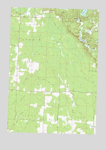
Bavaria, WI USGS Topographic Map
Click on map above to begin viewing in our Map Viewer.

This topographic map contains these locations and features:
Feature Name Type Latitude Longitude GNIS ID View Map
BavariaPopulated PlaceN45.31413°W89.36401°1577507View Map
Bullhead LakeLakeN45.35284°W89.26415°1562400View Map
Dynamite LakeLakeN45.37224°W89.27052°1564229View Map
Eagle LakeLakeN45.33466°W89.25537°1564246View Map
Horseshoe LakeLakeN45.34384°W89.26833°1566735View Map
Liberty Bell School (historical)SchoolN45.27024°W89.32484°1840783View Map
Little Partridge LakeLakeN45.35192°W89.27579°1568348View Map
Lower Wolf LakeLakeN45.36321°W89.27889°1568763View Map
OrmsbyPopulated PlaceN45.25608°W89.25262°1577760View Map
Ormsby PondReservoirN45.25787°W89.25224°1570862View Map
Partridge LakeLakeN45.34491°W89.27395°1571071View Map
Rocky Glen School (historical)SchoolN45.35830°W89.33123°1840799View Map
Saddlebag LakeLakeN45.33804°W89.26545°1572805View Map
Saint Paul Church (historical)ChurchN45.33607°W89.36318°1840807View Map
Sucker CreekStreamN45.27080°W89.25012°1575006View Map
Sunny Slope School (historical)SchoolN45.31774°W89.36345°1840818View Map
Town CemeteryCemeteryN45.34384°W89.36317°1575529View Map
Town of SummitCivilN45.33620°W89.36356°1584249View Map
Upper Wolf LakeLakeN45.36559°W89.27898°1576002View Map

Note: Coordinates in the location and feature list above are referenced to NAD83 datum.


Copyright (C) 2008-2026 Ryan Niemi / Sunset Dynamics ... All Rights Reserved
