TopoQuest Logo
Do you find TopoQuest useful?
Help keep TopoQuest running and adding new maps/features by donating!
Bitcoin:  19c7KJd3qBynnjoSw5npx9KScwjBe4ifkT
Litecoin:  LXs6TkuXGGXo1vDsWCkWVdjQX94eUKd6ui
Home View Maps Find Maps Find Places Resources & Links


Elton, Louisiana Topographic Map

USGS Map Title: Elton, LA
USGS Map MRC: 30092D6
DRG (GeoTIFF) Download: o30092d6.tif


Neighboring USGS Topographic Map Quads:


  Oberlin, LA  
30092E7
 

  Soileau, LA  
30092E6
 

  Duralde, LA  
30092E5
 

  Kinder, LA  
30092D7
 

  Elton, LA  
30092D6
 

  Basile, LA  
30092D5
 

  Welsh North, LA  
30092C7
 

  Hathaway, LA  
30092C6
 

  Evangeline, LA  
30092C5


Map MRC Location:

N31°
W93°
N31°
W92°
H8 H7 H6 H5 H4 H3 H2 H1
G8 G7 G6 G5 G4 G3 G2 G1
F8 F7 F6 F5 F4 F3 F2 F1
E8 E7 E6 E5 E4 E3 E2 E1
D8 D7 D6 D5 D4 D3 D2 D1
C8 C7 C6 C5 C4 C3 C2 C1
B8 B7 B6 B5 B4 B3 B2 B1
A8 A7 A6 A5 A4 A3 A2 A1
N30°
W93°
N30°
W92°

Elton, LA USGS 1:24K Topographic Map Preview:
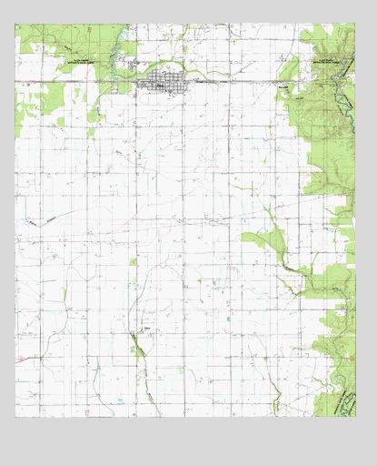
Elton, LA USGS Topographic Map
Click on map above to begin viewing in our Map Viewer.

This topographic map contains these locations and features:
Feature Name Type Latitude Longitude GNIS ID View Map
BarnsdallPopulated PlaceN30.4808°W92.6551°542954View Map
ChinaPopulated PlaceN30.4019°W92.7057°533915View Map
China CemeteryCemeteryN30.4302°W92.7124°533917View Map
China Gas FieldOilfieldN30.4152°W92.7488°545831View Map
Chretien CemeteryCemeteryN30.4735°W92.6512°533944View Map
Dry SloughStreamN30.4827°W92.6354°534627View Map
EltonPopulated PlaceN30.4813°W92.6957°534816View Map
Elton Elementary SchoolSchoolN30.4875°W92.7047°545825View Map
Elton Fire DepartmentBuildingN30.4816°W92.6989°2332377View Map
Elton High SchoolSchoolN30.4789°W92.6931°545826View Map
Elton Police DepartmentBuildingN30.4815°W92.6985°2334032View Map
Elton Post OfficePost OfficeN30.4808°W92.7060°1630361View Map
Faith Deliverance TempleChurchN30.4951°W92.7046°2601626View Map
First Baptist Church of EltonChurchN30.4789°W92.6945°2601772View Map
Golden Chain Baptist ChurchChurchN30.4823°W92.7046°2602045View Map
Greens GullyStreamN30.4838°W92.7135°1630363View Map
Jefferson Davis Parish Library Elton BranchBuildingN30.4809°W92.6927°2603075View Map
Jefferson Davis Parish Wastewater Treatment PlantLocaleN30.4877°W92.7018°2603446View Map
Liberty CemeteryCemeteryN30.4705°W92.7432°536420View Map
Mount Pilgrim Baptist ChurchChurchN30.4822°W92.7003°2602382View Map
Parish Governing Authority District 9CivilN30.4251°W92.6987°1930273View Map
Rogers Bayou Gas FieldOilfieldN30.3938°W92.6315°545871View Map
Rogers GullyStreamN30.3810°W92.6282°538689View Map
Saint Ann ChurchChurchN30.4266°W92.6510°538798View Map
Saint Joseph Catholic ChurchChurchN30.4832°W92.7015°2602665View Map
Saint Pauls Catholic ChurchChurchN30.4849°W92.6955°2602740View Map
South Elton Oil and Gas FieldOilfieldN30.4085°W92.6968°539491View Map
Southeast China Gas FieldOilfieldN30.3871°W92.7154°545877View Map
Tietjes AirportAirportN30.4341°W92.7221°2717222View Map
Town of EltonCivilN30.4812°W92.6976°2406446View Map
United Pentecostal ChurchChurchN30.4811°W92.6999°2602921View Map
Ward FourCivilN30.4666°W92.6940°545082View Map
West Tepetate Oil and Gas FieldOilfieldN30.4094°W92.6329°540333View Map

Note: Coordinates in the location and feature list above are referenced to NAD83 datum.


Copyright (C) 2008-2024 Ryan Niemi / Sunset Dynamics ... All Rights Reserved