TopoQuest Logo
Do you find TopoQuest useful?
Help keep TopoQuest running and adding new maps/features by donating!
Bitcoin:  19c7KJd3qBynnjoSw5npx9KScwjBe4ifkT
Litecoin:  LXs6TkuXGGXo1vDsWCkWVdjQX94eUKd6ui
Home View Maps Find Maps Find Places Resources & Links


Soileau, Louisiana Topographic Map

USGS Map Title: Soileau, LA
USGS Map MRC: 30092E6
DRG (GeoTIFF) Download: o30092e6.tif


Neighboring USGS Topographic Map Quads:


  Pine Chapel, LA  
30092F7
 

  Guy, LA  
30092F6
 

  Bond, LA  
30092F5
 

  Oberlin, LA  
30092E7
 

  Soileau, LA  
30092E6
 

  Duralde, LA  
30092E5
 

  Kinder, LA  
30092D7
 

  Elton, LA  
30092D6
 

  Basile, LA  
30092D5


Map MRC Location:

N31°
W93°
N31°
W92°
H8 H7 H6 H5 H4 H3 H2 H1
G8 G7 G6 G5 G4 G3 G2 G1
F8 F7 F6 F5 F4 F3 F2 F1
E8 E7 E6 E5 E4 E3 E2 E1
D8 D7 D6 D5 D4 D3 D2 D1
C8 C7 C6 C5 C4 C3 C2 C1
B8 B7 B6 B5 B4 B3 B2 B1
A8 A7 A6 A5 A4 A3 A2 A1
N30°
W93°
N30°
W92°

Soileau, LA USGS 1:24K Topographic Map Preview:
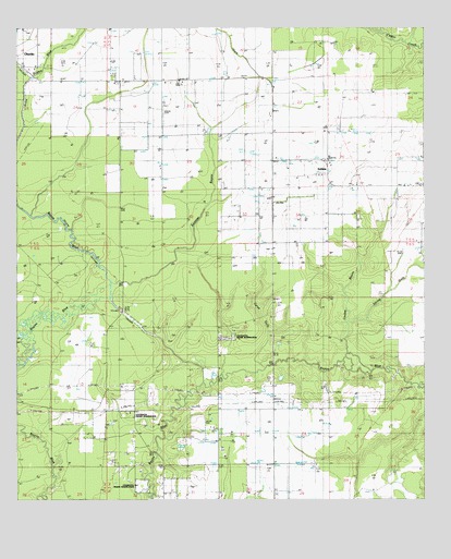
Soileau, LA USGS Topographic Map
Click on map above to begin viewing in our Map Viewer.

This topographic map contains these locations and features:
Feature Name Type Latitude Longitude GNIS ID View Map
Cole CemeteryCemeteryN30.5649°W92.6629°534031View Map
Coulee BayouStreamN30.5366°W92.6510°559674View Map
Coushatta Tribal Fire DepartmentBuildingN30.5242°W92.7145°2691830View Map
Cyrus GullyStreamN30.5374°W92.6693°534380View Map
Leeds SchoolSchoolN30.5199°W92.7110°536395View Map
Louisiana Noname 79 DamDamN30.5952°W92.6318°556940View Map
North Elton Gas FieldOilfieldN30.5174°W92.6732°537727View Map
Parish Governing Authority District 5CivilN30.6058°W92.6923°1930059View Map
Saint Peters CemeteryCemeteryN30.5199°W92.7110°539053View Map
SoileauPopulated PlaceN30.5891°W92.6549°542135View Map
Soileau ChurchChurchN30.5835°W92.6460°539469View Map
Sonnier BayouStreamN30.5544°W92.7257°539476View Map
Sonnier CemeteryCemeteryN30.5755°W92.6760°539477View Map
Southeast Oberlin Oil and Gas FieldOilfieldN30.5966°W92.7224°545472View Map
Spring GullyStreamN30.5463°W92.6490°539591View Map
Ward OneCivilN30.6113°W92.7476°544886View Map
Winn GullyStreamN30.6238°W92.6382°540503View Map

Note: Coordinates in the location and feature list above are referenced to NAD83 datum.


Copyright (C) 2008-2024 Ryan Niemi / Sunset Dynamics ... All Rights Reserved