TopoQuest Logo
Do you find TopoQuest useful?
Help keep TopoQuest running and adding new maps/features by donating!
Bitcoin:  19c7KJd3qBynnjoSw5npx9KScwjBe4ifkT
Litecoin:  LXs6TkuXGGXo1vDsWCkWVdjQX94eUKd6ui
Home View Maps Find Maps Find Places Resources & Links


Forest Green, Missouri Topographic Map

USGS Map Title: Forest Green, MO
USGS Map MRC: 39092C7
DRG (GeoTIFF) Download: o39092c7.tif


Neighboring USGS Topographic Map Quads:


  Keytesville, MO  
39092D8
 

  Salisbury, MO  
39092D7
 

  Clifton Hill, MO  
39092D6
 

  Cambridge, MO  
39092C8
 

  Forest Green, MO  
39092C7
 

  Armstrong, MO  
39092C6
 

  Saline City, MO  
39092B8
 

  Glasgow, MO  
39092B7
 

  Fayette, MO  
39092B6


Map MRC Location:

N40°
W93°
N40°
W92°
H8 H7 H6 H5 H4 H3 H2 H1
G8 G7 G6 G5 G4 G3 G2 G1
F8 F7 F6 F5 F4 F3 F2 F1
E8 E7 E6 E5 E4 E3 E2 E1
D8 D7 D6 D5 D4 D3 D2 D1
C8 C7 C6 C5 C4 C3 C2 C1
B8 B7 B6 B5 B4 B3 B2 B1
A8 A7 A6 A5 A4 A3 A2 A1
N39°
W93°
N39°
W92°

Forest Green, MO USGS 1:24K Topographic Map Preview:
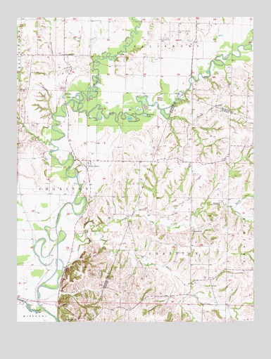
Forest Green, MO USGS Topographic Map
Click on map above to begin viewing in our Map Viewer.

This topographic map contains these locations and features:
Feature Name Type Latitude Longitude GNIS ID View Map
Bailey CemeteryCemeteryN39.3595°W92.8377°713541View Map
Barber BranchStreamN39.3334°W92.7952°713633View Map
Batts CreekStreamN39.2878°W92.8321°713741View Map
Bawker School (historical)SchoolN39.3165°W92.7872°743436View Map
Brown School (historical)SchoolN39.2681°W92.8324°734097View Map
Chariton ChurchChurchN39.2875°W92.7830°715734View Map
Doxies CreekStreamN39.2645°W92.8624°735582View Map
Duck LakeLakeN39.3428°W92.8434°717147View Map
East Fork Little Chariton RiverStreamN39.3406°W92.8449°717292View Map
Forest GreenPopulated PlaceN39.3150°W92.8377°718076View Map
Goose LakeLakeN39.3335°W92.8156°718598View Map
Heryford CemeteryCemeteryN39.3139°W92.8085°719407View Map
Horseshoe LakeLakeN39.3331°W92.8317°719871View Map
Hurst Community HallLocaleN39.3656°W92.7946°735663View Map
Icehouse LakeLakeN39.3345°W92.8069°720069View Map
Lewis MillPopulated PlaceN39.2575°W92.8530°741012View Map
Little Chariton River Tieback LeveeLeveeN39.2522°W92.8567°2109614View Map
Marian Hill ChurchChurchN39.2511°W92.8438°721863View Map
Mid-Missouri Planning RegionCivilN39.2503°W92.7503°754104View Map
Middle Fork Little Chariton RiverStreamN39.3406°W92.8449°722275View Map
Mott CreekStreamN39.3623°W92.7510°722685View Map
Nordmeyer School (historical)SchoolN39.3592°W92.8510°734095View Map
North Fork Batts CreekStreamN39.2970°W92.7621°723449View Map
Oil CityPopulated PlaceN39.3445°W92.8494°741115View Map
Old Channel Chariton RiverStreamN39.2550°W92.8613°723722View Map
Pleasant Hope CemeteryCemeteryN39.3692°W92.7896°724562View Map
Price CemeteryCemeteryN39.2553°W92.8174°724923View Map
Rooker School (historical)SchoolN39.2825°W92.7905°743551View Map
ShannondalePopulated PlaceN39.3592°W92.8499°735850View Map
Shannondale BranchStreamN39.3534°W92.8344°726270View Map
Shannondale School (historical)SchoolN39.3534°W92.8530°734096View Map

Note: Coordinates in the location and feature list above are referenced to NAD83 datum.


Copyright (C) 2008-2024 Ryan Niemi / Sunset Dynamics ... All Rights Reserved