TopoQuest Logo
Do you find TopoQuest useful?
Help keep TopoQuest running and adding new maps/features by donating!
Bitcoin:  19c7KJd3qBynnjoSw5npx9KScwjBe4ifkT
Litecoin:  LXs6TkuXGGXo1vDsWCkWVdjQX94eUKd6ui
Home View Maps Find Maps Find Places Resources & Links


Salisbury, Missouri Topographic Map

USGS Map Title: Salisbury, MO
USGS Map MRC: 39092D7
DRG (GeoTIFF) Download: o39092d7.tif


Neighboring USGS Topographic Map Quads:


  Mike, MO  
39092E8
 

  Bynumville, MO  
39092E7
 

  Prairie Hill, MO  
39092E6
 

  Keytesville, MO  
39092D8
 

  Salisbury, MO  
39092D7
 

  Clifton Hill, MO  
39092D6
 

  Cambridge, MO  
39092C8
 

  Forest Green, MO  
39092C7
 

  Armstrong, MO  
39092C6


Map MRC Location:

N40°
W93°
N40°
W92°
H8 H7 H6 H5 H4 H3 H2 H1
G8 G7 G6 G5 G4 G3 G2 G1
F8 F7 F6 F5 F4 F3 F2 F1
E8 E7 E6 E5 E4 E3 E2 E1
D8 D7 D6 D5 D4 D3 D2 D1
C8 C7 C6 C5 C4 C3 C2 C1
B8 B7 B6 B5 B4 B3 B2 B1
A8 A7 A6 A5 A4 A3 A2 A1
N39°
W93°
N39°
W92°

Salisbury, MO USGS 1:24K Topographic Map Preview:
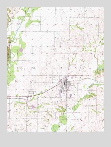
Salisbury, MO USGS Topographic Map
Click on map above to begin viewing in our Map Viewer.

This topographic map contains these locations and features:
Feature Name Type Latitude Longitude GNIS ID View Map
Bee CreekStreamN39.4395°W92.7563°713866View Map
Bentley School (historical)SchoolN39.3878°W92.8363°734083View Map
Brumall School (historical)SchoolN39.3861°W92.7702°734086View Map
City of SalisburyCivilN39.4233°W92.8025°2396529View Map
Coliman School (historical)SchoolN39.4464°W92.8432°734081View Map
EcclesPopulated PlaceN39.4892°W92.8688°740824View Map
Hopewell School (historical)CemeteryN39.3750°W92.8671°723237View Map
Immanuel CemeteryCemeteryN39.4092°W92.7991°720085View Map
Jones BranchStreamN39.4931°W92.8510°720403View Map
Lake BranchStreamN39.4023°W92.7841°720742View Map
McDonald School (historical)SchoolN39.4895°W92.7852°734084View Map
Muncas CreekStreamN39.4225°W92.7594°723063View Map
Prairie Valley ChurchChurchN39.4534°W92.7896°724886View Map
Prairie Valley School (historical)SchoolN39.4534°W92.7844°734085View Map
Redd School (historical)SchoolN39.4761°W92.8330°734080View Map
Saint Joseph CemeteryCemeteryN39.4278°W92.8171°725799View Map
SalisburyPopulated PlaceN39.4239°W92.8016°725956View Map
Salisbury CemeteryCemeteryN39.4172°W92.7838°725957View Map
Salisbury Fire DepartmentBuildingN39.4241°W92.8024°2621699View Map
Salisbury Municipal Airport (historical)AirportN39.4278°W92.8530°758932View Map
Salisbury Police DepartmentBuildingN39.4237°W92.8030°2752527View Map
Salisbury Post OfficePost OfficeN39.4220°W92.8005°2782687View Map
Sterling Price Community LakeReservoirN39.4003°W92.8414°727078View Map
Sterling Price Lake DamDamN39.4000°W92.8435°760356View Map
Township of SalisburyCivilN39.4066°W92.7858°766467View Map
Trent School (historical)SchoolN39.4211°W92.8430°734082View Map

Note: Coordinates in the location and feature list above are referenced to NAD83 datum.


Copyright (C) 2008-2024 Ryan Niemi / Sunset Dynamics ... All Rights Reserved