TopoQuest Logo
Do you find TopoQuest useful?
Help keep TopoQuest running and adding new maps/features by donating!
Bitcoin:  19c7KJd3qBynnjoSw5npx9KScwjBe4ifkT
Litecoin:  LXs6TkuXGGXo1vDsWCkWVdjQX94eUKd6ui
Home View Maps Find Maps Find Places Resources & Links


Fountain, North Carolina Topographic Map

USGS Map Title: Fountain, NC
USGS Map MRC: 35077F6
DRG (GeoTIFF) Download: o35077f6.tif


Neighboring USGS Topographic Map Quads:


  Elm City, NC  
35077G7
 

  Pinetops, NC  
35077G6
 

  Old Sparta, NC  
35077G5
 

  Saratoga, NC  
35077F7
 

  Fountain, NC  
35077F6
 

  Falkland, NC  
35077F5
 

  Stantonsburg, NC  
35077E7
 

  Walstonburg, NC  
35077E6
 

  Farmville, NC  
35077E5


Map MRC Location:

N36°
W78°
N36°
W77°
H8 H7 H6 H5 H4 H3 H2 H1
G8 G7 G6 G5 G4 G3 G2 G1
F8 F7 F6 F5 F4 F3 F2 F1
E8 E7 E6 E5 E4 E3 E2 E1
D8 D7 D6 D5 D4 D3 D2 D1
C8 C7 C6 C5 C4 C3 C2 C1
B8 B7 B6 B5 B4 B3 B2 B1
A8 A7 A6 A5 A4 A3 A2 A1
N35°
W78°
N35°
W77°

Fountain, NC USGS 1:24K Topographic Map Preview:
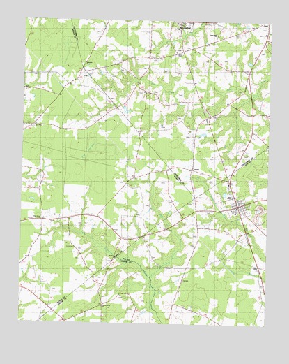
Fountain, NC USGS Topographic Map
Click on map above to begin viewing in our Map Viewer.

This topographic map contains these locations and features:
Feature Name Type Latitude Longitude GNIS ID View Map
Aspen Grove ChurchChurchN35.6854°W77.6925°1004228View Map
Baker Town Fire DepartmentBuildingN35.7216°W77.7462°2638172View Map
Carraway ChurchChurchN35.6432°W77.6669°1004233View Map
FountainPopulated PlaceN35.6740°W77.6400°1023415View Map
Fountain Emergency Medical ServicesBuildingN35.6721°W77.6409°2720596View Map
Fountain Police DepartmentBuildingN35.6737°W77.6402°2130854View Map
Fountain Police DepartmentBuildingN35.6734°W77.6421°2131035View Map
Fountain Post OfficePost OfficeN35.6744°W77.6390°1000748View Map
Fountain QuarryMineN35.6706°W77.6294°2648496View Map
Fountain Rural Fire DepartmentBuildingN35.6721°W77.6410°1007607View Map
Good News ChurchChurchN35.7063°W77.7441°1004221View Map
Living Hope ChurchChurchN35.7446°W77.6522°1004225View Map
Memorial CemeteryCemeteryN35.6718°W77.6525°1004229View Map
Otter Creek ChurchChurchN35.7110°W77.6530°1004226View Map
Piney Grove ChurchChurchN35.6679°W77.7394°1004227View Map
RebaPopulated PlaceN35.6740°W77.6391°1022179View Map
Reid ChapelChurchN35.6779°W77.6425°1004230View Map
Saint James ChurchChurchN35.6646°W77.6761°1004232View Map
Spring Branch ChurchChurchN35.6324°W77.7075°1004231View Map
Strickland PondReservoirN35.7152°W77.7014°999289View Map
Strickland Pond DamDamN35.7152°W77.7014°999290View Map
The PocosinSwampN35.6946°W77.7178°1004220View Map
ToddyLocaleN35.6488°W77.6275°1024352View Map
Town of FountainCivilN35.6720°W77.6308°2406512View Map
Township 9-Otter CreekCivilN35.7254°W77.6604°1026666View Map
TurnagePopulated PlaceN35.6885°W77.6616°1006392View Map
Ward RunStreamN35.6452°W77.6830°996783View Map
WebbsPopulated PlaceN35.7349°W77.6861°1004223View Map
Webbs ChapelChurchN35.7363°W77.6719°1004224View Map
Webbtown ChurchChurchN35.7324°W77.7189°1004222View Map

Note: Coordinates in the location and feature list above are referenced to NAD83 datum.


Copyright (C) 2008-2024 Ryan Niemi / Sunset Dynamics ... All Rights Reserved