TopoQuest Logo
Do you find TopoQuest useful?
Help keep TopoQuest running and adding new maps/features by donating!
Bitcoin:  19c7KJd3qBynnjoSw5npx9KScwjBe4ifkT
Litecoin:  LXs6TkuXGGXo1vDsWCkWVdjQX94eUKd6ui
Home View Maps Find Maps Find Places Resources & Links


Ashwood, Texas Topographic Map

USGS Map Title: Ashwood, TX
USGS Map MRC: 29095A7
DRG (GeoTIFF) Download: o29095a7.tif


Neighboring USGS Topographic Map Quads:


  Pledger, TX  
29095B8
 

  Danciger, TX  
29095B7
 

  West Columbia, TX  
29095B6
 

  Van Vleck, TX  
29095A8
 

  Ashwood, TX  
29095A7
 

  Sweeny, TX  
29095A6
 

  Bay City, TX  
28095H8
 

  Bay City NE, TX  
28095H7
 

  Cedar Lane, TX  
28095H6


Map MRC Location:

N30°
W96°
N30°
W95°
H8 H7 H6 H5 H4 H3 H2 H1
G8 G7 G6 G5 G4 G3 G2 G1
F8 F7 F6 F5 F4 F3 F2 F1
E8 E7 E6 E5 E4 E3 E2 E1
D8 D7 D6 D5 D4 D3 D2 D1
C8 C7 C6 C5 C4 C3 C2 C1
B8 B7 B6 B5 B4 B3 B2 B1
A8 A7 A6 A5 A4 A3 A2 A1
N29°
W96°
N29°
W95°

Ashwood, TX USGS 1:24K Topographic Map Preview:
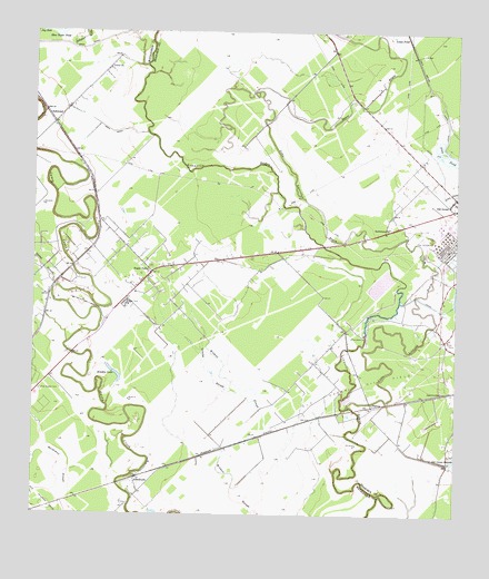
Ashwood, TX USGS Topographic Map
Click on map above to begin viewing in our Map Viewer.

This topographic map contains these locations and features:
Feature Name Type Latitude Longitude GNIS ID View Map
AbercrombiePopulated PlaceN29.0322°W95.7533°1379307View Map
AllenhurstPopulated PlaceN29.0094°W95.8447°1379333View Map
AshwoodPopulated PlaceN29.1041°W95.8713°1379368View Map
Bethlehem ChurchChurchN29.0747°W95.7700°1351968View Map
Bouldin LakeLakeN29.0376°W95.8520°1352724View Map
Dance BayouStreamN29.1100°W95.8086°1355623View Map
Free System CemeteryCemeteryN29.0322°W95.8733°1357710View Map
Grassy SloughStreamN29.0297°W95.8091°1358320View Map
HasimaPopulated PlaceN29.0283°W95.7744°1379905View Map
Linnville Creek ReservoirReservoirN29.0522°W95.7715°1857718View Map
Linnville Creek Reservoir DamDamN29.0469°W95.7769°1857717View Map
Little Linnville BayouStreamN29.0280°W95.7819°1361400View Map
Morris PondSwampN29.0816°W95.7766°1363164View Map
Old Ocean Post OfficePost OfficeN29.0801°W95.7503°2732268View Map
Peterson AirportAirportN29.1093°W95.7770°2675758View Map
Snead SloughStreamN29.0589°W95.8686°1368556View Map
Sugar ValleyPopulated PlaceN29.0628°W95.8397°1369320View Map
Sugar Valley Oil FieldOilfieldN29.0561°W95.8641°1369321View Map
Union ChurchChurchN29.1158°W95.8533°1370442View Map

Note: Coordinates in the location and feature list above are referenced to NAD83 datum.


Copyright (C) 2008-2024 Ryan Niemi / Sunset Dynamics ... All Rights Reserved