TopoQuest Logo
Do you find TopoQuest useful?
Help keep TopoQuest running and adding new maps/features by donating!
Bitcoin:  19c7KJd3qBynnjoSw5npx9KScwjBe4ifkT
Litecoin:  LXs6TkuXGGXo1vDsWCkWVdjQX94eUKd6ui
Home View Maps Find Maps Find Places Resources & Links


Carthage, Missouri Topographic Map

USGS Map Title: Carthage, MO
USGS Map MRC: 37094B3
DRG (GeoTIFF) Download: o37094b3.tif


Neighboring USGS Topographic Map Quads:


  Neck City, MO  
37094C4
 

  Jasper, MO  
37094C3
 

  Maple Grove, MO  
37094C2
 

  Webb City, MO  
37094B4
 

  Carthage, MO  
37094B3
 

  Avilla, MO  
37094B2
 

  Joplin East, MO  
37094A4
 

  Fidelity, MO  
37094A3
 

  Reeds, MO  
37094A2


Map MRC Location:

N38°
W95°
N38°
W94°
H8 H7 H6 H5 H4 H3 H2 H1
G8 G7 G6 G5 G4 G3 G2 G1
F8 F7 F6 F5 F4 F3 F2 F1
E8 E7 E6 E5 E4 E3 E2 E1
D8 D7 D6 D5 D4 D3 D2 D1
C8 C7 C6 C5 C4 C3 C2 C1
B8 B7 B6 B5 B4 B3 B2 B1
A8 A7 A6 A5 A4 A3 A2 A1
N37°
W95°
N37°
W94°

Carthage, MO USGS 1:24K Topographic Map Preview:
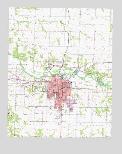
Carthage, MO USGS Topographic Map
Click on map above to begin viewing in our Map Viewer.

This topographic map contains these locations and features:
Feature Name Type Latitude Longitude GNIS ID View Map
Barlet's Base AirportAirportN37.1280°W94.2537°2679410View Map
Bethel ChurchChurchN37.1262°W94.2716°714047View Map
Camp PutnamLocaleN37.1873°W94.2777°715282View Map
CarthagePopulated PlaceN37.1764°W94.3102°715455View Map
Carthage Fire DepartmentBuildingN37.1731°W94.3145°2620371View Map
Carthage High SchoolSchoolN37.1455°W94.2993°2709706View Map
Carthage Junior High SchoolSchoolN37.1736°W94.3105°2709707View Map
Carthage Middle SchoolSchoolN37.1629°W94.3019°2709708View Map
Carthage Police DepartmentBuildingN37.1759°W94.3134°2752169View Map
Carthage Post OfficePost OfficeN37.1768°W94.3124°2783171View Map
Carthage Technical CenterSchoolN37.1740°W94.3009°2709714View Map
Cedar Hill CemeteryCemeteryN37.1717°W94.2924°715603View Map
Centennial School (historical)SchoolN37.1405°W94.2508°745699View Map
City of CarthageCivilN37.1638°W94.3063°2393760View Map
Columbian Elementary SchoolSchoolN37.1678°W94.3238°716139View Map
EdwinLocaleN37.1542°W94.3238°740320View Map
Eugene Field School (historical)SchoolN37.1731°W94.3055°717648View Map
Fairview ChurchChurchN37.2284°W94.3683°717774View Map
Fairview Elementary SchoolSchoolN37.1552°W94.2953°2709710View Map
Frerer StripAirportN37.1350°W94.3636°2679310View Map
Green Cove School (historical)SchoolN37.1826°W94.2666°746097View Map
Green Grove School (historical)SchoolN37.1581°W94.2697°718791View Map
Hawthorne School (historical)SchoolN37.1792°W94.3211°719245View Map
High Hill School (historical)SchoolN37.1312°W94.3663°719528View Map
Jasper CountyCivilN37.2035°W94.3406°758503View Map
Jasper County Sheriff's OfficeBuildingN37.1772°W94.3111°2752312View Map
KDMO-AM (Carthage)TowerN37.1745°W94.2947°759262View Map
KDMO-AM (Carthage)TowerN37.1828°W94.3622°754303View Map
Kellogg LakeReservoirN37.1885°W94.2930°762830View Map
Kellogg Lake DamDamN37.1884°W94.2936°762829View Map
Kellogg Lake ParkParkN37.1873°W94.2947°720510View Map
KendricktownPopulated PlaceN37.1948°W94.3099°720535View Map
Knells ParkLocaleN37.1753°W94.3480°740321View Map
KnightsPopulated PlaceN37.1403°W94.2513°740992View Map
KRGK-FM (Carthage)TowerN37.1828°W94.3599°759146View Map
La Grange School (historical)SchoolN37.2051°W94.2899°720714View Map
Lee's Flying ParkAirportN37.2317°W94.3102°2770283View Map
Lone Star School (historical)SchoolN37.1551°W94.3461°721473View Map
Marion School (historical)SchoolN37.2064°W94.3352°721869View Map
Mark Twain Elementary SchoolSchoolN37.1634°W94.3122°721873View Map
MaxvillePopulated PlaceN37.1981°W94.2683°721996View Map
Mercy Hospital CarthageHospitalN37.1359°W94.3211°2655067View Map
Monitor School (historical)SchoolN37.1770°W94.3505°722528View Map
Morgan HeightsPopulated PlaceN37.1659°W94.3552°722615View Map
Myers Park Memorial Municipal Airport (historical)AirportN37.1459°W94.3127°758627View Map
Oak Hill CemeteryCemeteryN37.1708°W94.3328°723615View Map
Our Lady of the Ozarks College (historical)SchoolN37.1564°W94.3086°723894View Map
Park CemeteryCemeteryN37.1726°W94.3299°724015View Map
Pleasant Grove School (historical)SchoolN37.1253°W94.2566°724501View Map
Pleasant ValleyPopulated PlaceN37.1548°W94.3424°724611View Map
Prairie Dale School (historical)SchoolN37.2339°W94.2808°746095View Map
Prairie View School (historical)SchoolN37.1409°W94.3111°724896View Map
Radium School (historical)SchoolN37.1987°W94.2661°746096View Map
Saint Anns SchoolSchoolN37.1687°W94.3080°725723View Map
Shiloh School (historical)SchoolN37.2426°W94.3347°746094View Map
Steadley Elementary SchoolSchoolN37.1392°W94.3411°2709709View Map
Township of MarionCivilN37.2057°W94.3455°766815View Map

Note: Coordinates in the location and feature list above are referenced to NAD83 datum.


Copyright (C) 2008-2024 Ryan Niemi / Sunset Dynamics ... All Rights Reserved