TopoQuest Logo
Do you find TopoQuest useful?
Help keep TopoQuest running and adding new maps/features by donating!
Bitcoin:  19c7KJd3qBynnjoSw5npx9KScwjBe4ifkT
Litecoin:  LXs6TkuXGGXo1vDsWCkWVdjQX94eUKd6ui
Home View Maps Find Maps Find Places Resources & Links


Kildare, Texas Topographic Map

USGS Map Title: Kildare, TX
USGS Map MRC: 32094H2
DRG (GeoTIFF) Download: o32094h2.tif


Neighboring USGS Topographic Map Quads:


  Linden, TX  
33094A3
 

  Atlanta South, TX  
33094A2
 

  Ravanna, AR  
33094A1
 

  Lanier, TX  
32094H3
 

  Kildare, TX  
32094H2
 

  McLeod, TX  
32094H1
 

  Jefferson, TX  
32094G3
 

  Smithland, TX  
32094G2
 

  Trees, LA  
32094G1


Map MRC Location:

N33°
W95°
N33°
W94°
H8 H7 H6 H5 H4 H3 H2 H1
G8 G7 G6 G5 G4 G3 G2 G1
F8 F7 F6 F5 F4 F3 F2 F1
E8 E7 E6 E5 E4 E3 E2 E1
D8 D7 D6 D5 D4 D3 D2 D1
C8 C7 C6 C5 C4 C3 C2 C1
B8 B7 B6 B5 B4 B3 B2 B1
A8 A7 A6 A5 A4 A3 A2 A1
N32°
W95°
N32°
W94°

Kildare, TX USGS 1:24K Topographic Map Preview:
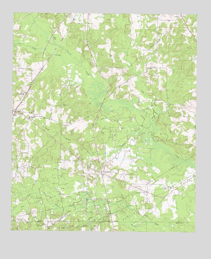
Kildare, TX USGS Topographic Map
Click on map above to begin viewing in our Map Viewer.

This topographic map contains these locations and features:
Feature Name Type Latitude Longitude GNIS ID View Map
Bear CreekStreamN32.8965°W94.2316°1330225View Map
Bivins-McLeod DivisionCivilN32.9926°W94.1416°1938539View Map
Camp CreekStreamN32.9699°W94.2030°1331967View Map
Cass County Fire District 1 Kildare StationBuildingN32.8954°W94.1583°2655462View Map
Cole CreekStreamN32.9329°W94.1538°1333082View Map
Corey BranchStreamN32.9296°W94.1557°1333354View Map
Duck CreekStreamN32.9824°W94.2444°1334716View Map
Ferrell CemeteryCemeteryN32.9474°W94.2155°1335754View Map
Grogan DamDamN32.9951°W94.2085°1855009View Map
Grogan LakeReservoirN32.9951°W94.2085°1855010View Map
Haynes Oil FieldOilfieldN32.9276°W94.1819°1337502View Map
HuffinsPopulated PlaceN32.9993°W94.1357°1380862View Map
KildarePopulated PlaceN32.9432°W94.2482°1374370View Map
Kildare JunctionPopulated PlaceN32.9085°W94.1885°1378525View Map
Kildare Oil FieldOilfieldN32.8996°W94.2305°1339098View Map
Kildare Post OfficePost OfficeN32.9439°W94.2492°2732062View Map
Leek CreekStreamN32.9424°W94.1566°1374499View Map
Linden-Kildare Junior High SchoolSchoolN32.9401°W94.2385°1339967View Map
Moore BranchStreamN32.9443°W94.1841°1341862View Map
New Zion ChurchChurchN32.9410°W94.2355°1342556View Map
Saint John ChurchChurchN32.9429°W94.2377°1345933View Map
Saint Paul ChurchChurchN32.9396°W94.2274°1346079View Map
Saint Paul ChurchChurchN32.9693°W94.1566°1346080View Map
Spear LakeLakeN32.9871°W94.2237°1347633View Map
Timber BranchStreamN32.8790°W94.1516°1348571View Map

Note: Coordinates in the location and feature list above are referenced to NAD83 datum.


Copyright (C) 2008-2024 Ryan Niemi / Sunset Dynamics ... All Rights Reserved