TopoQuest Logo
Do you find TopoQuest useful?
Help keep TopoQuest running and adding new maps/features by donating!
Bitcoin:  19c7KJd3qBynnjoSw5npx9KScwjBe4ifkT
Litecoin:  LXs6TkuXGGXo1vDsWCkWVdjQX94eUKd6ui
Home View Maps Find Maps Find Places Resources & Links


Little Rose, Wisconsin Topographic Map

USGS Map Title: Little Rose, WI
USGS Map MRC: 44090G2
DRG (GeoTIFF) Download: o44090g2.tif


Neighboring USGS Topographic Map Quads:


  Abbotsford, WI  
44090H3
 

  Milan, WI  
44090H2
 

  Wien, WI  
44090H1
 

  Spencer North, WI  
44090G3
 

  Little Rose, WI  
44090G2
 

  Stratford, WI  
44090G1
 

  Spencer South, WI  
44090F3
 

  Marshfield, WI  
44090F2
 

  Hewitt, WI  
44090F1


Map MRC Location:

N45°
W91°
N45°
W90°
H8 H7 H6 H5 H4 H3 H2 H1
G8 G7 G6 G5 G4 G3 G2 G1
F8 F7 F6 F5 F4 F3 F2 F1
E8 E7 E6 E5 E4 E3 E2 E1
D8 D7 D6 D5 D4 D3 D2 D1
C8 C7 C6 C5 C4 C3 C2 C1
B8 B7 B6 B5 B4 B3 B2 B1
A8 A7 A6 A5 A4 A3 A2 A1
N44°
W91°
N44°
W90°

Little Rose, WI USGS 1:24K Topographic Map Preview:
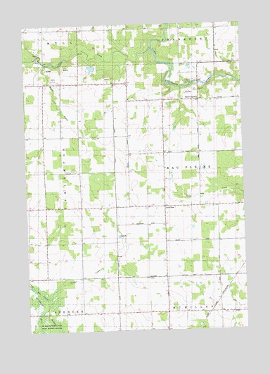
Little Rose, WI USGS Topographic Map
Click on map above to begin viewing in our Map Viewer.

This topographic map contains these locations and features:
Feature Name Type Latitude Longitude GNIS ID View Map
0.39 ReservoirReservoirN44.7583°W90.2335°1793620View Map
Carlson CreekStreamN44.7639°W90.2376°1562717View Map
Del Fatti Construction Number 1 G-8737 DamDamN44.8566°W90.2068°1793342View Map
Dill CreekStreamN44.8652°W90.1762°1563982View Map
Emanuel ChurchChurchN44.8480°W90.1496°1844103View Map
Enterprise School (historical)SchoolN44.8508°W90.2293°1876687View Map
Harding School (historical)SchoolN44.8008°W90.2393°1876695View Map
Kopp G 26 DamDamN44.7583°W90.2335°1793619View Map
Lindbergh School (historical)SchoolN44.8439°W90.1507°1876707View Map
Little RosePopulated PlaceN44.8008°W90.1704°1568390View Map
Lone Pine School (historical)SchoolN44.8733°W90.2187°1876708View Map
March RapidsPopulated PlaceN44.8444°W90.1501°1569022View Map
March Rapids County ParkParkN44.8508°W90.1499°1844190View Map
McArthur School (historical)SchoolN44.8008°W90.1704°1876715View Map
Raeder CreekStreamN44.8591°W90.2371°1572025View Map
Saint Adalbert ChurchChurchN44.7714°W90.1715°1572809View Map
Timilin School (historical)SchoolN44.7575°W90.1804°1876746View Map
Town of Eau PleineCivilN44.8161°W90.1419°1583127View Map
Upham School (historical)SchoolN44.8733°W90.1399°1876752View Map
Wescott School (historical)SchoolN44.8436°W90.1807°1876757View Map
West Kerwin School (historical)SchoolN44.7577°W90.1346°1876758View Map

Note: Coordinates in the location and feature list above are referenced to NAD83 datum.


Copyright (C) 2008-2024 Ryan Niemi / Sunset Dynamics ... All Rights Reserved