TopoQuest Logo
Do you find TopoQuest useful?
Help keep TopoQuest running and adding new maps/features by donating!
Bitcoin:  19c7KJd3qBynnjoSw5npx9KScwjBe4ifkT
Litecoin:  LXs6TkuXGGXo1vDsWCkWVdjQX94eUKd6ui
Home View Maps Find Maps Find Places Resources & Links


Spencer North, Wisconsin Topographic Map

USGS Map Title: Spencer North, WI
USGS Map MRC: 44090G3
DRG (GeoTIFF) Download: o44090g3.tif


Neighboring USGS Topographic Map Quads:


  Curtiss, WI  
44090H4
 

  Abbotsford, WI  
44090H3
 

  Milan, WI  
44090H2
 

  Riplinger, WI  
44090G4
 

  Spencer North, WI  
44090G3
 

  Little Rose, WI  
44090G2
 

  Loyal East, WI  
44090F4
 

  Spencer South, WI  
44090F3
 

  Marshfield, WI  
44090F2


Map MRC Location:

N45°
W91°
N45°
W90°
H8 H7 H6 H5 H4 H3 H2 H1
G8 G7 G6 G5 G4 G3 G2 G1
F8 F7 F6 F5 F4 F3 F2 F1
E8 E7 E6 E5 E4 E3 E2 E1
D8 D7 D6 D5 D4 D3 D2 D1
C8 C7 C6 C5 C4 C3 C2 C1
B8 B7 B6 B5 B4 B3 B2 B1
A8 A7 A6 A5 A4 A3 A2 A1
N44°
W91°
N44°
W90°

Spencer North, WI USGS 1:24K Topographic Map Preview:
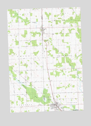
Spencer North, WI USGS Topographic Map
Click on map above to begin viewing in our Map Viewer.

This topographic map contains these locations and features:
Feature Name Type Latitude Longitude GNIS ID View Map
Brighton CemeteryCemeteryN44.8436°W90.3004°1562207View Map
Brighton School (historical)SchoolN44.7722°W90.2601°1876672View Map
Christ the King Catholic ChurchChurchN44.7561°W90.2990°1876678View Map
Groveside School (historical)SchoolN44.7855°W90.3724°1876592View Map
Maplewood School (historical)SchoolN44.8289°W90.3571°1876594View Map
Marathon County Public Library Spencer BranchBuildingN44.7567°W90.2981°2722993View Map
Romeo School (historical)SchoolN44.8080°W90.3101°1876731View Map
Saint Johns Lutheran ChurchChurchN44.7869°W90.3054°1573102View Map
SpencerPopulated PlaceN44.7577°W90.2968°1574525View Map
Spencer Elementary SchoolSchoolN44.7591°W90.2937°2713409View Map
Spencer Fire DepartmentBuildingN44.7505°W90.2971°2696780View Map
Spencer High SchoolSchoolN44.7592°W90.2937°1845289View Map
Spencer MarshSwampN44.7702°W90.3337°1574533View Map
Spencer Village Police DepartmentBuildingN44.7566°W90.2980°2759760View Map
Town of BrightonCivilN44.8147°W90.2567°1582858View Map
Trinity CemeteryCemeteryN44.8227°W90.3165°1575617View Map
UnityPopulated PlaceN44.8516°W90.3165°1575925View Map
Unity Elementary SchoolSchoolN44.8491°W90.3129°1845305View Map
Unity ParkParkN44.8358°W90.3112°1575928View Map
Village of SpencerCivilN44.7544°W90.2983°1584183View Map
Village of UnityCivilN44.8512°W90.3130°1584319View Map
West Spencer CemeteryCemeteryN44.7583°W90.3215°1576562View Map
Willow Brook School (historical)SchoolN44.7930°W90.3371°1876608View Map
Winding CreekStreamN44.8597°W90.2590°1576855View Map
WOSX-FM (Spencer)TowerN44.8097°W90.3643°1582630View Map

Note: Coordinates in the location and feature list above are referenced to NAD83 datum.


Copyright (C) 2008-2024 Ryan Niemi / Sunset Dynamics ... All Rights Reserved