TopoQuest Logo
Do you find TopoQuest useful?
Help keep TopoQuest running and adding new maps/features by donating!
Bitcoin:  19c7KJd3qBynnjoSw5npx9KScwjBe4ifkT
Litecoin:  LXs6TkuXGGXo1vDsWCkWVdjQX94eUKd6ui
Home View Maps Find Maps Find Places Resources & Links


Lonedell, Missouri Topographic Map

USGS Map Title: Lonedell, MO
USGS Map MRC: 38090C7
DRG (GeoTIFF) Download: o38090c7.tif


Neighboring USGS Topographic Map Quads:


  Moselle, MO  
38090D8
 

  Gray Summit, MO  
38090D7
 

  Pacific, MO  
38090D6
 

  Saint Clair, MO  
38090C8
 

  Lonedell, MO  
38090C7
 

  Cedar Hill, MO  
38090C6
 

  Cyclone Hollow, MO  
38090B8
 

  Richwoods, MO  
38090B7
 

  Fletcher, MO  
38090B6


Map MRC Location:

N39°
W91°
N39°
W90°
H8 H7 H6 H5 H4 H3 H2 H1
G8 G7 G6 G5 G4 G3 G2 G1
F8 F7 F6 F5 F4 F3 F2 F1
E8 E7 E6 E5 E4 E3 E2 E1
D8 D7 D6 D5 D4 D3 D2 D1
C8 C7 C6 C5 C4 C3 C2 C1
B8 B7 B6 B5 B4 B3 B2 B1
A8 A7 A6 A5 A4 A3 A2 A1
N38°
W91°
N38°
W90°

Lonedell, MO USGS 1:24K Topographic Map Preview:
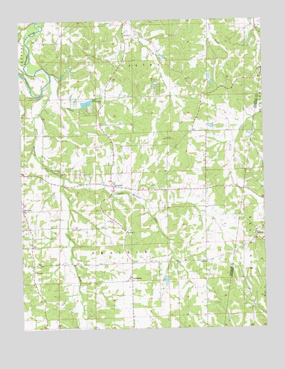
Lonedell, MO USGS Topographic Map
Click on map above to begin viewing in our Map Viewer.

This topographic map contains these locations and features:
Feature Name Type Latitude Longitude GNIS ID View Map
Al Swantner ReservoirReservoirN38.3184°W90.7851°764603View Map
Anderson Lake DamDamN38.3317°W90.7751°764404View Map
Calvey (historical)Populated PlaceN38.3476°W90.7962°740104View Map
Diamond SchoolSchoolN38.2639°W90.7957°741675View Map
Drake SchoolSchoolN38.3509°W90.8287°741671View Map
Emmett Brison DamDamN38.3417°W90.8001°764604View Map
Emmett Brison ReservoirReservoirN38.3417°W90.8001°764605View Map
Fairview ChurchChurchN38.2773°W90.7801°717784View Map
Faith Revival CenterChurchN38.2742°W90.8693°717828View Map
Finney CemeteryCemeteryN38.3599°W90.8024°717927View Map
G Williams DamDamN38.2717°W90.8018°764405View Map
GrubvillePopulated PlaceN38.2884°W90.7549°718907View Map
HemkerPopulated PlaceN38.3073°W90.7776°730651View Map
Hickory Flat SchoolSchoolN38.3076°W90.7799°741674View Map
Johnson BranchStreamN38.3539°W90.8593°731594View Map
Lake ArrowheadReservoirN38.3415°W90.8411°758245View Map
Lake Arrowhead DamDamN38.3401°W90.8435°764403View Map
Lake Marion DamDamN38.3684°W90.7568°764402View Map
Lake TorinoReservoirN38.3634°W90.8268°764379View Map
Lake Torino DamDamN38.3634°W90.8268°764378View Map
Lake Von Der Rosa DamDamN38.3534°W90.7785°764409View Map
Little Meramec RiverStreamN38.3501°W90.8604°731605View Map
Lone Dell Camp (historical)LocaleN38.3359°W90.8576°741670View Map
LonedellPopulated PlaceN38.3081°W90.8276°731607View Map
Lonedell Lookout TowerTowerN38.3267°W90.7968°755290View Map
Lonedell Post OfficePost OfficeN38.3083°W90.8276°2783062View Map
LuebberingPopulated PlaceN38.2703°W90.8193°731610View Map
Mount HopePopulated PlaceN38.2984°W90.8737°741084View Map
Mount Olive ChurchChurchN38.3692°W90.8207°731622View Map
Mount Pleasant School (historical)SchoolN38.3567°W90.7690°741672View Map
Oak Grove CemeteryCemeteryN38.3430°W90.8608°1923217View Map
Oak Grove ChurchChurchN38.3142°W90.8549°731627View Map
Pierce CreekStreamN38.3112°W90.8526°724320View Map
Prairie School (historical)SchoolN38.2695°W90.8312°730649View Map
Rockford SchoolSchoolN38.2909°W90.8724°741673View Map
Saint Clair Fire Protection District Station 2BuildingN38.3090°W90.8319°2621344View Map
Saint Francis of Assisi Catholic CemeteryCemeteryN38.2706°W90.8196°2702130View Map
School R-14SchoolN38.2898°W90.8210°726116View Map
Swantner Lake DamDamN38.3184°W90.7851°764602View Map
Sycamore School (historical)SchoolN38.3076°W90.8204°730650View Map
Township of PrairieCivilN38.2647°W90.8620°766651View Map
Von Der Ahe DamDamN38.3617°W90.7518°764912View Map
Von Der Rosa Number 2 ReservoirReservoirN38.3617°W90.7518°764913View Map
Von Derosa Number 2 Lake DamDamN38.3501°W90.7768°765259View Map
Von Derosa Number 3 Lake DamDamN38.3501°W90.7801°765260View Map
Waits SawmillLocaleN38.3662°W90.8696°755642View Map
Watters Lake DamDamN38.3601°W90.8035°765047View Map
Williams LakeReservoirN38.2694°W90.8012°764406View Map
Willow Ford (historical)LocaleN38.3723°W90.8690°755643View Map
Woodcock CemeteryCemeteryN38.2938°W90.8275°729094View Map

Note: Coordinates in the location and feature list above are referenced to NAD83 datum.


Copyright (C) 2008-2024 Ryan Niemi / Sunset Dynamics ... All Rights Reserved