TopoQuest Logo
Do you find TopoQuest useful?
Help keep TopoQuest running and adding new maps/features by donating!
Bitcoin:  19c7KJd3qBynnjoSw5npx9KScwjBe4ifkT
Litecoin:  LXs6TkuXGGXo1vDsWCkWVdjQX94eUKd6ui
Home View Maps Find Maps Find Places Resources & Links


Cedar Hill, Missouri Topographic Map

USGS Map Title: Cedar Hill, MO
USGS Map MRC: 38090C6
DRG (GeoTIFF) Download: o38090c6.tif


Neighboring USGS Topographic Map Quads:


  Gray Summit, MO  
38090D7
 

  Pacific, MO  
38090D6
 

  House Springs, MO  
38090D5
 

  Lonedell, MO  
38090C7
 

  Cedar Hill, MO  
38090C6
 

  Belews Creek, MO  
38090C5
 

  Richwoods, MO  
38090B7
 

  Fletcher, MO  
38090B6
 

  De Soto, MO  
38090B5


Map MRC Location:

N39°
W91°
N39°
W90°
H8 H7 H6 H5 H4 H3 H2 H1
G8 G7 G6 G5 G4 G3 G2 G1
F8 F7 F6 F5 F4 F3 F2 F1
E8 E7 E6 E5 E4 E3 E2 E1
D8 D7 D6 D5 D4 D3 D2 D1
C8 C7 C6 C5 C4 C3 C2 C1
B8 B7 B6 B5 B4 B3 B2 B1
A8 A7 A6 A5 A4 A3 A2 A1
N38°
W91°
N38°
W90°

Cedar Hill, MO USGS 1:24K Topographic Map Preview:
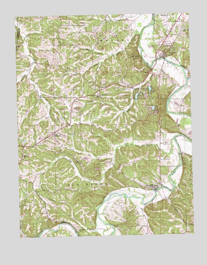
Cedar Hill, MO USGS Topographic Map
Click on map above to begin viewing in our Map Viewer.

This topographic map contains these locations and features:
Feature Name Type Latitude Longitude GNIS ID View Map
Belews CreekStreamN38.3376°W90.6273°713889View Map
Bethlehem ChurchChurchN38.2531°W90.7082°714095View Map
Bethlehem CreekStreamN38.2631°W90.6943°714108View Map
Bethlehem School (historical)SchoolN38.2539°W90.7090°737694View Map
Black Hawke School (historical)SchoolN38.2626°W90.7424°737693View Map
Calvey School (historical)SchoolN38.3437°W90.7390°737692View Map
Cedar Grove School (historical)SchoolN38.2531°W90.6629°737697View Map
Cedar HillPopulated PlaceN38.3534°W90.6412°737691View Map
Cedar Hill Census Designated PlaceCensusN38.3575°W90.6410°2393369View Map
Cedar Hill ChurchChurchN38.3659°W90.6282°736290View Map
Cedar Hill Fire Protection District Station 1BuildingN38.3512°W90.6429°2621039View Map
Cedar Hill Fire Protection District Station 2BuildingN38.3060°W90.7293°2620909View Map
Cedar Hill Lake Number 1ReservoirN38.3340°W90.6545°763677View Map
Cedar Hill Lake Number 1 DamDamN38.3340°W90.6544°763676View Map
Cedar Hill Lake Number 2ReservoirN38.3287°W90.6640°763563View Map
Cedar Hill Lake Number 2 DamDamN38.3302°W90.6630°763562View Map
Cedar Hill Lake Number 3ReservoirN38.3297°W90.6609°764855View Map
Cedar Hill Lake Number 3 DamDamN38.3301°W90.6618°764854View Map
Cedar Hill LakesReservoirN38.3326°W90.6544°715604View Map
Cedar Hill LakesPopulated PlaceN38.3298°W90.6576°1669591View Map
Cedar Hill ManorPopulated PlaceN38.3589°W90.6458°2469164View Map
Cedar Hill Post OfficePost OfficeN38.3538°W90.6456°2783211View Map
Cedar Ridge Number 2 DamDamN38.3417°W90.7118°764944View Map
Des Peres Quarry Lake DamDamN38.3067°W90.6268°765203View Map
DittmerPopulated PlaceN38.3356°W90.6882°716919View Map
Dittmer Post OfficePost OfficeN38.3325°W90.6885°2782775View Map
Dry CreekStreamN38.2713°W90.6706°717094View Map
Dutch CreekStreamN38.3637°W90.6599°717214View Map
Flatrock CampLocaleN38.2514°W90.7399°718000View Map
Grubville Post OfficePost OfficeN38.2960°W90.7465°2782806View Map
Grubville SchoolSchoolN38.2962°W90.7465°718908View Map
Hidden Valley LakeReservoirN38.2884°W90.6918°764204View Map
Hidden Valley Lake DamDamN38.2884°W90.6918°764203View Map
Isum CreekStreamN38.3442°W90.6298°720184View Map
Jones CreekStreamN38.3042°W90.6379°720413View Map
Kirchners LakeReservoirN38.3434°W90.6985°764194View Map
Lake AdelleReservoirN38.3219°W90.6524°758242View Map
Lake Adelle DamDamN38.3234°W90.6535°764192View Map
Lake Maryann DamDamN38.2934°W90.7001°764205View Map
Lakes FamarReservoirN38.3217°W90.7051°764209View Map
Lakes Famar Lower DamDamN38.3217°W90.7051°764208View Map
Lakes Famar Upper DamDamN38.3217°W90.7068°764210View Map
Local School (historical)SchoolN38.3670°W90.6285°737695View Map
Maple Grove SchoolSchoolN38.3289°W90.6910°721826View Map
Mayfield School (historical)SchoolN38.2873°W90.6654°737696View Map
Morse MillPopulated PlaceN38.2767°W90.6532°736327View Map
Morse Mill Post OfficePost OfficeN38.2787°W90.6487°2782754View Map
North Fork Jones CreekStreamN38.2942°W90.6810°723461View Map
Number 883 DamDamN38.2884°W90.6568°765082View Map
Number 884 DamDamN38.3451°W90.7135°764945View Map
OermannPopulated PlaceN38.3081°W90.7235°736333View Map
One Hundred and One RanchPopulated PlaceN38.3506°W90.6657°723821View Map
Ryan Lake DamDamN38.3067°W90.7335°764202View Map
Saint Martins ChurchChurchN38.3289°W90.6901°736342View Map
Skullbones CreekStreamN38.3451°W90.6526°736350View Map
Skullens CemeteryCemeteryN38.3737°W90.6401°726516View Map
Stewart Lake DamDamN38.3217°W90.6835°764946View Map
Sun Fish Lake DamDamN38.3434°W90.6985°764193View Map
Turn-Bo DamDamN38.3334°W90.7251°764251View Map
Turn-Bo LakeReservoirN38.3334°W90.7251°764252View Map
Village of Cedar Hill LakesCivilN38.3300°W90.6581°2397581View Map
West Fork Jones CreekStreamN38.2945°W90.6810°728566View Map
Wine CreekStreamN38.3520°W90.6821°728995View Map

Note: Coordinates in the location and feature list above are referenced to NAD83 datum.


Copyright (C) 2008-2024 Ryan Niemi / Sunset Dynamics ... All Rights Reserved