TopoQuest Logo
Do you find TopoQuest useful?
Help keep TopoQuest running and adding new maps/features by donating!
Bitcoin:  19c7KJd3qBynnjoSw5npx9KScwjBe4ifkT
Litecoin:  LXs6TkuXGGXo1vDsWCkWVdjQX94eUKd6ui
Home View Maps Find Maps Find Places Resources & Links


Marshfield, Missouri Topographic Map

USGS Map Title: Marshfield, MO
USGS Map MRC: 37092C8
DRG (GeoTIFF) Download: o37092c8.tif


Neighboring USGS Topographic Map Quads:


  Elkland, MO  
37093D1
 

  Beach, MO  
37092D8
 

  Niangua, MO  
37092D7
 

  Strafford, MO  
37093C1
 

  Marshfield, MO  
37092C8
 

  High Prairie, MO  
37092C7
 

  Oak Grove Heights, MO  
37093B1
 

  Fordland, MO  
37092B8
 

  Seymour, MO  
37092B7


Map MRC Location:

N38°
W93°
N38°
W92°
H8 H7 H6 H5 H4 H3 H2 H1
G8 G7 G6 G5 G4 G3 G2 G1
F8 F7 F6 F5 F4 F3 F2 F1
E8 E7 E6 E5 E4 E3 E2 E1
D8 D7 D6 D5 D4 D3 D2 D1
C8 C7 C6 C5 C4 C3 C2 C1
B8 B7 B6 B5 B4 B3 B2 B1
A8 A7 A6 A5 A4 A3 A2 A1
N37°
W93°
N37°
W92°

Marshfield, MO USGS 1:24K Topographic Map Preview:
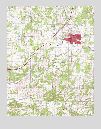
Marshfield, MO USGS Topographic Map
Click on map above to begin viewing in our Map Viewer.

This topographic map contains these locations and features:
Feature Name Type Latitude Longitude GNIS ID View Map
Anderson School (historical)SchoolN37.3181°W92.9341°713291View Map
Bell SpringSpringN37.2634°W92.9041°713918View Map
Biggs Lower Lake DamDamN37.3517°W92.9235°763295View Map
Bumgarden FordPopulated PlaceN37.2684°W92.9788°740707View Map
Calvary ChurchChurchN37.3495°W92.9299°742177View Map
Church of ChristChurchN37.3275°W92.9068°742176View Map
City of MarshfieldCivilN37.3414°W92.9117°2395025View Map
Clifton CemeteryCemeteryN37.2628°W92.9316°742174View Map
Clubhouse CreekStreamN37.2673°W92.9313°716021View Map
CrownPopulated PlaceN37.2645°W92.9513°716556View Map
Crown SchoolSchoolN37.2656°W92.9596°716559View Map
Dailey SchoolSchoolN37.3562°W92.9924°716636View Map
Dry CreekStreamN37.2656°W92.9468°717090View Map
Edwards Chapel (historical)ChurchN37.3195°W92.9943°717415View Map
Friendship CemeteryCemeteryN37.2609°W92.9582°742175View Map
Friendship ChurchChurchN37.2642°W92.9616°718238View Map
Greenwood SchoolSchoolN37.3237°W92.9943°718847View Map
KMRF-AM (Marshfield)TowerN37.3487°W92.9080°759267View Map
Lacey BranchStreamN37.3084°W92.9366°720723View Map
Lindstrew FordPopulated PlaceN37.2653°W92.9218°741016View Map
MarshfieldPopulated PlaceN37.3387°W92.9071°721909View Map
Marshfield CemeteryCemeteryN37.3330°W92.9130°2703093View Map
Marshfield Fire Department Station 1BuildingN37.3398°W92.9066°2620895View Map
Marshfield Fire Department Station 3BuildingN37.3317°W92.9334°2620714View Map
Marshfield Fire Protection DistrictBuildingN37.3322°W92.9040°2621643View Map
Marshfield Police DepartmentBuildingN37.3364°W92.9065°2752123View Map
Marshfield Post OfficePost OfficeN37.3393°W92.9078°2782835View Map
Marshfield Shopping CenterLocaleN37.3414°W92.9332°742509View Map
Marshfield Village Shopping CenterLocaleN37.3412°W92.9341°742510View Map
Mount Sinai CemeteryCemeteryN37.2837°W92.8754°742173View Map
Mount Sinai ChurchChurchN37.2839°W92.8760°730008View Map
NorthviewPopulated PlaceN37.2867°W92.9966°735753View Map
Number 796 DamDamN37.3567°W92.9902°764781View Map
Oak Hill SchoolSchoolN37.2950°W92.8813°723622View Map
Osborn CemeteryCemeteryN37.2831°W92.9321°723862View Map
Ragsdale CreekStreamN37.2606°W92.9107°725066View Map
Saint James School (historical)SchoolN37.2673°W92.9135°725757View Map
Shockey SchoolSchoolN37.2928°W92.9524°726398View Map
Thomas CemeteryCemeteryN37.3320°W92.9660°727578View Map
Township of MarshfieldCivilN37.3473°W92.9043°2397831View Map
Township of Ozark (historical)CivilN37.3309°W92.8985°767534View Map
Township of West OzarkCivilN37.2702°W92.9804°2397896View Map
Turnbo CreekStreamN37.2695°W92.9902°735892View Map
Webster CountyCivilN37.2809°W92.8759°758565View Map
Webster County Sheriff's OfficeBuildingN37.3386°W92.9068°2752209View Map
Welch CemeteryCemeteryN37.3062°W92.9857°728484View Map
Welles Church (historical)ChurchN37.3423°W92.9835°734968View Map

Note: Coordinates in the location and feature list above are referenced to NAD83 datum.


Copyright (C) 2008-2024 Ryan Niemi / Sunset Dynamics ... All Rights Reserved