TopoQuest Logo
Do you find TopoQuest useful?
Help keep TopoQuest running and adding new maps/features by donating!
Bitcoin:  19c7KJd3qBynnjoSw5npx9KScwjBe4ifkT
Litecoin:  LXs6TkuXGGXo1vDsWCkWVdjQX94eUKd6ui
Home View Maps Find Maps Find Places Resources & Links


Martell, Wisconsin Topographic Map

USGS Map Title: Martell, WI
USGS Map MRC: 44092G4
DRG (GeoTIFF) Download: o44092g4.tif


Neighboring USGS Topographic Map Quads:


  Roberts, WI  
44092H5
 

  Baldwin West, WI  
44092H4
 

  Baldwin East, WI  
44092H3
 

  River Falls East, WI  
44092G5
 

  Martell, WI  
44092G4
 

  El Paso, WI  
44092G3
 

  Diamond Bluff East, WI  
44092F5
 

  Ellsworth, WI  
44092F4
 

  Waverly, WI  
44092F3


Map MRC Location:

N45°
W93°
N45°
W92°
H8 H7 H6 H5 H4 H3 H2 H1
G8 G7 G6 G5 G4 G3 G2 G1
F8 F7 F6 F5 F4 F3 F2 F1
E8 E7 E6 E5 E4 E3 E2 E1
D8 D7 D6 D5 D4 D3 D2 D1
C8 C7 C6 C5 C4 C3 C2 C1
B8 B7 B6 B5 B4 B3 B2 B1
A8 A7 A6 A5 A4 A3 A2 A1
N44°
W93°
N44°
W92°

Martell, WI USGS 1:24K Topographic Map Preview:
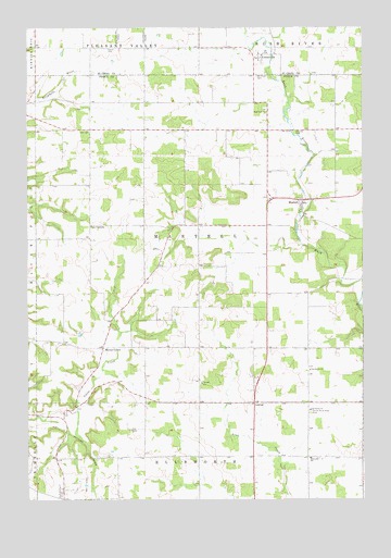
Martell, WI USGS Topographic Map
Click on map above to begin viewing in our Map Viewer.

This topographic map contains these locations and features:
Feature Name Type Latitude Longitude GNIS ID View Map
.11 ReservoirReservoirN44.8066°W92.4952°1793526View Map
.12 ReservoirReservoirN44.8100°W92.4935°1793524View Map
.40 ReservoirReservoirN44.8082°W92.4908°1793522View Map
0.7 ReservoirReservoirN44.8600°W92.4869°1793313View Map
1 ReservoirReservoirN44.8366°W92.4919°1792846View Map
CentervillePopulated PlaceN44.8669°W92.4135°1581615View Map
Clay CornersLocaleN44.8230°W92.4763°1563131View Map
Clay Corners School (historical)SchoolN44.8225°W92.4771°1578307View Map
Cloverdale School (historical)SchoolN44.8133°W92.4360°1578311View Map
Donovan Robey Number 1 G 8180 DamDamN44.8083°W92.4902°1793521View Map
Donovan Robey Number 2 G 8180.1 DamDamN44.8100°W92.4935°1793523View Map
Donovan Robey Number 3 G 8180.2 DamDamN44.8066°W92.4952°1793525View Map
Falde FarmsLocaleN44.8219°W92.4236°2726640View Map
Fay School (historical)SchoolN44.8480°W92.4066°1578323View Map
Frier School (historical)SchoolN44.7614°W92.4371°1578327View Map
Herum School (historical)SchoolN44.8480°W92.4563°1578335View Map
Knutson Family FarmsLocaleN44.8106°W92.4511°2726635View Map
LawtonPopulated PlaceN44.7758°W92.4157°1577692View Map
Lyndon Hill FarmLocaleN44.8008°W92.4539°2726639View Map
MartellPopulated PlaceN44.8297°W92.3977°1569089View Map
Martell Lutheran CemeteryCemeteryN44.8319°W92.4080°1964276View Map
Martell Methodist CemeteryCemeteryN44.8294°W92.4102°1964277View Map
Maynard School (historical)SchoolN44.7614°W92.4785°1578347View Map
Morton CornerPopulated PlaceN44.7905°W92.4721°1577734View Map
Morton Corner School (historical)SchoolN44.7900°W92.4724°1578350View Map
Mount Olivet CemeteryCemeteryN44.8623°W92.4148°1581680View Map
Our Savior ChurchChurchN44.7739°W92.3946°1570940View Map
Our Savior ChurchChurchN44.7841°W92.3952°1570941View Map
Roger Swenson G-8498 DamDamN44.8600°W92.4869°1793312View Map
Rohl FarmsLocaleN44.8158°W92.4344°2726638View Map
Rush River Lutheran CemeteryCemeteryN44.8532°W92.4118°1964280View Map
Rush River Lutheran ChurchChurchN44.8533°W92.4116°1572743View Map
South Rush River CemeteryCemeteryN44.7730°W92.3949°1574489View Map
South Rush River School (historical)SchoolN44.7897°W92.3955°1578369View Map
Sunnyside Elementary SchoolSchoolN44.7610°W92.3951°1575102View Map
Thomas D H Sitz 636 DamDamN44.8366°W92.4919°1792845View Map
Town of MartellCivilN44.8190°W92.4360°1583668View Map
Walker FarmsLocaleN44.7778°W92.4806°2726634View Map
White Rock FarmLocaleN44.7908°W92.4883°2726641View Map

Note: Coordinates in the location and feature list above are referenced to NAD83 datum.


Copyright (C) 2008-2024 Ryan Niemi / Sunset Dynamics ... All Rights Reserved