TopoQuest Logo
Do you find TopoQuest useful?
Help keep TopoQuest running and adding new maps/features by donating!
Bitcoin:  19c7KJd3qBynnjoSw5npx9KScwjBe4ifkT
Litecoin:  LXs6TkuXGGXo1vDsWCkWVdjQX94eUKd6ui
Home View Maps Find Maps Find Places Resources & Links


Ellsworth, Wisconsin Topographic Map

USGS Map Title: Ellsworth, WI
USGS Map MRC: 44092F4
DRG (GeoTIFF) Download: o44092f4.tif


Neighboring USGS Topographic Map Quads:


  River Falls East, WI  
44092G5
 

  Martell, WI  
44092G4
 

  El Paso, WI  
44092G3
 

  Diamond Bluff East, WI  
44092F5
 

  Ellsworth, WI  
44092F4
 

  Waverly, WI  
44092F3
 

  Red Wing, MN  
44092E5
 

  Bay City, WI  
44092E4
 

  Maiden Rock, WI  
44092E3


Map MRC Location:

N45°
W93°
N45°
W92°
H8 H7 H6 H5 H4 H3 H2 H1
G8 G7 G6 G5 G4 G3 G2 G1
F8 F7 F6 F5 F4 F3 F2 F1
E8 E7 E6 E5 E4 E3 E2 E1
D8 D7 D6 D5 D4 D3 D2 D1
C8 C7 C6 C5 C4 C3 C2 C1
B8 B7 B6 B5 B4 B3 B2 B1
A8 A7 A6 A5 A4 A3 A2 A1
N44°
W93°
N44°
W92°

Ellsworth, WI USGS 1:24K Topographic Map Preview:
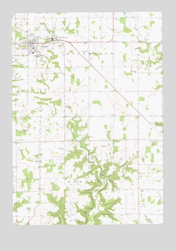
Ellsworth, WI USGS Topographic Map
Click on map above to begin viewing in our Map Viewer.

This topographic map contains these locations and features:
Feature Name Type Latitude Longitude GNIS ID View Map
0.5 ReservoirReservoirN44.7183°W92.4919°1793276View Map
Bethlehem Lutheran CemeteryCemeteryN44.6732°W92.4978°1964271View Map
Bethlehem Lutheran ChurchChurchN44.6736°W92.4977°1561656View Map
Clayfield Catholic CemeteryCemeteryN44.6900°W92.4155°1964272View Map
Clayfield ChurchChurchN44.6894°W92.4166°1563135View Map
Clayfield School (historical)SchoolN44.7036°W92.4360°1578308View Map
Conroy School (historical)SchoolN44.6747°W92.4060°1578312View Map
Coulson H2047 DamDamN44.7183°W92.4919°1793275View Map
Cudd School (historical)SchoolN44.7327°W92.4388°1578315View Map
Drake School (historical)SchoolN44.6522°W92.4780°1578317View Map
East EllsworthPopulated PlaceN44.7341°W92.4680°1564314View Map
East Ellsworth Post OfficePost OfficeN44.7341°W92.4663°1833570View Map
East End ParkParkN44.7336°W92.4696°1833571View Map
EllsworthPopulated PlaceN44.7322°W92.4874°1564550View Map
Ellsworth Area Ambulance ServiceBuildingN44.7310°W92.4848°2698360View Map
Ellsworth High SchoolSchoolN44.7262°W92.4828°1833572View Map
Ellsworth Middle SchoolSchoolN44.7214°W92.4830°2715720View Map
Ellsworth Police DepartmentBuildingN44.7328°W92.4828°2759562View Map
Ellsworth Post OfficePost OfficeN44.7319°W92.4824°1833573View Map
Ellsworth Public LibraryBuildingN44.7322°W92.4827°1833574View Map
Ellsworth Village HallBuildingN44.7327°W92.4830°1833575View Map
Ellsworth Volunteer Fire DepartmentBuildingN44.7309°W92.4852°2697903View Map
Elm Grove School (historical)SchoolN44.6461°W92.3966°1578320View Map
Esdaile CemeteryCemeteryN44.6311°W92.4385°1564695View Map
Evergreen EstatesPopulated PlaceN44.7381°W92.4894°2611797View Map
First Presbyterian ChurchChurchN44.7319°W92.4874°1833576View Map
Hartland ChurchChurchN44.6591°W92.4780°1566107View Map
Herbert School (historical)SchoolN44.6600°W92.3760°1578333View Map
Hill and Dale School (historical)SchoolN44.6744°W92.4771°1578336View Map
Hillcrest Elementary SchoolSchoolN44.7273°W92.4810°2715721View Map
Kingdom HallChurchN44.6950°W92.4569°1567505View Map
Lantz School (historical)SchoolN44.7319°W92.3960°1578339View Map
Maple Grove CemeteryCemeteryN44.7245°W92.4794°1568974View Map
Mission Church (historical)ChurchN44.7141°W92.3963°1578348View Map
Murphy School (historical)SchoolN44.7036°W92.3960°1578351View Map
Oak Center School (historical)SchoolN44.6455°W92.4527°1578352View Map
Old Clayfield CemeteryCemeteryN44.7030°W92.4145°1964278View Map
Pierce CountyCivilN44.7196°W92.4225°1581107View Map
Pierce County CourthouseBuildingN44.7327°W92.4855°1833577View Map
Pierce County FairgroundsParkN44.7361°W92.4846°1833578View Map
Pierce County JailBuildingN44.7326°W92.4853°2759388View Map
Pierce County Sheriff's OfficeBuildingN44.7326°W92.4853°2759456View Map
Saint Francis Catholic ChurchChurchN44.7283°W92.4813°1833579View Map
Saint Francis SchoolSchoolN44.7289°W92.4809°1833580View Map
Saint Pauls CemeteryCemeteryN44.7319°W92.4374°1573470View Map
Saint Pauls ChurchChurchN44.7330°W92.4185°1573484View Map
Sleepy Hollow School (historical)SchoolN44.7025°W92.4774°1578366View Map
Snows CornerPopulated PlaceN44.6739°W92.4969°1577829View Map
Summit Hill ParkParkN44.7339°W92.4769°1833581View Map
Town of EllsworthCivilN44.7317°W92.4313°1583156View Map
Town of HartlandCivilN44.6451°W92.4364°1583361View Map
Ulvin HillSummitN44.6305°W92.4549°1575850View Map
Village of EllsworthCivilN44.7364°W92.4807°1583155View Map
Zion Covenant CemeteryCemeteryN44.7143°W92.3965°1577173View Map
Zion Covenant ChurchChurchN44.7350°W92.4794°1833582View Map

Note: Coordinates in the location and feature list above are referenced to NAD83 datum.


Copyright (C) 2008-2024 Ryan Niemi / Sunset Dynamics ... All Rights Reserved