TopoQuest Logo
Do you find TopoQuest useful?
Help keep TopoQuest running and adding new maps/features by donating!
Bitcoin:  19c7KJd3qBynnjoSw5npx9KScwjBe4ifkT
Litecoin:  LXs6TkuXGGXo1vDsWCkWVdjQX94eUKd6ui
Home View Maps Find Maps Find Places Resources & Links


Diamond Bluff East, Wisconsin Topographic Map

USGS Map Title: Diamond Bluff East, WI
USGS Map MRC: 44092F5
DRG (GeoTIFF) Download: o44092f5.tif


Neighboring USGS Topographic Map Quads:


  River Falls West, WI  
44092G6
 

  River Falls East, WI  
44092G5
 

  Martell, WI  
44092G4
 

  Diamond Bluff West, WI  
44092F6
 

  Diamond Bluff East, WI  
44092F5
 

  Ellsworth, WI  
44092F4
 

  Welch, MN  
44092E6
 

  Red Wing, MN  
44092E5
 

  Bay City, WI  
44092E4


Map MRC Location:

N45°
W93°
N45°
W92°
H8 H7 H6 H5 H4 H3 H2 H1
G8 G7 G6 G5 G4 G3 G2 G1
F8 F7 F6 F5 F4 F3 F2 F1
E8 E7 E6 E5 E4 E3 E2 E1
D8 D7 D6 D5 D4 D3 D2 D1
C8 C7 C6 C5 C4 C3 C2 C1
B8 B7 B6 B5 B4 B3 B2 B1
A8 A7 A6 A5 A4 A3 A2 A1
N44°
W93°
N44°
W92°

Diamond Bluff East, WI USGS 1:24K Topographic Map Preview:
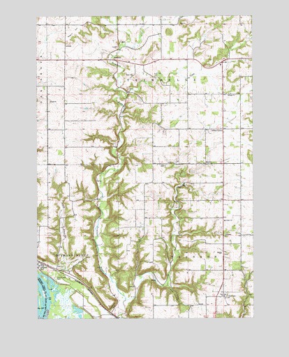
Diamond Bluff East, WI USGS Topographic Map
Click on map above to begin viewing in our Map Viewer.

This topographic map contains these locations and features:
Feature Name Type Latitude Longitude GNIS ID View Map
.46 ReservoirReservoirN44.6783°W92.6119°1793520View Map
Bernard Kemmerer G8637 DamDamN44.6783°W92.6119°1793519View Map
Bethel ChurchChurchN44.6883°W92.5532°1561641View Map
Bethel Mission Covenant CemeteryCemeteryN44.6885°W92.5524°1964270View Map
Diamond Bluff CemeteryCemeteryN44.6418°W92.6155°1563961View Map
Diamond Bluff Census Designated PlaceCensusN44.6489°W92.6189°2586474View Map
Fisher CouleeValleyN44.6380°W92.5479°1565007View Map
H G Armbruster Group DamDamN44.7116°W92.5952°1792667View Map
Hope CouleeValleyN44.6455°W92.6083°1566682View Map
Lindgren Elementary SchoolSchoolN44.6652°W92.5166°1568139View Map
Little Trimbelle CreekStreamN44.6325°W92.5741°1568448View Map
MoevillePopulated PlaceN44.6886°W92.5274°1569634View Map
Negro HillSummitN44.7436°W92.6033°1570144View Map
Ottman CornersPopulated PlaceN44.7033°W92.5171°1570922View Map
Skidmore BluffCliffN44.6300°W92.5813°1574233View Map
Spring CreekStreamN44.7177°W92.5721°1574617View Map
Svea Lutheran CemeteryCemeteryN44.6341°W92.5168°1964285View Map
Svea Lutheran ChurchChurchN44.6339°W92.5171°1575140View Map
Town of Diamond BluffCivilN44.6568°W92.6164°1583084View Map
Town of TrentonCivilN44.6333°W92.5355°1584293View Map
Town of TrimbelleCivilN44.7324°W92.5581°1584295View Map
TrimbellePopulated PlaceN44.7316°W92.5799°1575607View Map

Note: Coordinates in the location and feature list above are referenced to NAD83 datum.


Copyright (C) 2008-2024 Ryan Niemi / Sunset Dynamics ... All Rights Reserved