TopoQuest Logo
Do you find TopoQuest useful?
Help keep TopoQuest running and adding new maps/features by donating!
Bitcoin:  19c7KJd3qBynnjoSw5npx9KScwjBe4ifkT
Litecoin:  LXs6TkuXGGXo1vDsWCkWVdjQX94eUKd6ui
Home View Maps Find Maps Find Places Resources & Links


Matherville, Illinois Topographic Map

USGS Map Title: Matherville, IL
USGS Map MRC: 41090C5
DRG (GeoTIFF) Download: o41090c5.tif


Neighboring USGS Topographic Map Quads:


  Andalusia, IL  
41090D6
 

  Milan, IL  
41090D5
 

  Coal Valley, IL  
41090D4
 

  Reynolds, IL  
41090C6
 

  Matherville, IL  
41090C5
 

  Orion, IL  
41090C4
 

  Aledo East, IL  
41090B6
 

  Viola, IL  
41090B5
 

  New Windsor, IL  
41090B4


Map MRC Location:

N42°
W91°
N42°
W90°
H8 H7 H6 H5 H4 H3 H2 H1
G8 G7 G6 G5 G4 G3 G2 G1
F8 F7 F6 F5 F4 F3 F2 F1
E8 E7 E6 E5 E4 E3 E2 E1
D8 D7 D6 D5 D4 D3 D2 D1
C8 C7 C6 C5 C4 C3 C2 C1
B8 B7 B6 B5 B4 B3 B2 B1
A8 A7 A6 A5 A4 A3 A2 A1
N41°
W91°
N41°
W90°

Matherville, IL USGS 1:24K Topographic Map Preview:
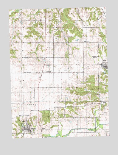
Matherville, IL USGS Topographic Map
Click on map above to begin viewing in our Map Viewer.

This topographic map contains these locations and features:
Feature Name Type Latitude Longitude GNIS ID View Map
BodenPopulated PlaceN41.2584°W90.5871°404642View Map
CablePopulated PlaceN41.2839°W90.5074°405328View Map
Cable Village CemeteryCemeteryN41.2795°W90.5035°1968269View Map
Camp CreekStreamN41.2609°W90.5143°405455View Map
Center School (historical)SchoolN41.3500°W90.6079°405834View Map
Coal CreekStreamN41.2509°W90.5812°406285View Map
Coal Dale School (historical)SchoolN41.2692°W90.5710°406301View Map
Coal Valley MineMineN41.3278°W90.5115°406306View Map
Farlows Grove CemeteryCemeteryN41.2536°W90.6004°408272View Map
Friends CemeteryCemeteryN41.3175°W90.5265°408757View Map
German CemeteryCemeteryN41.3006°W90.5310°408967View Map
Gilchrist MineMineN41.2564°W90.5940°409001View Map
Greene Township Fire Station MathervilleBuildingN41.2600°W90.6075°2640564View Map
Lake MathervilleReservoirN41.2626°W90.6106°413123View Map
Lake Matherville DamDamN41.2614°W90.6112°1691592View Map
MathervillePopulated PlaceN41.2598°W90.6079°413122View Map
Matherville Elementary SchoolSchoolN41.2648°W90.6062°2042118View Map
Matherville Post OfficePost OfficeN41.2596°W90.6092°1808632View Map
Orangemans HallPopulated PlaceN41.3136°W90.6082°423047View Map
PreemptionPopulated PlaceN41.3128°W90.5846°416190View Map
Preemption CemeteryCemeteryN41.3197°W90.5807°416191View Map
Preemption Post OfficePost OfficeN41.3125°W90.5842°1808641View Map
Quaker CemeteryCemeteryN41.3200°W90.5123°1968290View Map
Saint Anthonys ChurchChurchN41.2659°W90.6071°1720195View Map
Schoening Family CemeteryCemeteryN41.3297°W90.5491°418099View Map
SherrardPopulated PlaceN41.3189°W90.5060°418376View Map
Sherrard CemeteryCemeteryN41.3195°W90.5129°418377View Map
Sherrard Fire Protection DistrictBuildingN41.3218°W90.5018°2640427View Map
Sherrard Police DepartmentBuildingN41.3192°W90.5065°2757034View Map
Sherrard Post OfficePost OfficeN41.3188°W90.5063°2788724View Map
Sherrard SchoolSchoolN41.3425°W90.5279°1748076View Map
Township of BowlingCivilN41.3714°W90.6088°428699View Map
Township of PreemptionCivilN41.2842°W90.6096°429603View Map
Village of MathervilleCivilN41.2594°W90.6055°2399273View Map
Weihler AirportAirportN41.3162°W90.5515°427808View Map
Woods CemeteryCemeteryN41.3414°W90.5687°421476View Map

Note: Coordinates in the location and feature list above are referenced to NAD83 datum.


Copyright (C) 2008-2024 Ryan Niemi / Sunset Dynamics ... All Rights Reserved