TopoQuest Logo
Do you find TopoQuest useful?
Help keep TopoQuest running and adding new maps/features by donating!
Bitcoin:  19c7KJd3qBynnjoSw5npx9KScwjBe4ifkT
Litecoin:  LXs6TkuXGGXo1vDsWCkWVdjQX94eUKd6ui
Home View Maps Find Maps Find Places Resources & Links


Orion, Illinois Topographic Map

USGS Map Title: Orion, IL
USGS Map MRC: 41090C4
DRG (GeoTIFF) Download: o41090c4.tif


Neighboring USGS Topographic Map Quads:


  Milan, IL  
41090D5
 

  Coal Valley, IL  
41090D4
 

  Green Rock, IL  
41090D3
 

  Matherville, IL  
41090C5
 

  Orion, IL  
41090C4
 

  Andover, IL  
41090C3
 

  Viola, IL  
41090B5
 

  New Windsor, IL  
41090B4
 

  Woodhull, IL  
41090B3


Map MRC Location:

N42°
W91°
N42°
W90°
H8 H7 H6 H5 H4 H3 H2 H1
G8 G7 G6 G5 G4 G3 G2 G1
F8 F7 F6 F5 F4 F3 F2 F1
E8 E7 E6 E5 E4 E3 E2 E1
D8 D7 D6 D5 D4 D3 D2 D1
C8 C7 C6 C5 C4 C3 C2 C1
B8 B7 B6 B5 B4 B3 B2 B1
A8 A7 A6 A5 A4 A3 A2 A1
N41°
W91°
N41°
W90°

Orion, IL USGS 1:24K Topographic Map Preview:
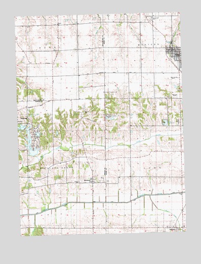
Orion, IL USGS Topographic Map
Click on map above to begin viewing in our Map Viewer.

This topographic map contains these locations and features:
Feature Name Type Latitude Longitude GNIS ID View Map
Arasmith School (historical)SchoolN41.2856°W90.4154°1747343View Map
Barney School (historical)SchoolN41.2536°W90.4490°424015View Map
Beulah CemeteryCemeteryN41.3698°W90.4693°1967772View Map
Beulah ChurchChurchN41.3698°W90.4682°404354View Map
Brush Hill School (historical)SchoolN41.3125°W90.4537°1720165View Map
Brushwood CemeteryCemeteryN41.3189°W90.4501°409421View Map
Caughey School (historical)SchoolN41.3698°W90.4554°424028View Map
Frye LakeReservoirN41.2971°W90.4894°408784View Map
Fyre Lake DamDamN41.2956°W90.4882°1692258View Map
Happy Corner School (historical)SchoolN41.3695°W90.4057°1747382View Map
Jordan School (historical)SchoolN41.3411°W90.4524°1748073View Map
Karl LakeReservoirN41.3119°W90.4974°1692261View Map
Karl Lake DamDamN41.3100°W90.4951°1692260View Map
Lake LynnwoodReservoirN41.3124°W90.3879°1747396View Map
Lake LynnwoodReservoirN41.3114°W90.3887°1691537View Map
Lake of the HillsReservoirN41.3159°W90.4326°1747390View Map
Long View Mine (historical)MineN41.2550°W90.3801°424068View Map
Lynn GroveWoodsN41.3028°W90.3848°1812586View Map
Lynnwood Lake DamDamN41.3117°W90.3868°1691536View Map
Merryman CemeteryCemeteryN41.2511°W90.4960°424073View Map
Merryman School (historical)SchoolN41.2548°W90.4996°1720184View Map
Mud CreekStreamN41.2711°W90.4018°414178View Map
Oak Hill School (historical)SchoolN41.3100°W90.4157°1747405View Map
Oakwood Country Club LakeReservoirN41.3717°W90.4768°1691559View Map
Oakwood Country Club Lake DamDamN41.3717°W90.4768°1691558View Map
OphiemPopulated PlaceN41.2525°W90.3876°415140View Map
OrionPopulated PlaceN41.3548°W90.3815°415174View Map
Orion ChurchChurchN41.3303°W90.3762°1747406View Map
Orion Fire Protection DistrictBuildingN41.3540°W90.3789°2640421View Map
Orion Post OfficePost OfficeN41.3541°W90.3817°1812588View Map
Oxford Township Fire Professional Ophiem StationBuildingN41.2527°W90.3844°2640723View Map
Parker RunStreamN41.2620°W90.4890°422383View Map
Parker School (historical)SchoolN41.2825°W90.4835°1720189View Map
Renee LakeReservoirN41.3077°W90.4852°1692263View Map
Renee Lake DamDamN41.3067°W90.4835°1692262View Map
Rural Town Hall School (historical)SchoolN41.3692°W90.4926°424093View Map
Rustic Hill School (historical)SchoolN41.3184°W90.3860°1747414View Map
SwedonaPopulated PlaceN41.2792°W90.4449°419474View Map
Swedona CemeteryCemeteryN41.2803°W90.4343°1952082View Map
Township of LynnCivilN41.2818°W90.3776°429295View Map
Township of Richland GroveCivilN41.2831°W90.4930°429633View Map
Township of RuralCivilN41.3704°W90.4913°429682View Map
Township of WesternCivilN41.3691°W90.3763°429913View Map
Tracy School (historical)SchoolN41.2534°W90.4160°1747429View Map
Village of OrionCivilN41.3514°W90.3765°2399584View Map
Village of SherrardCivilN41.3110°W90.4992°2399803View Map
Washington School (historical)SchoolN41.3495°W90.4899°1748077View Map
Western CemeteryCemeteryN41.2798°W90.4554°419475View Map
Western Township CemeteryCemeteryN41.3714°W90.3971°420955View Map
WPXR-FM (Rock Island)TowerN41.3278°W90.3798°428539View Map
WQAD-TV (Moline)TowerN41.3123°W90.3798°428556View Map
WXLP-FM (Moline)TowerN41.3378°W90.3796°428517View Map

Note: Coordinates in the location and feature list above are referenced to NAD83 datum.


Copyright (C) 2008-2024 Ryan Niemi / Sunset Dynamics ... All Rights Reserved