TopoQuest Logo
Do you find TopoQuest useful?
Help keep TopoQuest running and adding new maps/features by donating!
Bitcoin:  19c7KJd3qBynnjoSw5npx9KScwjBe4ifkT
Litecoin:  LXs6TkuXGGXo1vDsWCkWVdjQX94eUKd6ui
Home View Maps Find Maps Find Places Resources & Links


Beaver, Louisiana Topographic Map

USGS Map Title: Beaver, LA
USGS Map MRC: 30092G5
DRG (GeoTIFF) Download: o30092g5.tif


Neighboring USGS Topographic Map Quads:


  Pawnee, LA  
30092H6
 

  Glenmora, LA  
30092H5
 

  Cocodrie Lake, LA  
30092H4
 

  Oakdale, LA  
30092G6
 

  Beaver, LA  
30092G5
 

  Pine Prairie, LA  
30092G4
 

  Guy, LA  
30092F6
 

  Bond, LA  
30092F5
 

  Mamou, LA  
30092F4


Map MRC Location:

N31°
W93°
N31°
W92°
H8 H7 H6 H5 H4 H3 H2 H1
G8 G7 G6 G5 G4 G3 G2 G1
F8 F7 F6 F5 F4 F3 F2 F1
E8 E7 E6 E5 E4 E3 E2 E1
D8 D7 D6 D5 D4 D3 D2 D1
C8 C7 C6 C5 C4 C3 C2 C1
B8 B7 B6 B5 B4 B3 B2 B1
A8 A7 A6 A5 A4 A3 A2 A1
N30°
W93°
N30°
W92°

Beaver, LA USGS 1:24K Topographic Map Preview:
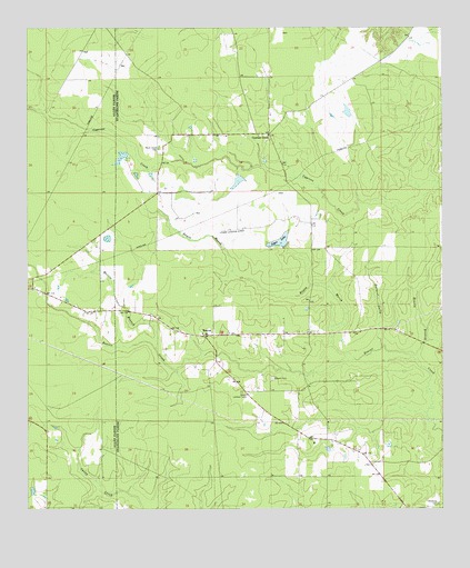
Beaver, LA USGS Topographic Map
Click on map above to begin viewing in our Map Viewer.

This topographic map contains these locations and features:
Feature Name Type Latitude Longitude GNIS ID View Map
Bayou MarshStreamN30.7891°W92.5262°532685View Map
Beasly BranchStreamN30.7883°W92.5071°532847View Map
BeaverPopulated PlaceN30.7958°W92.5721°532850View Map
Beaver CemeteryCemeteryN30.7841°W92.5512°532853View Map
Beaver Creek Baptist ChurchChurchN30.7957°W92.5724°2600576View Map
Beaver Lookout TowerTowerN30.7802°W92.5585°558740View Map
Cypress CreekPopulated PlaceN30.8477°W92.5515°534353View Map
Delafosse CemeteryCemeteryN30.7519°W92.5015°534478View Map
Dyer AirportAirportN30.8071°W92.5918°1632896View Map
Earnest GullyStreamN30.7921°W92.5174°534692View Map
Leger LakeReservoirN30.8195°W92.5488°555015View Map
Leger Lake DamDamN30.8185°W92.5468°556970View Map
Leger Landing Strip (historical)AirportN30.8227°W92.5626°1958157View Map
Louisiana Noname 100 DamDamN30.8019°W92.6085°556971View Map
Louisiana Noname 99 DamDamN30.8419°W92.5951°556969View Map
Marsh Bayou State Wildlife Management AreaAreaN30.8244°W92.5779°1958156View Map
Morris BranchStreamN30.7916°W92.5863°537233View Map
Pecan Grove CemeteryCemeteryN30.8438°W92.5851°538041View Map

Note: Coordinates in the location and feature list above are referenced to NAD83 datum.


Copyright (C) 2008-2024 Ryan Niemi / Sunset Dynamics ... All Rights Reserved