TopoQuest Logo
Do you find TopoQuest useful?
Help keep TopoQuest running and adding new maps/features by donating!
Bitcoin:  19c7KJd3qBynnjoSw5npx9KScwjBe4ifkT
Litecoin:  LXs6TkuXGGXo1vDsWCkWVdjQX94eUKd6ui
Home View Maps Find Maps Find Places Resources & Links


Cocodrie Lake, Louisiana Topographic Map

USGS Map Title: Cocodrie Lake, LA
USGS Map MRC: 30092H4
DRG (GeoTIFF) Download: o30092h4.tif


Neighboring USGS Topographic Map Quads:


  Forest Hill, LA  
31092A5
 

  Lecompte, LA  
31092A4
 

  Cheneyville, LA  
31092A3
 

  Glenmora, LA  
30092H5
 

  Cocodrie Lake, LA  
30092H4
 

  Lone Pine, LA  
30092H3
 

  Beaver, LA  
30092G5
 

  Pine Prairie, LA  
30092G4
 

  Saint Landry, LA  
30092G3


Map MRC Location:

N31°
W93°
N31°
W92°
H8 H7 H6 H5 H4 H3 H2 H1
G8 G7 G6 G5 G4 G3 G2 G1
F8 F7 F6 F5 F4 F3 F2 F1
E8 E7 E6 E5 E4 E3 E2 E1
D8 D7 D6 D5 D4 D3 D2 D1
C8 C7 C6 C5 C4 C3 C2 C1
B8 B7 B6 B5 B4 B3 B2 B1
A8 A7 A6 A5 A4 A3 A2 A1
N30°
W93°
N30°
W92°

Cocodrie Lake, LA USGS 1:24K Topographic Map Preview:
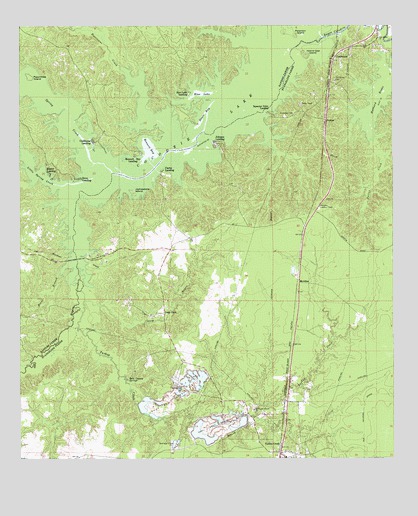
Cocodrie Lake, LA USGS Topographic Map
Click on map above to begin viewing in our Map Viewer.

This topographic map contains these locations and features:
Feature Name Type Latitude Longitude GNIS ID View Map
Belle Chaney (historical)Populated PlaceN30.8880°W92.4196°549416View Map
Belle Chaney SpringsSpringN30.8988°W92.4632°532920View Map
Bennett BayBayN30.9649°W92.4560°553600View Map
Bennett Bay LandingPopulated PlaceN30.9624°W92.4618°553601View Map
Blue LakeLakeN30.9805°W92.4393°553723View Map
Blue Lake LandingPopulated PlaceN30.9813°W92.4429°542999View Map
Butler CreekStreamN30.9669°W92.3829°533589View Map
Caney BayouStreamN30.9210°W92.4779°533726View Map
Clarks LandingPopulated PlaceN30.9594°W92.4521°554005View Map
Clear CreekStreamN30.9560°W92.4949°547225View Map
ClearwaterPopulated PlaceN30.9905°W92.3940°554026View Map
Clubhouse LandingPopulated PlaceN30.9671°W92.4754°543091View Map
Cocodrie LakeLakeN30.9999°W92.3814°554036View Map
Cocodrie SwampSwampN30.9907°W92.4154°551828View Map
Dove LandingPopulated PlaceN30.9563°W92.4787°543151View Map
Duplissey CemeteryCemeteryN30.9749°W92.4079°534661View Map
First United Pentecostal ChurchChurchN30.8773°W92.4113°2602001View Map
Hester LandingPopulated PlaceN30.9580°W92.4896°543290View Map
Horse BranchStreamN30.9288°W92.4862°547476View Map
Hubbard BrakeLakeN30.9805°W92.3797°554794View Map
Hurricane CreekStreamN30.9882°W92.4657°554809View Map
Island Gap IslandIslandN30.9927°W92.4046°535957View Map
Jayhawkers IslandIslandN30.9532°W92.4615°536007View Map
Johnson LandingPopulated PlaceN30.9674°W92.4346°543344View Map
Lake CovePopulated PlaceN30.9177°W92.4515°543373View Map
Lake Cove School (historical)SchoolN30.9385°W92.4437°549418View Map
Little Spring CreekStreamN30.9541°W92.4846°547614View Map
McCormack CemeteryCemeteryN30.8960°W92.4446°536973View Map
MeridianPopulated PlaceN30.9255°W92.4054°555298View Map
Meridian Lookout TowerTowerN30.9480°W92.3996°558804View Map
Neals BayBayN30.9749°W92.4374°537531View Map
NobracPopulated PlaceN30.9730°W92.3974°543528View Map
Oak Grove CemeteryCemeteryN30.9841°W92.3940°537772View Map
Oak Grove ChurchChurchN30.9969°W92.3796°537777View Map
Peachtree IslandIslandN30.9860°W92.4962°538031View Map
Peterson IslandIslandN30.9985°W92.4090°538087View Map
Spring CreekStreamN30.9602°W92.4712°556116View Map
Squealer Point LandingPopulated PlaceN30.9755°W92.4165°543694View Map
Tanners CreekStreamN30.9955°W92.4715°556202View Map
Turkey CreekPopulated PlaceN30.8771°W92.4132°556279View Map
Turkey CreekStreamN30.9213°W92.4782°556280View Map

Note: Coordinates in the location and feature list above are referenced to NAD83 datum.


Copyright (C) 2008-2024 Ryan Niemi / Sunset Dynamics ... All Rights Reserved