TopoQuest Logo
Do you find TopoQuest useful?
Help keep TopoQuest running and adding new maps/features by donating!
Bitcoin:  19c7KJd3qBynnjoSw5npx9KScwjBe4ifkT
Litecoin:  LXs6TkuXGGXo1vDsWCkWVdjQX94eUKd6ui
Home View Maps Find Maps Find Places Resources & Links


Nekoma, Illinois Topographic Map

USGS Map Title: Nekoma, IL
USGS Map MRC: 41090B2
DRG (GeoTIFF) Download: o41090b2.tif


Neighboring USGS Topographic Map Quads:


  Andover, IL  
41090C3
 

  Cambridge, IL  
41090C2
 

  German Corner, IL  
41090C1
 

  Woodhull, IL  
41090B3
 

  Nekoma, IL  
41090B2
 

  Galva, IL  
41090B1
 

  Wataga, IL  
41090A3
 

  Oneida, IL  
41090A2
 

  Victoria, IL  
41090A1


Map MRC Location:

N42°
W91°
N42°
W90°
H8 H7 H6 H5 H4 H3 H2 H1
G8 G7 G6 G5 G4 G3 G2 G1
F8 F7 F6 F5 F4 F3 F2 F1
E8 E7 E6 E5 E4 E3 E2 E1
D8 D7 D6 D5 D4 D3 D2 D1
C8 C7 C6 C5 C4 C3 C2 C1
B8 B7 B6 B5 B4 B3 B2 B1
A8 A7 A6 A5 A4 A3 A2 A1
N41°
W91°
N41°
W90°

Nekoma, IL USGS 1:24K Topographic Map Preview:
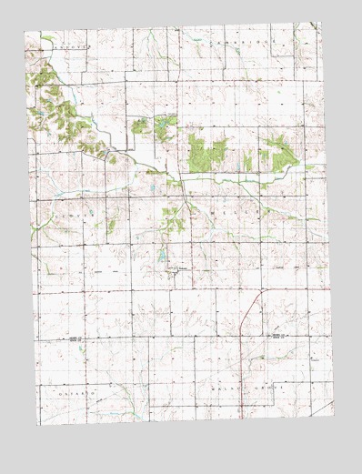
Nekoma, IL USGS Topographic Map
Click on map above to begin viewing in our Map Viewer.

This topographic map contains these locations and features:
Feature Name Type Latitude Longitude GNIS ID View Map
Dugout CreekStreamN41.2075°W90.2048°407469View Map
Kelly School (historical)SchoolN41.1661°W90.1521°1747387View Map
Maple Hill School (historical)SchoolN41.1964°W90.1540°1747399View Map
Maple Ridge School (historical)SchoolN41.1809°W90.2193°1747400View Map
NekomaPopulated PlaceN41.1728°W90.1887°414345View Map
New Pine School (historical)SchoolN41.2106°W90.2382°1747402View Map
North Ontario Church (historical)ChurchN41.1517°W90.2290°424079View Map
Nystrom LakeReservoirN41.2193°W90.1930°1692475View Map
Nystrom Lake DamDamN41.2184°W90.1951°1692474View Map
Piatt CemeteryCemeteryN41.2223°W90.1871°415626View Map
Pierce School (historical)SchoolN41.1328°W90.1643°1720340View Map
Red Oak CemeteryCemeteryN41.2198°W90.1998°416455View Map
Red Oak School (historical)SchoolN41.2328°W90.2087°1747411View Map
Reynolds School (historical)SchoolN41.1373°W90.2285°1720342View Map
River Side School (historical)SchoolN41.1967°W90.1871°424089View Map
Simpson School (historical)SchoolN41.1361°W90.2021°1720343View Map
Snow Hill School (historical)SchoolN41.1664°W90.2279°1747421View Map
Swamp College School (historical)SchoolN41.2220°W90.1623°1747428View Map
Thompson PondReservoirN41.1774°W90.1951°1691561View Map
Thompson Pond DamDamN41.1784°W90.1968°1691560View Map
Township of WellerCivilN41.1934°W90.1520°429908View Map

Note: Coordinates in the location and feature list above are referenced to NAD83 datum.


Copyright (C) 2008-2024 Ryan Niemi / Sunset Dynamics ... All Rights Reserved