TopoQuest Logo
Do you find TopoQuest useful?
Help keep TopoQuest running and adding new maps/features by donating!
Bitcoin:  19c7KJd3qBynnjoSw5npx9KScwjBe4ifkT
Litecoin:  LXs6TkuXGGXo1vDsWCkWVdjQX94eUKd6ui
Home View Maps Find Maps Find Places Resources & Links


Cambridge, Illinois Topographic Map

USGS Map Title: Cambridge, IL
USGS Map MRC: 41090C2
DRG (GeoTIFF) Download: o41090c2.tif


Neighboring USGS Topographic Map Quads:


  Green Rock, IL  
41090D3
 

  Geneseo, IL  
41090D2
 

  Atkinson, IL  
41090D1
 

  Andover, IL  
41090C3
 

  Cambridge, IL  
41090C2
 

  German Corner, IL  
41090C1
 

  Woodhull, IL  
41090B3
 

  Nekoma, IL  
41090B2
 

  Galva, IL  
41090B1


Map MRC Location:

N42°
W91°
N42°
W90°
H8 H7 H6 H5 H4 H3 H2 H1
G8 G7 G6 G5 G4 G3 G2 G1
F8 F7 F6 F5 F4 F3 F2 F1
E8 E7 E6 E5 E4 E3 E2 E1
D8 D7 D6 D5 D4 D3 D2 D1
C8 C7 C6 C5 C4 C3 C2 C1
B8 B7 B6 B5 B4 B3 B2 B1
A8 A7 A6 A5 A4 A3 A2 A1
N41°
W91°
N41°
W90°

Cambridge, IL USGS 1:24K Topographic Map Preview:
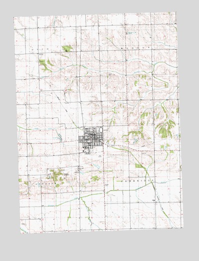
Cambridge, IL USGS Topographic Map
Click on map above to begin viewing in our Map Viewer.

This topographic map contains these locations and features:
Feature Name Type Latitude Longitude GNIS ID View Map
Boyd Wheatleys Farm Airport (historical)AirportN41.2825°W90.2185°427097View Map
CambridgePopulated PlaceN41.3036°W90.1929°405421View Map
Cambridge Community Grade SchoolSchoolN41.2964°W90.2004°1812538View Map
Cambridge Fire Protection DistrictBuildingN41.3018°W90.1870°2640443View Map
Cambridge High SchoolSchoolN41.2986°W90.1996°1747351View Map
Cambridge Lutheran ChurchChurchN41.3011°W90.1979°1962339View Map
Cambridge Post OfficePost OfficeN41.3032°W90.1931°1812539View Map
Cambridge Public LibraryBuildingN41.3031°W90.1960°1812540View Map
College Square ParkParkN41.3020°W90.1954°425843View Map
Edwards School (historical)SchoolN41.2739°W90.2029°1747365View Map
Excelsior School (historical)SchoolN41.2506°W90.1846°1747367View Map
Fairview School (historical)SchoolN41.2834°W90.2376°1747368View Map
First Baptist ChurchChurchN41.3020°W90.1929°1962340View Map
Grace ChurchChurchN41.3531°W90.2310°409228View Map
Grace Episcopal CemeteryCemeteryN41.3534°W90.2307°1952050View Map
Griffin School (historical)SchoolN41.3164°W90.2323°1747380View Map
Hand ParkParkN41.3042°W90.2010°425844View Map
Henry CountyCivilN41.3531°W90.1314°424238View Map
Henry County FairgroundsLocaleN41.3084°W90.1862°410069View Map
Henry County Sheriff's OfficeBuildingN41.3021°W90.1972°2756834View Map
Hillcrest Nursing HomeBuildingN41.3639°W90.1646°426958View Map
Hillery CreekStreamN41.2698°W90.2026°410280View Map
McNay CemeteryCemeteryN41.2764°W90.1843°426967View Map
Middle District School (historical)SchoolN41.2950°W90.1560°1747401View Map
Munson CemeteryCemeteryN41.3400°W90.1798°414239View Map
Munson Center SchoolSchoolN41.3686°W90.1660°424077View Map
Munson Township Cemetery Prairie Nature PreserveParkN41.3403°W90.1793°2013675View Map
Munson Township HallBuildingN41.3686°W90.1660°424116View Map
Osco Grange Hall (historical)BuildingN41.3678°W90.2221°428376View Map
Pleasant Hill School (historical)SchoolN41.3392°W90.1846°1747408View Map
Pleasant Valley School (historical)SchoolN41.2503°W90.1471°1747410View Map
Rose Dale CemeteryCemeteryN41.2853°W90.2043°416938View Map
Saint John Vianney Catholic ChurchChurchN41.2961°W90.1982°425842View Map
Sunnyside School (historical)SchoolN41.3359°W90.2323°1747427View Map
Talbot CemeteryCemeteryN41.2937°W90.1553°425839View Map
Township of CambridgeCivilN41.2802°W90.1459°428752View Map
Township of MunsonCivilN41.3680°W90.1446°429413View Map
UlahPopulated PlaceN41.2692°W90.1462°420006View Map
Unionville School (historical)SchoolN41.2511°W90.2254°1747430View Map
Vale School (historical)SchoolN41.3386°W90.1368°1747433View Map
Valley View Club LakeReservoirN41.2850°W90.1918°1691533View Map
Valley View Club Lake DamDamN41.2850°W90.1918°1691532View Map
Valley View Country ClubLocaleN41.2936°W90.1876°425841View Map
Village of CambridgeCivilN41.2983°W90.1908°2397538View Map
Wellen School (historical)SchoolN41.3681°W90.2215°1747435View Map
Wheatley Landing Strip (historical)AirportN41.2834°W90.2076°425840View Map

Note: Coordinates in the location and feature list above are referenced to NAD83 datum.


Copyright (C) 2008-2024 Ryan Niemi / Sunset Dynamics ... All Rights Reserved