TopoQuest Logo
Do you find TopoQuest useful?
Help keep TopoQuest running and adding new maps/features by donating!
Bitcoin:  19c7KJd3qBynnjoSw5npx9KScwjBe4ifkT
Litecoin:  LXs6TkuXGGXo1vDsWCkWVdjQX94eUKd6ui
Home View Maps Find Maps Find Places Resources & Links


Woodhull, Illinois Topographic Map

USGS Map Title: Woodhull, IL
USGS Map MRC: 41090B3
DRG (GeoTIFF) Download: o41090b3.tif


Neighboring USGS Topographic Map Quads:


  Orion, IL  
41090C4
 

  Andover, IL  
41090C3
 

  Cambridge, IL  
41090C2
 

  New Windsor, IL  
41090B4
 

  Woodhull, IL  
41090B3
 

  Nekoma, IL  
41090B2
 

  North Henderson, IL  
41090A4
 

  Wataga, IL  
41090A3
 

  Oneida, IL  
41090A2


Map MRC Location:

N42°
W91°
N42°
W90°
H8 H7 H6 H5 H4 H3 H2 H1
G8 G7 G6 G5 G4 G3 G2 G1
F8 F7 F6 F5 F4 F3 F2 F1
E8 E7 E6 E5 E4 E3 E2 E1
D8 D7 D6 D5 D4 D3 D2 D1
C8 C7 C6 C5 C4 C3 C2 C1
B8 B7 B6 B5 B4 B3 B2 B1
A8 A7 A6 A5 A4 A3 A2 A1
N41°
W91°
N41°
W90°

Woodhull, IL USGS 1:24K Topographic Map Preview:
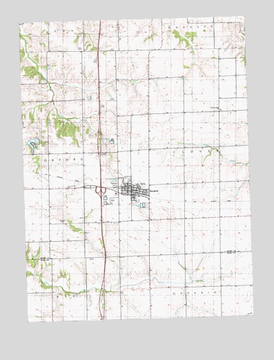
Woodhull, IL USGS Topographic Map
Click on map above to begin viewing in our Map Viewer.

This topographic map contains these locations and features:
Feature Name Type Latitude Longitude GNIS ID View Map
Alwood High SchoolSchoolN41.1811°W90.3137°403477View Map
Bethany Lutheran ChurchChurchN41.1800°W90.3210°426942View Map
Bethany Lutheran ChurchChurchN41.1800°W90.3204°1984840View Map
Center School (historical)SchoolN41.2184°W90.2662°1719862View Map
Clover Chapel CemeteryCemeteryN41.2109°W90.2676°1952044View Map
Clover Chapel ChurchChurchN41.2109°W90.2676°406267View Map
Clover Township Fire Protection DistrictBuildingN41.1765°W90.3148°2640733View Map
Crescent LakeReservoirN41.1968°W90.3693°406770View Map
Crescent LakeReservoirN41.1350°W90.3668°1691507View Map
Crescent Lake DamDamN41.1350°W90.3668°1691506View Map
Doyle School (historical)SchoolN41.1378°W90.3068°1719866View Map
Fairplay School (historical)SchoolN41.1953°W90.2854°1719863View Map
Franklin School (historical)SchoolN41.1298°W90.3421°1719865View Map
Interchange 32CrossingN41.1786°W90.3326°1812577View Map
Kansas School (historical)SchoolN41.2175°W90.3043°1719861View Map
Maple Valley School (historical)SchoolN41.2389°W90.2676°1719860View Map
Saint Johns CemeteryCemeteryN41.1659°W90.3537°417377View Map
Saint Johns ChurchChurchN41.1759°W90.3112°425855View Map
Saint Johns ChurchChurchN41.1761°W90.3118°1984841View Map
Stickney School (historical)SchoolN41.1703°W90.2668°1719864View Map
Summit Level CemeteryCemeteryN41.1806°W90.3518°419352View Map
Township of CloverCivilN41.1942°W90.2657°428823View Map
Tri - County Ambulance DistrictBuildingN41.1766°W90.3153°2673998View Map
United Church of WoodhullChurchN41.1800°W90.3171°1984842View Map
United Presbyterian ChurchChurchN41.1798°W90.3168°425856View Map
Village of WoodhullCivilN41.1786°W90.3220°2399731View Map
White School (historical)SchoolN41.1381°W90.2676°1719867View Map
WoodhullPopulated PlaceN41.1789°W90.3160°421425View Map
Woodhull CemeteryCemeteryN41.1834°W90.3201°425854View Map
Woodhull Post OfficePost OfficeN41.1783°W90.3154°1812607View Map
Woodhull Town HallBuildingN41.1786°W90.3154°1984843View Map

Note: Coordinates in the location and feature list above are referenced to NAD83 datum.


Copyright (C) 2008-2024 Ryan Niemi / Sunset Dynamics ... All Rights Reserved