TopoQuest Logo
Do you find TopoQuest useful?
Help keep TopoQuest running and adding new maps/features by donating!
Bitcoin:  19c7KJd3qBynnjoSw5npx9KScwjBe4ifkT
Litecoin:  LXs6TkuXGGXo1vDsWCkWVdjQX94eUKd6ui
Home View Maps Find Maps Find Places Resources & Links


Andover, Illinois Topographic Map

USGS Map Title: Andover, IL
USGS Map MRC: 41090C3
DRG (GeoTIFF) Download: o41090c3.tif


Neighboring USGS Topographic Map Quads:


  Coal Valley, IL  
41090D4
 

  Green Rock, IL  
41090D3
 

  Geneseo, IL  
41090D2
 

  Orion, IL  
41090C4
 

  Andover, IL  
41090C3
 

  Cambridge, IL  
41090C2
 

  New Windsor, IL  
41090B4
 

  Woodhull, IL  
41090B3
 

  Nekoma, IL  
41090B2


Map MRC Location:

N42°
W91°
N42°
W90°
H8 H7 H6 H5 H4 H3 H2 H1
G8 G7 G6 G5 G4 G3 G2 G1
F8 F7 F6 F5 F4 F3 F2 F1
E8 E7 E6 E5 E4 E3 E2 E1
D8 D7 D6 D5 D4 D3 D2 D1
C8 C7 C6 C5 C4 C3 C2 C1
B8 B7 B6 B5 B4 B3 B2 B1
A8 A7 A6 A5 A4 A3 A2 A1
N41°
W91°
N41°
W90°

Andover, IL USGS 1:24K Topographic Map Preview:
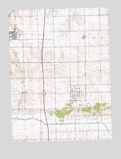
Andover, IL USGS Topographic Map
Click on map above to begin viewing in our Map Viewer.

This topographic map contains these locations and features:
Feature Name Type Latitude Longitude GNIS ID View Map
AndoverPopulated PlaceN41.2939°W90.2921°403516View Map
Andover Post OfficePost OfficeN41.2937°W90.2931°2788188View Map
Andover Township CemeteryCemeteryN41.2870°W90.2954°425835View Map
Andover United Methodist ChurchChurchN41.2895°W90.2971°425832View Map
Augusiana Lutheran ChurchChurchN41.2925°W90.2885°425833View Map
C R Hanna Elementary SchoolSchoolN41.3495°W90.3740°425828View Map
Denton FarmLocaleN41.3520°W90.3185°1748451View Map
Edwards Valley School (historical)SchoolN41.2517°W90.2965°424036View Map
Forest View School (historical)SchoolN41.3381°W90.2993°424041View Map
Harmony School (historical)SchoolN41.3103°W90.3426°1748453View Map
Interchange 24CrossingN41.2953°W90.3337°1812575View Map
Jenny Lind ChapelChurchN41.2914°W90.2990°426961View Map
Lake ParkParkN41.2867°W90.2904°425838View Map
Love ParkParkN41.3511°W90.3629°425837View Map
Lutheran HomeBuildingN41.2809°W90.3185°1748455View Map
Lynn CenterPopulated PlaceN41.2959°W90.3579°412763View Map
Lynn Center CemeteryCemeteryN41.3028°W90.3582°1952080View Map
Lynn Center Post OfficePost OfficeN41.2960°W90.3588°2788734View Map
Maple Hill School (historical)SchoolN41.3398°W90.3390°1748456View Map
Orion High SchoolSchoolN41.3536°W90.3648°425826View Map
Orion Lutheran CemeteryCemeteryN41.3572°W90.3671°425834View Map
Orion Middle SchoolSchoolN41.3520°W90.3746°425827View Map
OscoPopulated PlaceN41.3478°W90.2804°415194View Map
Osco Center School (historical)SchoolN41.3678°W90.2615°1748457View Map
Osco Community ChurchChurchN41.3464°W90.2796°425831View Map
Osco Community Fire Protection DistrictBuildingN41.3469°W90.2821°2640426View Map
Osco Post OfficePost OfficeN41.3479°W90.2812°2788501View Map
Our Lady of Peace Catholic ChurchChurchN41.3495°W90.3721°425830View Map
Pleasant Valley School (historical)SchoolN41.2517°W90.3398°424086View Map
Presbyterian CemeteryCemeteryN41.2934°W90.2818°425836View Map
Saint Paul Lutheran ChurchChurchN41.3542°W90.3735°425829View Map
South Edwards RiverStreamN41.2656°W90.2615°418746View Map
Township of AndoverCivilN41.2806°W90.2616°428592View Map
Township of OscoCivilN41.3680°W90.2609°429509View Map
Village of AndoverCivilN41.2949°W90.2907°2397962View Map

Note: Coordinates in the location and feature list above are referenced to NAD83 datum.


Copyright (C) 2008-2024 Ryan Niemi / Sunset Dynamics ... All Rights Reserved