TopoQuest Logo
Do you find TopoQuest useful?
Help keep TopoQuest running and adding new maps/features by donating!
Bitcoin:  19c7KJd3qBynnjoSw5npx9KScwjBe4ifkT
Litecoin:  LXs6TkuXGGXo1vDsWCkWVdjQX94eUKd6ui
Home View Maps Find Maps Find Places Resources & Links


Pittsburg, Illinois Topographic Map

USGS Map Title: Pittsburg, IL
USGS Map MRC: 37088G7
DRG (GeoTIFF) Download: o37088g7.tif


Neighboring USGS Topographic Map Quads:


  West Frankfort, IL  
37088H8
 

  Thompsonville, IL  
37088H7
 

  Akin, IL  
37088H6
 

  Johnston City, IL  
37088G8
 

  Pittsburg, IL  
37088G7
 

  Harco, IL  
37088G6
 

  Marion, IL  
37088F8
 

  Crab Orchard, IL  
37088F7
 

  Carrier Mills, IL  
37088F6


Map MRC Location:

N38°
W89°
N38°
W88°
H8 H7 H6 H5 H4 H3 H2 H1
G8 G7 G6 G5 G4 G3 G2 G1
F8 F7 F6 F5 F4 F3 F2 F1
E8 E7 E6 E5 E4 E3 E2 E1
D8 D7 D6 D5 D4 D3 D2 D1
C8 C7 C6 C5 C4 C3 C2 C1
B8 B7 B6 B5 B4 B3 B2 B1
A8 A7 A6 A5 A4 A3 A2 A1
N37°
W89°
N37°
W88°

Pittsburg, IL USGS 1:24K Topographic Map Preview:
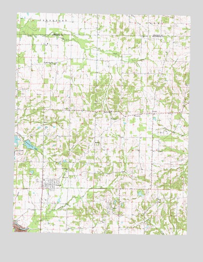
Pittsburg, IL USGS Topographic Map
Click on map above to begin viewing in our Map Viewer.

This topographic map contains these locations and features:
Feature Name Type Latitude Longitude GNIS ID View Map
AttilaPopulated PlaceN37.7698°W88.7712°403708View Map
Cedar Grove Church (historical)ChurchN37.8270°W88.7987°1737349View Map
Center School (historical)SchoolN37.8198°W88.7634°1737350View Map
Christian Chapel (historical)ChurchN37.7528°W88.8276°1737356View Map
Church of GodChurchN37.8195°W88.8062°406115View Map
Concord School (historical)SchoolN37.7906°W88.8003°1737357View Map
CorinthPopulated PlaceN37.8189°W88.7765°406585View Map
Corinth Election PrecinctCivilN37.8196°W88.7622°2397406View Map
County Line ChurchChurchN37.8631°W88.7848°406668View Map
Fresh Water LakeReservoirN37.8021°W88.8741°1690889View Map
Fresh Water Lake Impoundment Structure DamDamN37.8050°W88.8734°1690888View Map
HalfwayLocaleN37.8006°W88.8173°409649View Map
Harris CemeteryCemeteryN37.8287°W88.8562°409837View Map
Illinois No Name Number 14 DamDamN37.7717°W88.7851°1690904View Map
Johnston City LakeReservoirN37.7995°W88.8641°411189View Map
Johnston City Reservoir DamDamN37.8023°W88.8665°1690939View Map
Lake Creek Election PrecinctCivilN37.8189°W88.8728°2397415View Map
Liberty ChurchChurchN37.8203°W88.8362°411995View Map
Lincoln Elementary SchoolSchoolN37.8175°W88.7887°412142View Map
Murphey CemeteryCemeteryN37.8314°W88.8709°414244View Map
Number 8 ChapelChurchN37.8156°W88.8053°425247View Map
Oak Hill Post Office (historical)Post OfficeN37.7906°W88.8217°1824219View Map
PaultonPopulated PlaceN37.7639°W88.8040°415461View Map
PittsburgPopulated PlaceN37.7770°W88.8495°415746View Map
Pittsburg Post OfficePost OfficeN37.7769°W88.8546°2788695View Map
Pittsburg Volunteer Fire DepartmentBuildingN37.7762°W88.8486°2640625View Map
Pleasant Grove ChurchChurchN37.7606°W88.7967°1737337View Map
Plumville ChurchChurchN37.7520°W88.8359°415962View Map
Sanders CemeteryCemeteryN37.7814°W88.8362°417965View Map
Shiloh ChurchChurchN37.7978°W88.7715°418408View Map
Stilley CemeteryCemeteryN37.8464°W88.8481°419137View Map
Tulley School (historical)SchoolN37.7556°W88.8359°1736172View Map
Union Grove ChurchChurchN37.7862°W88.8362°420075View Map
Union Grove School (historical)SchoolN37.7900°W88.8362°1736173View Map
Village of PittsburgCivilN37.7771°W88.8499°2399681View Map
WDDD-AM (Johnston City)TowerN37.8539°W88.8701°428430View Map
Williams Prairie ChurchChurchN37.8462°W88.8495°421208View Map
Williamson County Fire Protection District Station 4BuildingN37.8194°W88.7750°2640597View Map

Note: Coordinates in the location and feature list above are referenced to NAD83 datum.


Copyright (C) 2008-2024 Ryan Niemi / Sunset Dynamics ... All Rights Reserved