TopoQuest Logo
Do you find TopoQuest useful?
Help keep TopoQuest running and adding new maps/features by donating!
Bitcoin:  19c7KJd3qBynnjoSw5npx9KScwjBe4ifkT
Litecoin:  LXs6TkuXGGXo1vDsWCkWVdjQX94eUKd6ui
Home View Maps Find Maps Find Places Resources & Links


Popes Creek, Maryland Topographic Map

USGS Map Title: Popes Creek, MD
USGS Map MRC: 38076D8
DRG (GeoTIFF) Download: o38076d8.tif


Neighboring USGS Topographic Map Quads:


  Port Tobacco, MD  
38077E1
 

  La Plata, MD  
38076E8
 

  Hughesville, MD  
38076E7
 

  Mathias Point, VA  
38077D1
 

  Popes Creek, MD  
38076D8
 

  Charlotte Hall, MD  
38076D7
 

  Dahlgren, VA  
38077C1
 

  Colonial Beach North, VA  
38076C8
 

  Rock Point, MD  
38076C7


Map MRC Location:

N39°
W77°
N39°
W76°
H8 H7 H6 H5 H4 H3 H2 H1
G8 G7 G6 G5 G4 G3 G2 G1
F8 F7 F6 F5 F4 F3 F2 F1
E8 E7 E6 E5 E4 E3 E2 E1
D8 D7 D6 D5 D4 D3 D2 D1
C8 C7 C6 C5 C4 C3 C2 C1
B8 B7 B6 B5 B4 B3 B2 B1
A8 A7 A6 A5 A4 A3 A2 A1
N38°
W77°
N38°
W76°

Popes Creek, MD USGS 1:24K Topographic Map Preview:
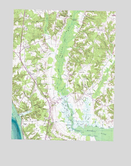
Popes Creek, MD USGS Topographic Map
Click on map above to begin viewing in our Map Viewer.

This topographic map contains these locations and features:
Feature Name Type Latitude Longitude GNIS ID View Map
Allens FreshPopulated PlaceN38.4140°W76.9405°589635View Map
Allens Fresh RunBayN38.4018°W76.9266°582886View Map
Amys AcresPopulated PlaceN38.4596°W76.8972°1676957View Map
Bel AltonPopulated PlaceN38.4640°W76.9828°588747View Map
Bel Alton EstatesPopulated PlaceN38.4682°W76.9761°1676963View Map
Bel Alton FacilitySchoolN38.4518°W76.9914°1676964View Map
Bel Alton Post OfficePost OfficeN38.4632°W76.9860°1676965View Map
Bel Alton Volunteer Fire Department and Emergency Medical ServicesBuildingN38.4617°W76.9887°1676962View Map
Birkwood EstatesPopulated PlaceN38.4468°W76.9222°1676969View Map
Bowling CreekStreamN38.4273°W76.9427°583340View Map
Bowling GutStreamN38.3879°W76.8877°583341View Map
Bowlings AlleyLocaleN38.4407°W76.9183°583342View Map
Bowman CreekStreamN38.4651°W76.9347°583343View Map
Budds LandingLocaleN38.3876°W76.8797°589847View Map
Bunker HillSummitN38.3990°W76.9716°589850View Map
Bunker Hill BranchStreamN38.3968°W76.9316°583481View Map
Carpenter PointCapeN38.3796°W76.9047°583593View Map
Chapel Point WoodsPopulated PlaceN38.4682°W76.9944°1676991View Map
Clark RunStreamN38.4493°W76.9419°583798View Map
Colby RunStreamN38.3854°W76.9244°583837View Map
Cooksey IslandIslandN38.3846°W76.9147°583879View Map
Cooksey KnollsPopulated PlaceN38.4679°W76.9041°1677003View Map
Cooksey PointCapeN38.3826°W76.9147°583880View Map
Cooksey RunStreamN38.4865°W76.9272°583881View Map
Cramer GutGutN38.4079°W76.9333°583959View Map
Deer ParkPopulated PlaceN38.4712°W76.9147°1677005View Map
Denstville Emergency Management ServicesBuildingN38.4809°W76.8916°2131787View Map
DentsvillePopulated PlaceN38.4818°W76.8925°584094View Map
Dentsville BridgeBridgeN38.4907°W76.9264°584095View Map
Dentsville Emergency Medical ServicesBuildingN38.4809°W76.8916°2087278View Map
District 4, Allens FreshCivilN38.4387°W76.9136°1929602View Map
Drinks RunStreamN38.4010°W76.9794°584149View Map
Ellenboro HillSummitN38.4054°W76.9675°584280View Map
Ellenboro Hill RunStreamN38.4068°W76.9733°584281View Map
FaulknerPopulated PlaceN38.4390°W76.9783°584352View Map
Faulkner Post OfficePost OfficeN38.4383°W76.9772°1677013View Map
Foggy BottomsBendN38.3915°W76.9289°584431View Map
Foggy Bottoms GutGutN38.3876°W76.9275°584432View Map
Ford RunStreamN38.4335°W76.8886°584436View Map
Forest CoveBayN38.3868°W76.8883°584442View Map
Fresh MarshSwampN38.4073°W76.9339°584503View Map
Gilbert AcresPopulated PlaceN38.4446°W76.9075°1677023View Map
Gilbert Swamp RunStreamN38.4185°W76.8983°584589View Map
Glasva BranchStreamN38.4032°W76.9739°584608View Map
Glasva Elementary SchoolSchoolN38.4110°W76.9528°1677027View Map
Hard CornerPopulated PlaceN38.3796°W76.9569°1677037View Map
Hells Bottom RunStreamN38.4510°W76.8752°584926View Map
Herbert RunStreamN38.4371°W76.9405°584930View Map
Hickory GutGutN38.4137°W76.9080°584949View Map
Hodister RunStreamN38.3898°W76.8964°584990View Map
HuckleberryPopulated PlaceN38.4157°W76.9864°590509View Map
Huckleberry BranchStreamN38.4143°W76.9780°585100View Map
Huntley EstatesPopulated PlaceN38.4446°W76.9239°1677054View Map
Husick EstatesPopulated PlaceN38.4740°W76.8969°1677055View Map
Ivory RunStreamN38.4496°W76.8766°585173View Map
James RunStreamN38.4868°W76.9280°585198View Map
KnollcrestPopulated PlaceN38.4523°W76.9008°1677064View Map
Lancaster RunStreamN38.4210°W76.8961°585348View Map
Lloyd DrainStreamN38.3751°W76.8944°585524View Map
Lothair StationPopulated PlaceN38.4354°W76.9661°1677068View Map
Maddox BranchStreamN38.4751°W76.9569°585651View Map
McReynolds PointCapeN38.3790°W76.8983°585771View Map
Mud CoveBayN38.3893°W76.8955°586082View Map
Mud CreekStreamN38.4290°W76.9439°586084View Map
Murphy RunStreamN38.4162°W76.9016°586117View Map
NewburgPopulated PlaceN38.3773°W76.9533°588702View Map
Newburg Post OfficePost OfficeN38.3778°W76.9538°1677093View Map
Newburg Volunteer Rescue Squad and Fire DepartmentBuildingN38.3767°W76.9533°2087277View Map
NewportPopulated PlaceN38.4196°W76.9033°588703View Map
Newport BranchStreamN38.4257°W76.9064°586183View Map
Newport MarshSwampN38.3913°W76.9174°586185View Map
Newport Marsh RunStreamN38.3882°W76.9180°586186View Map
Newport RunStreamN38.3890°W76.9075°586189View Map
Oden RunStreamN38.4312°W76.8900°586289View Map
Old Mill BranchStreamN38.4210°W76.9430°586317View Map
Peach RunStreamN38.4201°W76.9052°586452View Map
Popes CreekPopulated PlaceN38.3990°W76.9911°586651View Map
Popes CreekStreamN38.3957°W76.9891°586652View Map
Popes Creek BridgeBridgeN38.3965°W76.9889°586653View Map
Posey CreekStreamN38.3962°W76.9300°586681View Map
Preference EstatesPopulated PlaceN38.4862°W76.9930°1677124View Map
Ravens CrestSummitN38.3896°W76.9830°591099View Map
Rice CreekStreamN38.4596°W76.9375°586816View Map
Rogers MillPopulated PlaceN38.4937°W76.9311°591172View Map
Rogers Mill BranchStreamN38.4862°W76.9286°586916View Map
Rolling HillsPopulated PlaceN38.4798°W76.9928°1677129View Map
Ross BranchStreamN38.4554°W76.9453°586937View Map
Saint Clair GutGutN38.4148°W76.9066°586992View Map
Saint Marys Catholic Church CemeteryCemeteryN38.4349°W76.9109°1677140View Map
Saint Marys ChurchChurchN38.4340°W76.9097°587099View Map
Saint Stephen RunStreamN38.4573°W76.8783°587150View Map
Scar BranchStreamN38.4426°W76.9425°587239View Map
Spring Hill (historical)Populated PlaceN38.4915°W76.9858°1677150View Map
Spring Hill BranchStreamN38.4862°W76.9589°587508View Map
Steinhauser GutGutN38.3937°W76.9239°587542View Map
Stoner CreekStreamN38.4987°W76.9225°587577View Map
Stones BridgeBridgeN38.4023°W76.9822°587578View Map
Sunny Meadow SchoolSchoolN38.4473°W76.8878°2132489View Map
Tears GutGutN38.4043°W76.9333°587716View Map
Thomas ManorPopulated PlaceN38.4710°W76.8977°1677164View Map
Westwood PointCapeN38.4115°W76.9314°588169View Map
WicomicoPopulated PlaceN38.4135°W76.8766°588231View Map
Wicomico Mill (historical)LocaleN38.4157°W76.8869°1677182View Map
Wicomico RidgePopulated PlaceN38.4248°W76.9208°1677184View Map
Willmer CreekStreamN38.4190°W76.9402°588263View Map
Woodland PointCapeN38.3971°W76.9247°588329View Map
Woodside SchoolSchoolN38.4472°W76.8878°2132308View Map
Zekiah Swamp Natural Environment AreaParkN38.4182°W76.9361°1677189View Map
Zekiah Swamp RunStreamN38.4204°W76.9439°595193View Map

Note: Coordinates in the location and feature list above are referenced to NAD83 datum.


Copyright (C) 2008-2024 Ryan Niemi / Sunset Dynamics ... All Rights Reserved