TopoQuest Logo
Do you find TopoQuest useful?
Help keep TopoQuest running and adding new maps/features by donating!
Bitcoin:  19c7KJd3qBynnjoSw5npx9KScwjBe4ifkT
Litecoin:  LXs6TkuXGGXo1vDsWCkWVdjQX94eUKd6ui
Home View Maps Find Maps Find Places Resources & Links


Port Tobacco, Maryland Topographic Map

USGS Map Title: Port Tobacco, MD
USGS Map MRC: 38077E1
DRG (GeoTIFF) Download: o38077e1.tif


Neighboring USGS Topographic Map Quads:


  Fort Belvoir, VA  
38077F2
 

  Mount Vernon, VA  
38077F1
 

  Piscataway, MD  
38076F8
 

  Indian Head, MD  
38077E2
 

  Port Tobacco, MD  
38077E1
 

  La Plata, MD  
38076E8
 

  Nanjemoy, MD  
38077D2
 

  Mathias Point, VA  
38077D1
 

  Popes Creek, MD  
38076D8


Map MRC Location:

N39°
W78°
N39°
W77°
H8 H7 H6 H5 H4 H3 H2 H1
G8 G7 G6 G5 G4 G3 G2 G1
F8 F7 F6 F5 F4 F3 F2 F1
E8 E7 E6 E5 E4 E3 E2 E1
D8 D7 D6 D5 D4 D3 D2 D1
C8 C7 C6 C5 C4 C3 C2 C1
B8 B7 B6 B5 B4 B3 B2 B1
A8 A7 A6 A5 A4 A3 A2 A1
N38°
W78°
N38°
W77°

Port Tobacco, MD USGS 1:24K Topographic Map Preview:
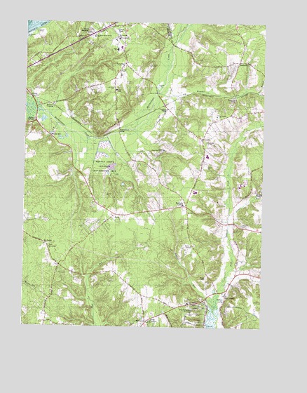
Port Tobacco, MD USGS Topographic Map
Click on map above to begin viewing in our Map Viewer.

This topographic map contains these locations and features:
Feature Name Type Latitude Longitude GNIS ID View Map
Avon CrestPopulated PlaceN38.5868°W77.0103°1676646View Map
BennsvillePopulated PlaceN38.6093°W77.0122°589738View Map
Bennsville SidingLocaleN38.5946°W77.0144°583156View Map
Bensville Census Designated PlaceCensusN38.6176°W77.0077°2389203View Map
Benville School (historical)SchoolN38.6187°W77.0114°1676647View Map
Billingsley ForestPopulated PlaceN38.6051°W77.0294°1676650View Map
Blessed Hope Baptist ChurchChurchN38.6057°W77.0841°1676652View Map
Bryans Road Census Designated PlaceCensusN38.6144°W77.0850°2389254View Map
Bryans Road Volunteer Fire Department and Rescue SquadBuildingN38.6244°W77.0742°2087275View Map
Buteaux CrossingPopulated PlaceN38.5915°W77.1111°589865View Map
Caernarvon WoodsPopulated PlaceN38.5457°W77.0297°1676659View Map
CamelotPopulated PlaceN38.5890°W77.0272°1676660View Map
Chapman LandingPopulated PlaceN38.6215°W77.1191°589935View Map
Chapman PointCapeN38.6185°W77.1247°583695View Map
Charles County Community CollegeSchoolN38.5590°W77.0105°1676665View Map
Charles County MuseumBuildingN38.5110°W77.0211°1676669View Map
Charles County Public Library - Potomac BranchBuildingN38.6233°W77.0871°2503179View Map
Civista Health CenterHospitalN38.6229°W77.0739°2044242View Map
Columbia ParkPopulated PlaceN38.5932°W77.0061°1676681View Map
CountrysidePopulated PlaceN38.6046°W77.0247°1676684View Map
District 7, PomonkeyCivilN38.6115°W77.1233°1929675View Map
Doctor James Craik Elementary SchoolSchoolN38.5690°W77.0298°1676739View Map
Ellerslie HeightsPopulated PlaceN38.5004°W77.0480°1676690View Map
Finagin AirfieldAirportN38.5115°W77.1226°2443786View Map
Foxhall EstatesPopulated PlaceN38.6085°W77.0261°1676700View Map
Freedom VillagePopulated PlaceN38.6137°W77.0375°1676701View Map
Garden EstatesPopulated PlaceN38.5218°W77.1047°1676704View Map
Graystone EstatesPopulated PlaceN38.5196°W77.0772°1676713View Map
Green MeadowsPopulated PlaceN38.6207°W77.0886°590368View Map
Habre De VentureLocaleN38.5329°W77.0353°584817View Map
HawthornePopulated PlaceN38.5404°W77.0114°1676718View Map
Hawthorne Country ClubLocaleN38.5423°W77.0103°592435View Map
Hawthorne ManorPopulated PlaceN38.5343°W77.0150°1676719View Map
Highland EstatesPopulated PlaceN38.5057°W77.0061°1676722View Map
Hoghole RunStreamN38.5085°W77.0236°585006View Map
Horizon CenterSchoolN38.5726°W77.0522°1676728View Map
J C Parks Elementary SchoolSchoolN38.6147°W77.0749°1676738View Map
Jennie RunStreamN38.5462°W77.0169°585220View Map
King George EstatesPopulated PlaceN38.5918°W77.0100°1676744View Map
Knotts CrossingPopulated PlaceN38.5943°W77.1216°590615View Map
Laurel AcresPopulated PlaceN38.6140°W77.0833°1676758View Map
Marshalls CornerPopulated PlaceN38.5496°W77.0391°590748View Map
Maryland AirportAirportN38.6033°W77.0751°595303View Map
Mason SpringsLocaleN38.5843°W77.1189°585730View Map
Mattawoman Wastewater Treatment PlantLocaleN38.5814°W77.1093°2503469View Map
Matthew Henson Middle SchoolSchoolN38.6138°W77.0768°1676778View Map
Maurice J McDonough High SchoolSchoolN38.5558°W77.0351°1676781View Map
McConchiePopulated PlaceN38.5021°W77.0600°590771View Map
Metropolitan ChurchChurchN38.6190°W77.0761°585804View Map
Metropolitan United Methodist Church CemeteryCemeteryN38.6188°W77.0776°1676787View Map
Millards MillPopulated PlaceN38.5779°W77.1105°590802View Map
MontrosePopulated PlaceN38.6162°W77.0911°1676791View Map
Mount CarmelPopulated PlaceN38.5560°W77.0036°1676793View Map
Mount Carmel CemeteryCemeteryN38.5562°W77.0006°1676794View Map
Mount Carmel EstatesPopulated PlaceN38.5635°W77.0028°1676795View Map
Mount PisgahPopulated PlaceN38.5337°W77.1128°590839View Map
Myrtle Grove EstatesPopulated PlaceN38.5501°W77.0886°1676797View Map
Myrtle Grove Lake DamDamN38.5651°W77.0814°594531View Map
Myrtle Grove Wildlife Management AreaParkN38.5665°W77.0822°586127View Map
NelsonPopulated PlaceN38.5410°W77.0866°1676798View Map
OakwoodPopulated PlaceN38.5673°W77.0336°1676805View Map
Old Womans RunStreamN38.5962°W77.0544°586326View Map
Pole BranchStreamN38.5965°W77.0025°586627View Map
PomfretPopulated PlaceN38.5773°W77.0305°586631View Map
Pomfret Census Designated PlaceCensusN38.5699°W77.0304°2629803View Map
Pomfret EstatesPopulated PlaceN38.5751°W77.0330°1676917View Map
Pomfret Post OfficePost OfficeN38.5831°W77.0265°1676818View Map
Pomfret SidingLocaleN38.5893°W77.0491°586632View Map
PomonkeyPopulated PlaceN38.6079°W77.0716°586633View Map
Pomonkey SchoolSchoolN38.6185°W77.0750°586636View Map
Port TobaccoPopulated PlaceN38.5137°W77.0183°588714View Map
Port Tobacco Courthouse Historic SiteParkN38.5110°W77.0211°1676820View Map
Port Tobacco CreekStreamN38.5001°W77.0250°582841View Map
Port Tobacco HillsPopulated PlaceN38.5029°W77.0528°1676821View Map
Port Tobacco Historic DistrictParkN38.5137°W77.0186°1676839View Map
Port Tobacco LakesPopulated PlaceN38.5012°W77.0341°1676822View Map
Port Tobacco Post OfficePost OfficeN38.5101°W77.0364°1676823View Map
Port Tobacco RivieraPopulated PlaceN38.5110°W77.0297°591052View Map
Port Tobacco SchoolSchoolN38.5098°W77.0378°586671View Map
Quiet AcresPopulated PlaceN38.6062°W77.0219°1676830View Map
RipleyPopulated PlaceN38.5448°W77.0783°591134View Map
Robert D Stethem Educational CenterSchoolN38.5703°W77.0291°1676673View Map
Robie ManorPopulated PlaceN38.5998°W77.0150°1676840View Map
Rose HillSummitN38.5201°W77.0282°591181View Map
Saint Catherines of Alexandria CemeteryCemeteryN38.5024°W77.0586°1676848View Map
Saint Johns CemeteryCemeteryN38.5980°W77.0788°587031View Map
Saint Johns ChapelChurchN38.6046°W77.0750°587035View Map
Saint Josephs CemeteryCemeteryN38.5870°W77.0239°1676847View Map
Saint Josephs ChurchChurchN38.5868°W77.0239°587055View Map
Saint Katherines ChurchChurchN38.5023°W77.0580°587059View Map
Saint Marys Star of the Sea SchoolSchoolN38.6193°W77.0880°587108View Map
Shady AcresPopulated PlaceN38.6182°W77.0164°1676850View Map
Smith ChapelChurchN38.5323°W77.1111°587396View Map
Smith Chapel CemeteryCemeteryN38.5329°W77.1114°1676854View Map
Tarrington CreekPopulated PlaceN38.6079°W77.0122°1676866View Map
Thomas Stone National Historic SiteParkN38.5293°W77.0378°1888967View Map
Town of Port Tobacco VillageCivilN38.5105°W77.0196°2391369View Map
Twinbrook EstatesPopulated PlaceN38.6232°W77.0069°1676872View Map
Ty-Ti-To AirportAirportN38.5211°W77.0695°595309View Map
Valley ViewPopulated PlaceN38.5340°W77.0011°1676873View Map

Note: Coordinates in the location and feature list above are referenced to NAD83 datum.


Copyright (C) 2008-2024 Ryan Niemi / Sunset Dynamics ... All Rights Reserved