TopoQuest Logo
Do you find TopoQuest useful?
Help keep TopoQuest running and adding new maps/features by donating!
Bitcoin:  19c7KJd3qBynnjoSw5npx9KScwjBe4ifkT
Litecoin:  LXs6TkuXGGXo1vDsWCkWVdjQX94eUKd6ui
Home View Maps Find Maps Find Places Resources & Links


Nanjemoy, Maryland Topographic Map

USGS Map Title: Nanjemoy, MD
USGS Map MRC: 38077D2
DRG (GeoTIFF) Download: o38077d2.tif


Neighboring USGS Topographic Map Quads:


  Quantico, VA  
38077E3
 

  Indian Head, MD  
38077E2
 

  Port Tobacco, MD  
38077E1
 

  Widewater, VA  
38077D3
 

  Nanjemoy, MD  
38077D2
 

  Mathias Point, VA  
38077D1
 

  Passapatanzy, VA  
38077C3
 

  King George, VA  
38077C2
 

  Dahlgren, VA  
38077C1


Map MRC Location:

N39°
W78°
N39°
W77°
H8 H7 H6 H5 H4 H3 H2 H1
G8 G7 G6 G5 G4 G3 G2 G1
F8 F7 F6 F5 F4 F3 F2 F1
E8 E7 E6 E5 E4 E3 E2 E1
D8 D7 D6 D5 D4 D3 D2 D1
C8 C7 C6 C5 C4 C3 C2 C1
B8 B7 B6 B5 B4 B3 B2 B1
A8 A7 A6 A5 A4 A3 A2 A1
N38°
W78°
N38°
W77°

Nanjemoy, MD USGS 1:24K Topographic Map Preview:
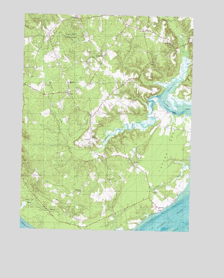
Nanjemoy, MD USGS Topographic Map
Click on map above to begin viewing in our Map Viewer.

This topographic map contains these locations and features:
Feature Name Type Latitude Longitude GNIS ID View Map
Barn CoveBayN38.4435°W77.1378°583027View Map
Bishopville PondReservoirN38.4518°W77.1997°594275View Map
Bunting Branch DamDamN38.4518°W77.1997°594274View Map
Burgess FieldAirportN38.3977°W77.1482°595341View Map
Burgess LandingLocaleN38.4304°W77.1811°1676981View Map
Chapel Hill School (historical)SchoolN38.4237°W77.1986°1676988View Map
District 3, NanjemoyCivilN38.4317°W77.2247°1929587View Map
DoncasterPopulated PlaceN38.4979°W77.2105°588643View Map
Durham CemeteryCemeteryN38.4730°W77.1544°1677010View Map
Durham ChurchChurchN38.4729°W77.1544°584200View Map
Emory ChapelChurchN38.4296°W77.1983°584302View Map
Friendship AcresPopulated PlaceN38.4432°W77.1483°1677018View Map
Friendship LandingLocaleN38.4540°W77.1505°1677019View Map
Grafton (historical)Populated PlaceN38.4404°W77.1989°1677030View Map
GraytonPopulated PlaceN38.4271°W77.1997°595637View Map
Green Leek School (historical)SchoolN38.4860°W77.2325°1677032View Map
Hancock RunStreamN38.4271°W77.2139°584852View Map
Hickory HillPopulated PlaceN38.4168°W77.1697°1677041View Map
Hill Top ForkStreamN38.4543°W77.1441°584977View Map
Holly Springs Farm AirportAirportN38.3976°W77.1858°595325View Map
Holly Springs School (historical)SchoolN38.3932°W77.1794°1677045View Map
IronsidesPopulated PlaceN38.4918°W77.1597°588681View Map
Ironsides Post OfficePost OfficeN38.4918°W77.1594°1677059View Map
Ironsides Volunteer Rescue Squad Company 58BuildingN38.4922°W77.1582°2131789View Map
Jacksontown (historical)Populated PlaceN38.4785°W77.2230°1677061View Map
King James Baptist Church Old Emory CemeteryCemeteryN38.4295°W77.1982°1677012View Map
Little CreekStreamN38.4140°W77.1269°585454View Map
MarshopePopulated PlaceN38.4754°W77.1908°1677073View Map
Maryland PointPopulated PlaceN38.3976°W77.2050°590755View Map
Mount HopePopulated PlaceN38.4598°W77.1761°1677083View Map
Mount Hope / Nanjemoy Elementary SchoolSchoolN38.4581°W77.1806°1677085View Map
Mount Hope Baptist ChurchChurchN38.4771°W77.1922°1677084View Map
Mount Hope SchoolSchoolN38.4765°W77.1908°586006View Map
NanjemoyPopulated PlaceN38.4548°W77.2169°586136View Map
Nanjemoy Creek Environmental Education CenterSchoolN38.4359°W77.1352°2132672View Map
Nanjemoy Episcopal ChurchChurchN38.4568°W77.2089°1677089View Map
Nanjemoy Post OfficePost OfficeN38.4544°W77.2173°1677090View Map
Nanjemoy SchoolSchoolN38.4607°W77.2161°586138View Map
Nanjemoy Volunteer Fire DepartmentBuildingN38.4541°W77.2157°1677088View Map
Neck LandingLocaleN38.4318°W77.1758°1677091View Map
Oak Grove CemeteryCemeteryN38.4039°W77.1830°1677099View Map
Oak Grove ChurchChurchN38.4037°W77.1839°586267View Map
Oak Grove SchoolSchoolN38.4143°W77.1666°586270View Map
RiversidePopulated PlaceN38.3879°W77.1464°591141View Map
Saint Ignatius ChurchChurchN38.4840°W77.1403°587011View Map
Saint Ignatius of Loyola CemeteryCemeteryN38.4842°W77.1403°1677137View Map
Smith Point School (historical)SchoolN38.4032°W77.2305°1677148View Map
Stretchmark HillSummitN38.4976°W77.2100°1677153View Map
Tayloe NeckCapeN38.4240°W77.1405°587705View Map
Thomas PointCapeN38.3829°W77.2497°588817View Map
Thorne Gut MarshSwampN38.3893°W77.2427°587777View Map
Trappe BridgeBridgeN38.4190°W77.1930°1677169View Map
Wards RunStreamN38.4723°W77.1286°588042View Map
Washington FieldAirportN38.4573°W77.2341°595324View Map

Note: Coordinates in the location and feature list above are referenced to NAD83 datum.


Copyright (C) 2008-2024 Ryan Niemi / Sunset Dynamics ... All Rights Reserved