TopoQuest Logo
Do you find TopoQuest useful?
Help keep TopoQuest running and adding new maps/features by donating!
Bitcoin:  19c7KJd3qBynnjoSw5npx9KScwjBe4ifkT
Litecoin:  LXs6TkuXGGXo1vDsWCkWVdjQX94eUKd6ui
Home View Maps Find Maps Find Places Resources & Links


Radley, Kansas Topographic Map

USGS Map Title: Radley, KS
USGS Map MRC: 37094D7
DRG (GeoTIFF) Download: o37094d7.tif


Neighboring USGS Topographic Map Quads:


  Brazilton, KS  
37094E8
 

  Girard, KS  
37094E7
 

  Arma, KS  
37094E6
 

  Grindstone Creek, KS  
37094D8
 

  Radley, KS  
37094D7
 

  Pittsburg, KS  
37094D6
 

  West Mineral, KS  
37094C8
 

  Cherokee, KS  
37094C7
 

  Kirkwood, KS  
37094C6


Map MRC Location:

N38°
W95°
N38°
W94°
H8 H7 H6 H5 H4 H3 H2 H1
G8 G7 G6 G5 G4 G3 G2 G1
F8 F7 F6 F5 F4 F3 F2 F1
E8 E7 E6 E5 E4 E3 E2 E1
D8 D7 D6 D5 D4 D3 D2 D1
C8 C7 C6 C5 C4 C3 C2 C1
B8 B7 B6 B5 B4 B3 B2 B1
A8 A7 A6 A5 A4 A3 A2 A1
N37°
W95°
N37°
W94°

Radley, KS USGS 1:24K Topographic Map Preview:
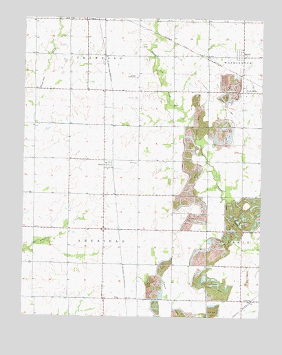
Radley, KS USGS Topographic Map
Click on map above to begin viewing in our Map Viewer.

This topographic map contains these locations and features:
Feature Name Type Latitude Longitude GNIS ID View Map
Base Line School (historical)SchoolN37.3828°W94.8319°483496View Map
Beachner Grain Elevator Number 4LocaleN37.4371°W94.8287°2695126View Map
BeulahPopulated PlaceN37.4403°W94.8283°469727View Map
Beulah CemeteryCemeteryN37.4392°W94.8152°469726View Map
Crawford County Farm (historical)LocaleN37.4667°W94.8158°483505View Map
Crawford County Fire District 3BuildingN37.3830°W94.8323°2111241View Map
Crossroads Baptist ChurchChurchN37.4257°W94.8336°2689814View Map
FillerPopulated PlaceN37.3826°W94.8252°484476View Map
Gem School (historical)SchoolN37.4117°W94.8691°483514View Map
Gooding School (historical)SchoolN37.4703°W94.8508°483515View Map
Harmony School (historical)SchoolN37.4548°W94.7786°483520View Map
Harport Landing Field (historical)AirportN37.4753°W94.8166°469722View Map
KSEK - FM (Girard)BuildingN37.4842°W94.8524°2625232View Map
Liberty School (historical)SchoolN37.4842°W94.8147°483529View Map
Mount Olive Baptist ChurchChurchN37.4705°W94.8099°469723View Map
Mount Zion School (historical)SchoolN37.4545°W94.8150°483543View Map
Pleasant Valley School (historical)SchoolN37.4406°W94.7919°483557View Map
RadleyPopulated PlaceN37.4845°W94.7602°469725View Map
South RadleyPopulated PlaceN37.4714°W94.7602°469724View Map
Township of SheridanCivilN37.3977°W94.8691°469628View Map
West Union CemeteryCemeteryN37.4036°W94.7777°469721View Map
West Union School (historical)SchoolN37.3970°W94.7786°483571View Map

Note: Coordinates in the location and feature list above are referenced to NAD83 datum.


Copyright (C) 2008-2024 Ryan Niemi / Sunset Dynamics ... All Rights Reserved