TopoQuest Logo
Do you find TopoQuest useful?
Help keep TopoQuest running and adding new maps/features by donating!
Bitcoin:  19c7KJd3qBynnjoSw5npx9KScwjBe4ifkT
Litecoin:  LXs6TkuXGGXo1vDsWCkWVdjQX94eUKd6ui
Home View Maps Find Maps Find Places Resources & Links


Brazilton, Kansas Topographic Map

USGS Map Title: Brazilton, KS
USGS Map MRC: 37094E8
DRG (GeoTIFF) Download: o37094e8.tif


Neighboring USGS Topographic Map Quads:


  Porterville, KS  
37095F1
 

  Hepler, KS  
37094F8
 

  Hiattville, KS  
37094F7
 

  Walnut, KS  
37095E1
 

  Brazilton, KS  
37094E8
 

  Girard, KS  
37094E7
 

  McCune NE, KS  
37095D1
 

  Grindstone Creek, KS  
37094D8
 

  Radley, KS  
37094D7


Map MRC Location:

N38°
W95°
N38°
W94°
H8 H7 H6 H5 H4 H3 H2 H1
G8 G7 G6 G5 G4 G3 G2 G1
F8 F7 F6 F5 F4 F3 F2 F1
E8 E7 E6 E5 E4 E3 E2 E1
D8 D7 D6 D5 D4 D3 D2 D1
C8 C7 C6 C5 C4 C3 C2 C1
B8 B7 B6 B5 B4 B3 B2 B1
A8 A7 A6 A5 A4 A3 A2 A1
N37°
W95°
N37°
W94°

Brazilton, KS USGS 1:24K Topographic Map Preview:
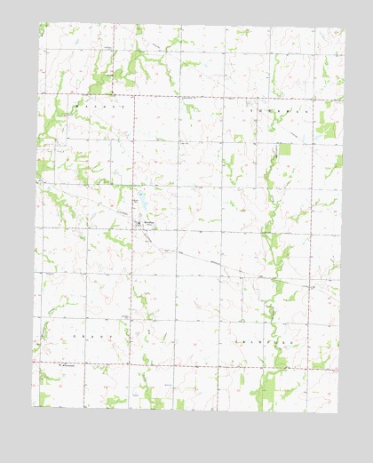
Brazilton, KS USGS Topographic Map
Click on map above to begin viewing in our Map Viewer.

This topographic map contains these locations and features:
Feature Name Type Latitude Longitude GNIS ID View Map
Bayless School (historical)SchoolN37.5437°W94.9239°483497View Map
BraziltonPopulated PlaceN37.5598°W94.9575°475133View Map
Brazilton CemeteryCemeteryN37.5580°W94.9516°2739725View Map
Brazilton Ruritan Fire DepartmentBuildingN37.5606°W94.9597°2111147View Map
Emery School (historical)SchoolN37.5148°W94.8883°483531View Map
Fair Oak School (historical)SchoolN37.5723°W94.9925°483509View Map
Fairview School (historical)SchoolN37.5142°W94.9247°483510View Map
GreenbushPopulated PlaceN37.5145°W94.9880°475130View Map
Immanuel Lutheran ChurchChurchN37.6016°W94.9362°2690298View Map
Iowa CemeteryCemeteryN37.5867°W94.9421°475134View Map
Lutheran CemeteryCemeteryN37.6168°W94.9702°475136View Map
Lutheran SchoolSchoolN37.6017°W94.9375°475135View Map
Meyers School (historical)SchoolN37.5834°W94.9111°483537View Map
Mills CemeteryCemeteryN37.5436°W94.9954°475132View Map
Pittsburg State University - Greenbush Astrophysical ObservatoryBuildingN37.5130°W94.9861°2692880View Map
Pleasant Valley School (historical)SchoolN37.6020°W94.9975°483558View Map
Saint Aloysius Church (historical)ChurchN37.5141°W94.9883°2690788View Map
Salem School (historical)SchoolN37.5434°W94.8880°483564View Map
Spangler Pleasant Valley CemeteryCemeteryN37.5299°W94.9609°475131View Map

Note: Coordinates in the location and feature list above are referenced to NAD83 datum.


Copyright (C) 2008-2024 Ryan Niemi / Sunset Dynamics ... All Rights Reserved