TopoQuest Logo
Do you find TopoQuest useful?
Help keep TopoQuest running and adding new maps/features by donating!
Bitcoin:  19c7KJd3qBynnjoSw5npx9KScwjBe4ifkT
Litecoin:  LXs6TkuXGGXo1vDsWCkWVdjQX94eUKd6ui
Home View Maps Find Maps Find Places Resources & Links


Rawson, Ohio Topographic Map

USGS Map Title: Rawson, OH
USGS Map MRC: 40083H7
DRG (GeoTIFF) Download: o40083h7.tif


Neighboring USGS Topographic Map Quads:


  Leipsic, OH  
41083A8
 

  McComb, OH  
41083A7
 

  Findlay, OH  
41083A6
 

  Bluffton, OH  
40083H8
 

  Rawson, OH  
40083H7
 

  Arlington, OH  
40083H6
 

  Beaverdam, OH  
40083G8
 

  Ada, OH  
40083G7
 

  Dunkirk, OH  
40083G6


Map MRC Location:

N41°
W84°
N41°
W83°
H8 H7 H6 H5 H4 H3 H2 H1
G8 G7 G6 G5 G4 G3 G2 G1
F8 F7 F6 F5 F4 F3 F2 F1
E8 E7 E6 E5 E4 E3 E2 E1
D8 D7 D6 D5 D4 D3 D2 D1
C8 C7 C6 C5 C4 C3 C2 C1
B8 B7 B6 B5 B4 B3 B2 B1
A8 A7 A6 A5 A4 A3 A2 A1
N40°
W84°
N40°
W83°

Rawson, OH USGS 1:24K Topographic Map Preview:
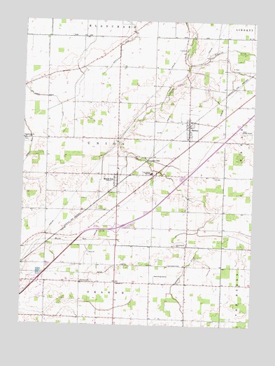
Rawson, OH USGS Topographic Map
Click on map above to begin viewing in our Map Viewer.

This topographic map contains these locations and features:
Feature Name Type Latitude Longitude GNIS ID View Map
Augustine FarmsLocaleN40.9169°W83.7856°2705688View Map
Bethesda ChurchChurchN40.8920°W83.8222°1037962View Map
Bluffton AirportAirportN40.8905°W83.8636°1082506View Map
CannonsburgPopulated PlaceN40.9148°W83.7849°1054426View Map
Cannonsburg CemeteryCemeteryN40.9081°W83.7905°1038799View Map
Clymer CemeteryCemeteryN40.9508°W83.8734°1730683View Map
CordeliaPopulated PlaceN40.8995°W83.7858°1065510View Map
Cordelia Post Office (historical)Post OfficeN40.9001°W83.7860°1990251View Map
Cory-Rawson Elementary SchoolSchoolN40.9517°W83.7858°1071953View Map
Cory-Rawson High SchoolSchoolN40.9373°W83.8035°1039385View Map
Cory-Rawson Middle SchoolSchoolN40.9370°W83.8049°1071954View Map
Flick CemeteryCemeteryN40.9881°W83.7875°1040523View Map
Gorsuch FarmLocaleN40.9778°W83.8194°2705687View Map
Homer Green DitchCanalN40.9687°W83.8647°1041725View Map
Interchange 142CrossingN40.8923°W83.8672°1077467View Map
Interchange 145CrossingN40.9148°W83.8233°1077468View Map
Jod Bark FarmLocaleN40.9700°W83.7767°2705689View Map
K and J FarmLocaleN40.9350°W83.7536°2705690View Map
Mount Corey Post OfficePost OfficeN40.9362°W83.8222°1990235View Map
Mount CoryPopulated PlaceN40.9367°W83.8224°1065066View Map
Pleasant View ChurchChurchN40.9514°W83.8747°1044625View Map
Pure Country GreenhousesBuildingN40.9131°W83.7531°2582426View Map
RawsonPopulated PlaceN40.9589°W83.7841°1044873View Map
Rawson Post OfficePost OfficeN40.9584°W83.7847°1990236View Map
Ross LakeReservoirN40.9427°W83.8061°1045208View Map
Schellbas CemeteryCemeteryN40.8779°W83.8051°1730691View Map
Smith CemeteryCemeteryN40.9440°W83.8189°1730692View Map
Tiderishi CreekStreamN40.9820°W83.7841°1066236View Map
Township of UnionCivilN40.9505°W83.8231°1086253View Map
Union Township Mount Cory Volunteer Fire DepartmentBuildingN40.9335°W83.8232°2549982View Map
Union Township Rawson Fire DepartmentBuildingN40.9516°W83.7842°2549981View Map
Village of Mount CoryCivilN40.9348°W83.8235°2399409View Map
Village of RawsonCivilN40.9569°W83.7850°2399047View Map

Note: Coordinates in the location and feature list above are referenced to NAD83 datum.


Copyright (C) 2008-2024 Ryan Niemi / Sunset Dynamics ... All Rights Reserved