TopoQuest Logo
Do you find TopoQuest useful?
Help keep TopoQuest running and adding new maps/features by donating!
Bitcoin:  19c7KJd3qBynnjoSw5npx9KScwjBe4ifkT
Litecoin:  LXs6TkuXGGXo1vDsWCkWVdjQX94eUKd6ui
Home View Maps Find Maps Find Places Resources & Links


Stetsonville, Wisconsin Topographic Map

USGS Map Title: Stetsonville, WI
USGS Map MRC: 45090A3
DRG (GeoTIFF) Download: o45090a3.tif


Neighboring USGS Topographic Map Quads:


  Medford NW, WI  
45090B4
 

  Medford, WI  
45090B3
 

  Rib River Lookout Tower, WI  
45090B2
 

  Medford SW, WI  
45090A4
 

  Stetsonville, WI  
45090A3
 

  Corinth, WI  
45090A2
 

  Curtiss, WI  
44090H4
 

  Abbotsford, WI  
44090H3
 

  Milan, WI  
44090H2


Map MRC Location:

N46°
W91°
N46°
W90°
H8 H7 H6 H5 H4 H3 H2 H1
G8 G7 G6 G5 G4 G3 G2 G1
F8 F7 F6 F5 F4 F3 F2 F1
E8 E7 E6 E5 E4 E3 E2 E1
D8 D7 D6 D5 D4 D3 D2 D1
C8 C7 C6 C5 C4 C3 C2 C1
B8 B7 B6 B5 B4 B3 B2 B1
A8 A7 A6 A5 A4 A3 A2 A1
N45°
W91°
N45°
W90°

Stetsonville, WI USGS 1:24K Topographic Map Preview:
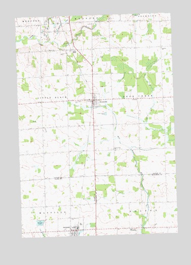
Stetsonville, WI USGS Topographic Map
Click on map above to begin viewing in our Map Viewer.

This topographic map contains these locations and features:
Feature Name Type Latitude Longitude GNIS ID View Map
1.25 ReservoirReservoirN45.0081°W90.3604°1792465View Map
Clearview SchoolSchoolN45.1052°W90.2582°1563167View Map
Cleveland School (historical)SchoolN45.0172°W90.3357°1840249View Map
Correction CreekStreamN45.1114°W90.3449°1563416View Map
Deer CreekStreamN45.0486°W90.2851°1563824View Map
DorchesterPopulated PlaceN45.0030°W90.3357°1564058View Map
Dorchester Area Emergency ServicesBuildingN45.0031°W90.3229°2697868View Map
Dorchester Elementary SchoolSchoolN45.0047°W90.3343°1837653View Map
Dorchester G262 DamDamN45.0033°W90.3268°1792732View Map
Dorchester Police DepartmentBuildingN45.0015°W90.3326°2759480View Map
Draper School (historical)SchoolN45.0175°W90.2787°1844093View Map
Kalepp DamDamN45.0066°W90.3618°1792464View Map
Kalepp LakeReservoirN45.0081°W90.3604°1567336View Map
Liberty School (historical)SchoolN45.0477°W90.3410°1840323View Map
Little BlackPopulated PlaceN45.1061°W90.3296°1568198View Map
Little Black RiverStreamN45.1108°W90.3490°1568200View Map
Medford SchoolSchoolN45.1055°W90.3451°1569308View Map
North Memorial CemeteryCemeteryN45.0100°W90.3354°1570466View Map
Peace United Church of ChristChurchN45.0022°W90.3326°1837708View Map
Pleasant Valley SchoolSchoolN45.0489°W90.2996°1571660View Map
Sacred Heart CemeteryCemeteryN45.0766°W90.3299°1572787View Map
Saint Louis ChurchChurchN45.0036°W90.3343°1837728View Map
Saint Louis Grade SchoolSchoolN45.0036°W90.3354°1837729View Map
Saint Peter Lutheran ChurchChurchN45.0005°W90.3351°1837734View Map
Spruce Grove School (historical)SchoolN45.1064°W90.2893°1840335View Map
StetsonvillePopulated PlaceN45.0769°W90.3151°1574869View Map
Stetsonville Elementary SchoolSchoolN45.0777°W90.3227°1833669View Map
Stetsonville Public CemeteryCemeteryN45.0600°W90.3157°1833670View Map
Stetsonville Volunteer Fire DepartmentBuildingN45.0773°W90.3086°2696764View Map
Taylor County AirportAirportN45.1045°W90.3073°1582068View Map
Town of Deer CreekCivilN45.0772°W90.2558°1583059View Map
Victory SchoolSchoolN45.0769°W90.2799°1576090View Map
Village of DorchesterCivilN45.0026°W90.3308°1583089View Map
Village of StetsonvilleCivilN45.0771°W90.3142°1584220View Map
Zion CemeteryCemeteryN45.0622°W90.3154°1577152View Map

Note: Coordinates in the location and feature list above are referenced to NAD83 datum.


Copyright (C) 2008-2024 Ryan Niemi / Sunset Dynamics ... All Rights Reserved