TopoQuest Logo
Do you find TopoQuest useful?
Help keep TopoQuest running and adding new maps/features by donating!
Bitcoin:  19c7KJd3qBynnjoSw5npx9KScwjBe4ifkT
Litecoin:  LXs6TkuXGGXo1vDsWCkWVdjQX94eUKd6ui
Home View Maps Find Maps Find Places Resources & Links


Stoutland, Missouri Topographic Map

USGS Map Title: Stoutland, MO
USGS Map MRC: 37092G5
DRG (GeoTIFF) Download: o37092g5.tif


Neighboring USGS Topographic Map Quads:


  Decaturville, MO  
37092H6
 

  Montreal, MO  
37092H5
 

  Conns Creek, MO  
37092H4
 

  Eldridge East, MO  
37092G6
 

  Stoutland, MO  
37092G5
 

  Richland, MO  
37092G4
 

  Lebanon, MO  
37092F6
 

  Oakland, MO  
37092F5
 

  Drynob, MO  
37092F4


Map MRC Location:

N38°
W93°
N38°
W92°
H8 H7 H6 H5 H4 H3 H2 H1
G8 G7 G6 G5 G4 G3 G2 G1
F8 F7 F6 F5 F4 F3 F2 F1
E8 E7 E6 E5 E4 E3 E2 E1
D8 D7 D6 D5 D4 D3 D2 D1
C8 C7 C6 C5 C4 C3 C2 C1
B8 B7 B6 B5 B4 B3 B2 B1
A8 A7 A6 A5 A4 A3 A2 A1
N37°
W93°
N37°
W92°

Stoutland, MO USGS 1:24K Topographic Map Preview:
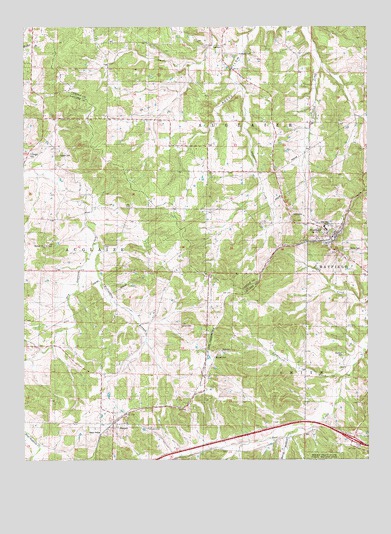
Stoutland, MO USGS Topographic Map
Click on map above to begin viewing in our Map Viewer.

This topographic map contains these locations and features:
Feature Name Type Latitude Longitude GNIS ID View Map
Barnett CemeteryCemeteryN37.7798°W92.5568°713679View Map
Braddock School (historical)SchoolN37.8328°W92.5580°742481View Map
City of StoutlandCivilN37.8136°W92.5143°2395979View Map
Cox Crossing School (historical)SchoolN37.7814°W92.5588°742484View Map
Deberry (historical)LocaleN37.8606°W92.5538°744748View Map
DelmarPopulated PlaceN37.7825°W92.5502°740807View Map
Fulbright CemeteryCemeteryN37.8381°W92.6232°718279View Map
Greenstreet School (historical)LocaleN37.7820°W92.6116°742483View Map
Hickory Grove School (historical)LocaleN37.7878°W92.5077°742485View Map
Hillhouse CemeteryCemeteryN37.8673°W92.5488°719617View Map
Honey CemeteryCemeteryN37.8109°W92.5027°719751View Map
Hooper CemeteryCemeteryN37.8378°W92.6127°719777View Map
Jordan CreekStreamN37.7809°W92.5016°720436View Map
Lomax CemeteryCemeteryN37.7889°W92.5688°721434View Map
Mayfield CemeteryCemeteryN37.7803°W92.5093°722012View Map
Pleasant Grove ChurchChurchN37.8120°W92.6171°724493View Map
Pritchett School (historical)LocaleN37.8692°W92.5538°742480View Map
SleeperPopulated PlaceN37.7606°W92.5930°726540View Map
Sleeper Volunteer Fire DepartmentBuildingN37.7596°W92.5942°2621444View Map
Spud HollowValleyN37.7567°W92.5296°726970View Map
StoutlandPopulated PlaceN37.8142°W92.5141°727163View Map
Stoutland Post OfficePost OfficeN37.8146°W92.5129°2783146View Map
Stoutland Volunteer Fire DepartmentBuildingN37.8111°W92.5138°2620307View Map
Turner SchoolLocaleN37.8267°W92.6041°742482View Map
Williamson BranchStreamN37.8128°W92.5985°728906View Map

Note: Coordinates in the location and feature list above are referenced to NAD83 datum.


Copyright (C) 2008-2024 Ryan Niemi / Sunset Dynamics ... All Rights Reserved