TopoQuest Logo
Do you find TopoQuest useful?
Help keep TopoQuest running and adding new maps/features by donating!
Bitcoin:  19c7KJd3qBynnjoSw5npx9KScwjBe4ifkT
Litecoin:  LXs6TkuXGGXo1vDsWCkWVdjQX94eUKd6ui
Home View Maps Find Maps Find Places Resources & Links


Tennessee City, Tennessee Topographic Map

USGS Map Title: Tennessee City, TN
USGS Map MRC: 36087A5
DRG (GeoTIFF) Download: o36087a5.tif


Neighboring USGS Topographic Map Quads:


  Woolworth, TN  
36087B6
 

  Ruskin, TN  
36087B5
 

  Vanleer, TN  
36087B4
 

  McEwen, TN  
36087A6
 

  Tennessee City, TN  
36087A5
 

  Dickson, TN  
36087A4
 

  Bucksnort, TN  
35087H6
 

  Spot, TN  
35087H5
 

  Texas Hollow, TN  
35087H4


Map MRC Location:

N37°
W88°
N37°
W87°
H8 H7 H6 H5 H4 H3 H2 H1
G8 G7 G6 G5 G4 G3 G2 G1
F8 F7 F6 F5 F4 F3 F2 F1
E8 E7 E6 E5 E4 E3 E2 E1
D8 D7 D6 D5 D4 D3 D2 D1
C8 C7 C6 C5 C4 C3 C2 C1
B8 B7 B6 B5 B4 B3 B2 B1
A8 A7 A6 A5 A4 A3 A2 A1
N36°
W88°
N36°
W87°

Tennessee City, TN USGS 1:24K Topographic Map Preview:
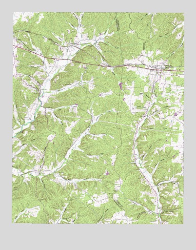
Tennessee City, TN USGS Topographic Map
Click on map above to begin viewing in our Map Viewer.

This topographic map contains these locations and features:
Feature Name Type Latitude Longitude GNIS ID View Map
Adam HollowValleyN36.0772°W87.6048°1275449View Map
Balthrop HollowValleyN36.0741°W87.5206°1276253View Map
Beasley (historical)Populated PlaceN36.0012°W87.5170°1313302View Map
Beatty HollowValleyN36.0546°W87.5323°1276696View Map
Ben Holland HollowValleyN36.0324°W87.5946°1310633View Map
Berryman CemeteryCemeteryN36.0820°W87.5817°1277064View Map
Brown HollowValleyN36.0666°W87.5961°1278587View Map
Buckhorn HollowValleyN36.0773°W87.5979°1278869View Map
Burch LakeReservoirN36.0300°W87.5555°1302324View Map
Burch Lake DamDamN36.0301°W87.5567°1302325View Map
Burgess Chapel (historical)ChurchN36.0964°W87.5856°1316920View Map
Commissioner District 6CivilN36.0244°W87.6108°2464545View Map
Crowell BranchStreamN36.0592°W87.5670°1310640View Map
Culvert BranchStreamN36.1059°W87.5656°1281819View Map
Davidson HollowValleyN36.0637°W87.5264°1282111View Map
Dogwood BranchStreamN36.1053°W87.5745°1282604View Map
Erranton CemeteryCemeteryN36.0023°W87.5197°1283843View Map
Ewing HollowValleyN36.0717°W87.5236°1283943View Map
Few ChapelChurchN36.1081°W87.5778°1306440View Map
Few ChapelPopulated PlaceN36.1064°W87.5792°1310646View Map
Few Chapel CemeteryCemeteryN36.0992°W87.5875°1284228View Map
Few HollowValleyN36.0289°W87.5237°1284229View Map
Fews Chapel CemeteryCemeteryN36.0095°W87.5186°1324076View Map
Fews Chapel Methodist Church (historical)ChurchN36.0092°W87.5186°1324077View Map
Fews Chapel School (historical)SchoolN36.0092°W87.5181°1324078View Map
Fews Chapel School (historical)SchoolN36.1078°W87.5781°1316937View Map
Fewville (historical)Populated PlaceN36.0065°W87.5189°1313319View Map
Gray CemeteryCemeteryN36.0928°W87.5978°1285994View Map
Grindstone HollowValleyN36.0225°W87.5196°1286311View Map
Gun HollowValleyN36.1211°W87.5767°1286434View Map
Hadley BranchStreamN36.1114°W87.5583°1310653View Map
Heath HollowValleyN36.1142°W87.5771°1287294View Map
Hickory HollowValleyN36.0024°W87.5886°1287609View Map
Holland CemeteryCemeteryN36.0306°W87.5906°1288055View Map
Holland CemeteryCemeteryN36.0831°W87.5747°1288057View Map
Holland HollowValleyN36.0274°W87.6053°1288063View Map
Holland School (historical)SchoolN36.0306°W87.5939°1316948View Map
Hurt HollowValleyN36.1248°W87.5229°1288852View Map
Jason ChapelPopulated PlaceN36.0645°W87.5278°1313335View Map
Jason Chapel Church of the NazareneChurchN36.0642°W87.5272°1306620View Map
Jason Chapel School (historical)SchoolN36.0637°W87.5272°1324121View Map
Jaybird HollowValleyN36.0913°W87.6015°1289315View Map
Johnson CemeteryCemeteryN36.0787°W87.6047°1289564View Map
Johnson HollowValleyN36.0809°W87.6046°1289617View Map
Kiley HollowValleyN36.0534°W87.5703°1290150View Map
Larkin BranchStreamN36.0567°W87.6178°1290642View Map
Lucas CemeteryCemeteryN36.0773°W87.5228°1306713View Map
Lucas HollowValleyN36.0676°W87.5264°1292255View Map
Martin BranchStreamN36.0295°W87.5956°1292793View Map
Mathews Mill (historical)LocaleN36.0670°W87.6067°1316962View Map
May CemeteryCemeteryN36.0706°W87.6075°1292995View Map
McElhiney CemeteryCemeteryN36.0662°W87.5381°1306734View Map
Murrell HollowValleyN36.0449°W87.5777°1295158View Map
Myatt HollowValleyN36.0371°W87.5305°1306808View Map
Nolan CemeteryCemeteryN36.0687°W87.5953°1295801View Map
Nolan HollowValleyN36.0672°W87.5957°1295803View Map
Old Sam HollowValleyN36.0088°W87.5167°1306866View Map
Perry CemeteryCemeteryN36.0448°W87.5828°1297207View Map
Ples Euqua HollowValleyN36.0301°W87.6051°1297964View Map
Providence School (historical)SchoolN36.0742°W87.6070°1316986View Map
Rice CemeteryCemeteryN36.0945°W87.5156°1324182View Map
Sawmill BranchStreamN36.1114°W87.5575°1300832View Map
Simmons LakeReservoirN36.0819°W87.5461°1302351View Map
Simmons Lake DamDamN36.0834°W87.5467°1302350View Map
Sinkhole HollowValleyN36.0101°W87.5306°1313353View Map
Sinkhole HollowValleyN36.0076°W87.5264°1303638View Map
Stewart BranchStreamN36.0984°W87.5834°1271358View Map
Stewart HollowValleyN36.0057°W87.5186°1271371View Map
Tennessee CityPopulated PlaceN36.0931°W87.5147°1304043View Map
Tennessee City CemeteryCemeteryN36.0928°W87.5139°1324222View Map
Tennessee City Missionary Baptist ChurchChurchN36.0931°W87.5197°1324223View Map
Tennessee City School (historical)SchoolN36.0906°W87.5195°1324224View Map
Tennessee City United Methodist ChurchChurchN36.0909°W87.5195°1324225View Map
Tennessee City Volunteer Fire DepartmentBuildingN36.0910°W87.5172°2653815View Map
Tom Johnson HollowValleyN36.1012°W87.6081°1272746View Map
Tummings BranchStreamN36.0595°W87.5664°1272975View Map
Vineyard CemeteryCemeteryN36.0403°W87.5347°1273474View Map
Walnut BranchStreamN36.0306°W87.5936°1273708View Map
Warner BranchStreamN36.1070°W87.5639°1273812View Map
Washburn CemeteryCemeteryN36.0928°W87.5947°1273858View Map
Yellow Bank BranchStreamN36.0851°W87.5984°1275262View Map

Note: Coordinates in the location and feature list above are referenced to NAD83 datum.


Copyright (C) 2008-2024 Ryan Niemi / Sunset Dynamics ... All Rights Reserved