TopoQuest Logo
Do you find TopoQuest useful?
Help keep TopoQuest running and adding new maps/features by donating!
Bitcoin:  19c7KJd3qBynnjoSw5npx9KScwjBe4ifkT
Litecoin:  LXs6TkuXGGXo1vDsWCkWVdjQX94eUKd6ui
Home View Maps Find Maps Find Places Resources & Links


Spot, Tennessee Topographic Map

USGS Map Title: Spot, TN
USGS Map MRC: 35087H5
DRG (GeoTIFF) Download: o35087h5.tif


Neighboring USGS Topographic Map Quads:


  McEwen, TN  
36087A6
 

  Tennessee City, TN  
36087A5
 

  Dickson, TN  
36087A4
 

  Bucksnort, TN  
35087H6
 

  Spot, TN  
35087H5
 

  Texas Hollow, TN  
35087H4
 

  Coble, TN  
35087G6
 

  Whitfield, TN  
35087G5
 

  Centerville, TN  
35087G4


Map MRC Location:

N36°
W88°
N36°
W87°
H8 H7 H6 H5 H4 H3 H2 H1
G8 G7 G6 G5 G4 G3 G2 G1
F8 F7 F6 F5 F4 F3 F2 F1
E8 E7 E6 E5 E4 E3 E2 E1
D8 D7 D6 D5 D4 D3 D2 D1
C8 C7 C6 C5 C4 C3 C2 C1
B8 B7 B6 B5 B4 B3 B2 B1
A8 A7 A6 A5 A4 A3 A2 A1
N35°
W88°
N35°
W87°

Spot, TN USGS 1:24K Topographic Map Preview:
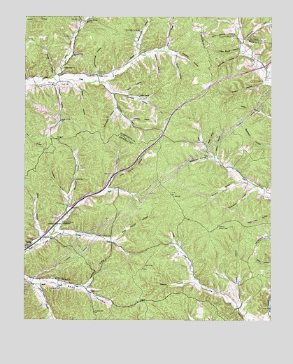
Spot, TN USGS Topographic Map
Click on map above to begin viewing in our Map Viewer.

This topographic map contains these locations and features:
Feature Name Type Latitude Longitude GNIS ID View Map
Baker HollowValleyN35.9477°W87.5348°1311335View Map
Baker HollowValleyN35.9465°W87.5328°1276181View Map
Berryman HollowValleyN35.9214°W87.6025°1277065View Map
Betty HollowValleyN35.9734°W87.6003°1277194View Map
Caney HollowValleyN35.9729°W87.6093°1279584View Map
Cave Spring HollowValleyN35.9924°W87.5177°1279968View Map
Chimney HollowValleyN35.9849°W87.5156°1280471View Map
Coleman BranchStreamN35.8920°W87.6247°1280937View Map
Coleman CemeteryCemeteryN35.8884°W87.6067°1280942View Map
Commissioner District 1CivilN35.8957°W87.5560°2464246View Map
Crawford HollowValleyN35.9904°W87.5141°1306171View Map
Crowell CemeteryCemeteryN35.9917°W87.6020°1281750View Map
Crowell HollowValleyN35.9685°W87.5803°1281753View Map
Franklin HollowValleyN35.9857°W87.5540°1284832View Map
Fuqua HollowValleyN35.9989°W87.6248°1285039View Map
Gordon HollowValleyN35.9726°W87.5041°1285701View Map
Hickory HollowValleyN35.8908°W87.5386°1287607View Map
Hurricane HollowValleyN35.9618°W87.5785°1288825View Map
Indian Camp HollowValleyN35.9864°W87.5164°1288939View Map
Indian CreekStreamN35.9748°W87.6109°1288959View Map
Indian Creek ChurchChurchN35.9790°W87.6059°1288973View Map
James CemeteryCemeteryN35.9720°W87.6028°1289270View Map
James HollowValleyN35.8808°W87.5157°1289278View Map
Jenkins CemeteryCemeteryN35.9167°W87.6072°1289345View Map
Jenkins SpringSpringN35.9153°W87.6054°1289367View Map
John Waynick HollowValleyN35.9287°W87.5830°1289503View Map
Ladd CemeteryCemeteryN35.9664°W87.5681°1290455View Map
Leathers HollowValleyN35.8891°W87.5935°1290880View Map
Limekiln HollowValleyN35.9576°W87.5717°1291291View Map
McMackins CemeteryCemeteryN35.9751°W87.6183°1293410View Map
Middle Fork Sugar CreekStreamN35.9098°W87.6111°1293680View Map
Miller BranchStreamN35.9728°W87.5853°1293906View Map
MilltownPopulated PlaceN35.9981°W87.5945°1315517View Map
Moss Waynick HollowValleyN35.9077°W87.5797°1294511View Map
Muscadine HollowValleyN35.9302°W87.5083°1295161View Map
North Fork Sugar CreekStreamN35.9101°W87.6111°1295915View Map
Only Division (historical)CensusN35.8978°W87.5684°1648786View Map
Pemberton BranchStreamN35.9731°W87.5853°1297128View Map
Pewitt HollowValleyN35.9100°W87.6163°1297286View Map
Pinewood Lookout TowerTowerN35.9142°W87.5272°1647787View Map
Pleasant Valley ChurchChurchN35.9148°W87.6061°1297936View Map
Poplar GrovePopulated PlaceN35.9762°W87.5889°1315758View Map
Poplar Grove Church of ChristChurchN35.9762°W87.5889°1326209View Map
Poplar Grove School (historical)SchoolN35.9765°W87.5881°1316985View Map
Potter CemeteryCemeteryN35.9428°W87.5320°1298349View Map
Pretty Creek School (historical)SchoolN35.8798°W87.5189°1319124View Map
Salt LickPopulated PlaceN35.9262°W87.5497°1315867View Map
Sanders HollowValleyN35.9257°W87.6033°1300704View Map
Schoolhouse HollowValleyN35.9761°W87.5884°1300898View Map
Shipman CemeteryCemeteryN35.9937°W87.5347°1324196View Map
Smith HollowValleyN35.9760°W87.6098°1270685View Map
Smith SpringSpringN35.9987°W87.5930°1270708View Map
South HollowValleyN35.9843°W87.5512°1270897View Map
Sparkman HollowValleyN35.9423°W87.5298°1270954View Map
SpotPopulated PlaceN35.8862°W87.5914°1271020View Map
Spot CemeteryCemeteryN35.8884°W87.5920°1319132View Map
Spot ChurchChurchN35.8915°W87.6047°1271021View Map
Spot School (historical)SchoolN35.8912°W87.6050°1319133View Map
Steele CemeteryCemeteryN35.9848°W87.5086°1271305View Map
Taylor SpringSpringN35.9672°W87.5668°1272250View Map
Thornton CemeteryCemeteryN35.9078°W87.6203°1272570View Map
Thornton SpringSpringN35.9067°W87.6214°1272574View Map
Tidwell CemeteryCemeteryN35.9214°W87.6014°1272620View Map
Turner CemeteryCemeteryN35.9095°W87.5820°1273068View Map
Waynick HollowValleyN35.9292°W87.5828°1311382View Map
Weems HollowValleyN35.9847°W87.5600°1274061View Map
Wells HollowValleyN35.9680°W87.5751°1274114View Map
Wetherspoon HollowValleyN35.9843°W87.5684°1274268View Map
Wetherspoon Hollow CemeteryCemeteryN35.9942°W87.5670°1274269View Map
White HollowValleyN35.9422°W87.5279°1274374View Map
WhitehousePopulated PlaceN35.9140°W87.6064°1314503View Map
Whitehouse School (historical)SchoolN35.9140°W87.6067°1319148View Map
Wilder LakeReservoirN35.9017°W87.5167°1302201View Map
Wilder Lake DamDamN35.9017°W87.5167°1302200View Map
Wilkens CemeteryCemeteryN35.9353°W87.5803°1274583View Map
Williams HollowValleyN35.9324°W87.5140°1274704View Map

Note: Coordinates in the location and feature list above are referenced to NAD83 datum.


Copyright (C) 2008-2024 Ryan Niemi / Sunset Dynamics ... All Rights Reserved