TopoQuest Logo
Do you find TopoQuest useful?
Help keep TopoQuest running and adding new maps/features by donating!
Bitcoin:  19c7KJd3qBynnjoSw5npx9KScwjBe4ifkT
Litecoin:  LXs6TkuXGGXo1vDsWCkWVdjQX94eUKd6ui
Home View Maps Find Maps Find Places Resources & Links


Troy Mills, Iowa Topographic Map

USGS Map Title: Troy Mills, IA
USGS Map MRC: 42091C6
DRG (GeoTIFF) Download: o42091c6.tif


Neighboring USGS Topographic Map Quads:


  Quasqueton, IA  
42091D7
 

  Winthrop, IA  
42091D6
 

  Masonville, IA  
42091D5
 

  Walker, IA  
42091C7
 

  Troy Mills, IA  
42091C6
 

  Coggon, IA  
42091C5
 

  Center Point, IA  
42091B7
 

  Lafayette, IA  
42091B6
 

  Central City, IA  
42091B5


Map MRC Location:

N43°
W92°
N43°
W91°
H8 H7 H6 H5 H4 H3 H2 H1
G8 G7 G6 G5 G4 G3 G2 G1
F8 F7 F6 F5 F4 F3 F2 F1
E8 E7 E6 E5 E4 E3 E2 E1
D8 D7 D6 D5 D4 D3 D2 D1
C8 C7 C6 C5 C4 C3 C2 C1
B8 B7 B6 B5 B4 B3 B2 B1
A8 A7 A6 A5 A4 A3 A2 A1
N42°
W92°
N42°
W91°

Troy Mills, IA USGS 1:24K Topographic Map Preview:
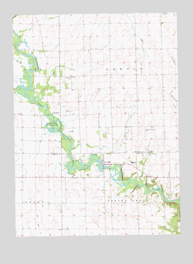
Troy Mills, IA USGS Topographic Map
Click on map above to begin viewing in our Map Viewer.

This topographic map contains these locations and features:
Feature Name Type Latitude Longitude GNIS ID View Map
AtlantaLocaleN42.3255°W91.6549°466233View Map
Atlanta Post Office (historical)Post OfficeN42.3111°W91.6849°2000063View Map
CanaLocaleN42.3122°W91.7435°466235View Map
Cana Post Office (historical)Post OfficeN42.3122°W91.7435°2000062View Map
Carson Landing Strip (historical)AirportN42.3042°W91.7113°2000167View Map
Circle Grove CemeteryCemeteryN42.3390°W91.7064°455417View Map
Dry CreekStreamN42.3005°W91.7068°456020View Map
Honey CreekStreamN42.3286°W91.7324°457603View Map
Hoover ChurchChurchN42.3397°W91.7060°457631View Map
Hoover Wildlife AreaParkN42.3389°W91.7238°2000050View Map
NewtonvilleLocaleN42.3544°W91.6557°466234View Map
Newtonville Post Office (historical)Post OfficeN42.3472°W91.6752°2000064View Map
North - Linn High SchoolSchoolN42.2909°W91.6610°459603View Map
North - Linn Middle SchoolSchoolN42.2913°W91.6611°2719835View Map
Saint Patrick's CemeteryCemeteryN42.3748°W91.6362°461243View Map
Sand CreekStreamN42.3417°W91.7399°461394View Map
Sand Creek Access AreaParkN42.3403°W91.7363°2000049View Map
Township of NewtonCivilN42.3402°W91.6561°468437View Map
Township of Spring GroveCivilN42.2532°W91.6559°468743View Map
Troy MillsPopulated PlaceN42.2900°W91.6824°462343View Map
Troy Mills CemeteryCemeteryN42.2837°W91.6957°462344View Map
Troy Mills Post OfficePost OfficeN42.2900°W91.6824°2046614View Map
Troy Mills State Fish and Game AreaParkN42.3150°W91.7224°462345View Map
Troy Mills Volunteer Fire DepartmentBuildingN42.2909°W91.6822°2577473View Map
Troy Mills Wapsie County ParkParkN42.3203°W91.7227°462346View Map
Upper Spring Grove CemeteryCemeteryN42.3090°W91.6507°462499View Map

Note: Coordinates in the location and feature list above are referenced to NAD83 datum.


Copyright (C) 2008-2024 Ryan Niemi / Sunset Dynamics ... All Rights Reserved