TopoQuest Logo
Do you find TopoQuest useful?
Help keep TopoQuest running and adding new maps/features by donating!
Bitcoin:  19c7KJd3qBynnjoSw5npx9KScwjBe4ifkT
Litecoin:  LXs6TkuXGGXo1vDsWCkWVdjQX94eUKd6ui
Home View Maps Find Maps Find Places Resources & Links


Walker, Iowa Topographic Map

USGS Map Title: Walker, IA
USGS Map MRC: 42091C7
DRG (GeoTIFF) Download: o42091c7.tif


Neighboring USGS Topographic Map Quads:


  Independence, IA  
42091D8
 

  Quasqueton, IA  
42091D7
 

  Winthrop, IA  
42091D6
 

  Cheney, IA  
42091C8
 

  Walker, IA  
42091C7
 

  Troy Mills, IA  
42091C6
 

  Center Point NW, IA  
42091B8
 

  Center Point, IA  
42091B7
 

  Lafayette, IA  
42091B6


Map MRC Location:

N43°
W92°
N43°
W91°
H8 H7 H6 H5 H4 H3 H2 H1
G8 G7 G6 G5 G4 G3 G2 G1
F8 F7 F6 F5 F4 F3 F2 F1
E8 E7 E6 E5 E4 E3 E2 E1
D8 D7 D6 D5 D4 D3 D2 D1
C8 C7 C6 C5 C4 C3 C2 C1
B8 B7 B6 B5 B4 B3 B2 B1
A8 A7 A6 A5 A4 A3 A2 A1
N42°
W92°
N42°
W91°

Walker, IA USGS 1:24K Topographic Map Preview:
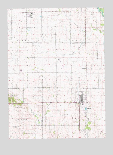
Walker, IA USGS Topographic Map
Click on map above to begin viewing in our Map Viewer.

This topographic map contains these locations and features:
Feature Name Type Latitude Longitude GNIS ID View Map
Bible ChurchChurchN42.3169°W91.7741°454594View Map
Bible Presbyterian ChurchChurchN42.3172°W91.7743°2047943View Map
Blazing Star Prairie AreaParkN42.3561°W91.8030°2000048View Map
City of RowleyCivilN42.3685°W91.8445°2396442View Map
City of WalkerCivilN42.2873°W91.7809°2397175View Map
Cono Christian SchoolSchoolN42.3165°W91.7754°455404View Map
Cono Christian SchoolSchoolN42.3167°W91.7752°2047942View Map
First Presbyterian ChurchChurchN42.3689°W91.8446°2000037View Map
KCRG-TV (Cedar Rapids)TowerN42.3164°W91.8588°467357View Map
KRIN-TV (Waterloo)TowerN42.3164°W91.8588°467371View Map
KUNI-FM (Cedar Falls)TowerN42.3164°W91.8588°463753View Map
RowleyPopulated PlaceN42.3700°W91.8441°460837View Map
Rowley (historical)LocaleN42.3692°W91.8441°2000039View Map
Rowley CemeteryCemeteryN42.3717°W91.8531°2000166View Map
Rowley City HallBuildingN42.3700°W91.8441°2000033View Map
Rowley Fire DepartmentBuildingN42.3701°W91.8443°2000034View Map
Rowley Post OfficePost OfficeN42.3700°W91.8446°2000035View Map
Rowley SchoolSchoolN42.3708°W91.8474°2000038View Map
Sacred Heart Catholic ChurchChurchN42.2869°W91.7796°2047008View Map
Sacred Heart CemeteryCemeteryN42.2943°W91.7778°460891View Map
Saint Marys CemeteryCemeteryN42.2617°W91.8683°461172View Map
Smith CreekStreamN42.3728°W91.7532°461694View Map
Spencers GrovePopulated PlaceN42.2844°W91.8691°464751View Map
Spencers Grove CemeteryCemeteryN42.2843°W91.8653°2000350View Map
Spencers Grove Post Office (historical)Post OfficeN42.2850°W91.8641°466639View Map
Township of ConoCivilN42.3414°W91.7728°467652View Map
Township of GrantCivilN42.2544°W91.7735°467944View Map
United Methodist ChurchChurchN42.3714°W91.8441°2000036View Map
WalkerPopulated PlaceN42.2867°W91.7807°462608View Map
Walker (historical)LocaleN42.2855°W91.7824°2047007View Map
Walker Bible ChurchChurchN42.2917°W91.7805°2047010View Map
Walker CemeteryCemeteryN42.2836°W91.7857°2048105View Map
Walker City HallBuildingN42.2869°W91.7793°2047004View Map
Walker Elementary CenterSchoolN42.2848°W91.7787°2047941View Map
Walker Fire DepartmentBuildingN42.2863°W91.7819°2047005View Map
Walker Post OfficePost OfficeN42.2867°W91.7807°2047006View Map
Walker United Methodist ChurchChurchN42.2855°W91.7791°2047009View Map

Note: Coordinates in the location and feature list above are referenced to NAD83 datum.


Copyright (C) 2008-2024 Ryan Niemi / Sunset Dynamics ... All Rights Reserved