TopoQuest Logo
Do you find TopoQuest useful?
Help keep TopoQuest running and adding new maps/features by donating!
Bitcoin:  19c7KJd3qBynnjoSw5npx9KScwjBe4ifkT
Litecoin:  LXs6TkuXGGXo1vDsWCkWVdjQX94eUKd6ui
Home View Maps Find Maps Find Places Resources & Links


Center Point, Iowa Topographic Map

USGS Map Title: Center Point, IA
USGS Map MRC: 42091B7
DRG (GeoTIFF) Download: o42091b7.tif


Neighboring USGS Topographic Map Quads:


  Cheney, IA  
42091C8
 

  Walker, IA  
42091C7
 

  Troy Mills, IA  
42091C6
 

  Center Point NW, IA  
42091B8
 

  Center Point, IA  
42091B7
 

  Lafayette, IA  
42091B6
 

  Center Point SW, IA  
42091A8
 

  Shellsburg, IA  
42091A7
 

  Cedar Rapids North, IA  
42091A6


Map MRC Location:

N43°
W92°
N43°
W91°
H8 H7 H6 H5 H4 H3 H2 H1
G8 G7 G6 G5 G4 G3 G2 G1
F8 F7 F6 F5 F4 F3 F2 F1
E8 E7 E6 E5 E4 E3 E2 E1
D8 D7 D6 D5 D4 D3 D2 D1
C8 C7 C6 C5 C4 C3 C2 C1
B8 B7 B6 B5 B4 B3 B2 B1
A8 A7 A6 A5 A4 A3 A2 A1
N42°
W92°
N42°
W91°

Center Point, IA USGS 1:24K Topographic Map Preview:
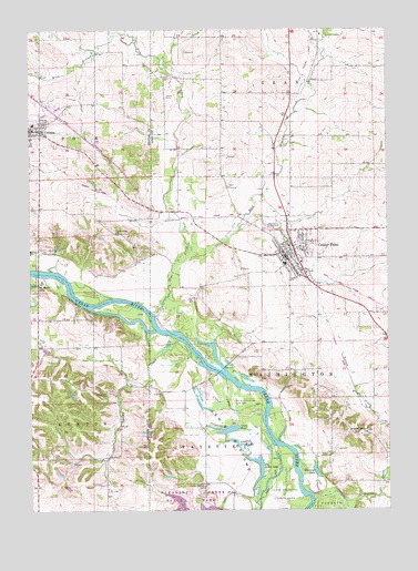
Center Point, IA USGS Topographic Map
Click on map above to begin viewing in our Map Viewer.

This topographic map contains these locations and features:
Feature Name Type Latitude Longitude GNIS ID View Map
Apple CreekStreamN42.1980°W91.8024°454215View Map
Big Lewis LakeLakeN42.1316°W91.7971°454617View Map
Blue CreekStreamN42.1758°W91.8310°454707View Map
Center PointPopulated PlaceN42.1908°W91.7852°455292View Map
Center Point - Urbana High SchoolSchoolN42.1883°W91.7917°2720060View Map
Center Point - Urbana Intermediate SchoolSchoolN42.2256°W91.8740°2000256View Map
Center Point - Urbana Middle SchoolSchoolN42.1891°W91.7860°2048015View Map
Center Point - Urbana Preschool / Primary SchoolSchoolN42.1851°W91.7859°2048016View Map
Center Point (historical)LocaleN42.1939°W91.7807°2048011View Map
Center Point Ambulance ServiceBuildingN42.1942°W91.7841°2599852View Map
Center Point CemeteryCemeteryN42.1971°W91.7912°2048147View Map
Center Point City HallBuildingN42.1875°W91.7802°2048010View Map
Center Point Fire DepartmentBuildingN42.1942°W91.7841°2048007View Map
Center Point Police DeptBuildingN42.1825°W91.7742°2048009View Map
Center Point Post OfficePost OfficeN42.1905°W91.7841°2048131View Map
Center Point Public LibraryBuildingN42.1942°W91.7838°2048008View Map
Center Point United Methodist ChurchChurchN42.1908°W91.7868°2048012View Map
City of Center PointCivilN42.1843°W91.7794°2393781View Map
Davis CemeteryCemeteryN42.2324°W91.8272°455806View Map
East Branch Blue CreekStreamN42.1900°W91.8202°456120View Map
First Christian ChurchChurchN42.1917°W91.7821°2048014View Map
Goose PondLakeN42.1461°W91.8052°456978View Map
Green's Grove CemeteryCemeteryN42.1453°W91.7583°2048134View Map
Hannen AirportAirportN42.2282°W91.7511°466738View Map
John Osborn Historical MarkerParkN42.1972°W91.7916°2048148View Map
Lewis BottomsBendN42.1439°W91.8057°458302View Map
Lewis Bottoms Access County ParkParkN42.1542°W91.8068°458303View Map
Lewis Preserve County Park (historical)ParkN42.1289°W91.7871°465943View Map
Little Lewis LakeLakeN42.1454°W91.8066°458477View Map
Manatheka (historical)Populated PlaceN42.2278°W91.8705°465538View Map
McBroom CemeteryCemeteryN42.1551°W91.8483°458883View Map
Nelson CreekStreamN42.1269°W91.7655°459450View Map
Pleasant Ridge CemeteryCemeteryN42.1309°W91.8150°460286View Map
Primitive Baptist ChurchChurchN42.1450°W91.7577°460450View Map
Rolling Acres Golf CourseLocaleN42.2089°W91.8057°2048018View Map
Saint Johns Lutheran ChurchChurchN42.1939°W91.7868°2048013View Map
Spring CreekStreamN42.1622°W91.8152°461873View Map
Sweeting QuarryMineN42.1803°W91.8169°2571230View Map
Township of WashingtonCivilN42.1723°W91.7673°468927View Map
United Methodist ChurchChurchN42.2233°W91.8702°2000257View Map
UrbanaPopulated PlaceN42.2242°W91.8743°462503View Map
Urbana Catholic ChurchChurchN42.2242°W91.8749°2000254View Map
Urbana CemeteryCemeteryN42.2205°W91.8660°2000360View Map
Urbana Police DeptBuildingN42.2247°W91.8709°2000251View Map
Urbana Post OfficePost OfficeN42.2239°W91.8749°2000250View Map
Urbana Town HallBuildingN42.2242°W91.8716°2000252View Map
West Branch Blue CreekStreamN42.2467°W91.8377°462809View Map
Williams LakeLakeN42.1351°W91.7755°463060View Map

Note: Coordinates in the location and feature list above are referenced to NAD83 datum.


Copyright (C) 2008-2024 Ryan Niemi / Sunset Dynamics ... All Rights Reserved