TopoQuest Logo
Do you find TopoQuest useful?
Help keep TopoQuest running and adding new maps/features by donating!
Bitcoin:  19c7KJd3qBynnjoSw5npx9KScwjBe4ifkT
Litecoin:  LXs6TkuXGGXo1vDsWCkWVdjQX94eUKd6ui
Home View Maps Find Maps Find Places Resources & Links


Ukonom Lake, California Topographic Map

USGS Map Title: Ukonom Lake, CA
USGS Map MRC: 41123E3
DRG (GeoTIFF) Download: o41123e3.tif


Neighboring USGS Topographic Map Quads:


  Clear Creek, CA  
41123F4
 

  Huckleberry Mountain, CA  
41123F3
 

  Grider Valley, CA  
41123F2
 

  Ukonom Mountain, CA  
41123E4
 

  Ukonom Lake, CA  
41123E3
 

  Marble Mountain, CA  
41123E2
 

  Somes Bar, CA  
41123D4
 

  Medicine Mountain, CA  
41123D3
 

  English Peak, CA  
41123D2


Map MRC Location:

N42°
W124°
N42°
W123°
H8 H7 H6 H5 H4 H3 H2 H1
G8 G7 G6 G5 G4 G3 G2 G1
F8 F7 F6 F5 F4 F3 F2 F1
E8 E7 E6 E5 E4 E3 E2 E1
D8 D7 D6 D5 D4 D3 D2 D1
C8 C7 C6 C5 C4 C3 C2 C1
B8 B7 B6 B5 B4 B3 B2 B1
A8 A7 A6 A5 A4 A3 A2 A1
N41°
W124°
N41°
W123°

Ukonom Lake, CA USGS 1:24K Topographic Map Preview:
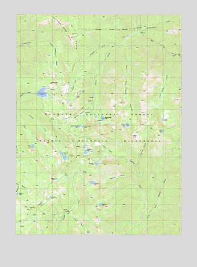
Ukonom Lake, CA USGS Topographic Map
Click on map above to begin viewing in our Map Viewer.

This topographic map contains these locations and features:
Feature Name Type Latitude Longitude GNIS ID View Map
Blue Granite LakeLakeN41.5660°W123.3108°219490View Map
Buns BasinBasinN41.5012°W123.3198°220168View Map
Burney LakeLakeN41.5624°W123.2920°220203View Map
Burney ValleyValleyN41.6112°W123.2928°1657366View Map
Burney Valley CreekStreamN41.6124°W123.2914°220204View Map
Cedar FlatFlatN41.5129°W123.3351°1657369View Map
Cedar Flat CabinLocaleN41.5151°W123.3339°220777View Map
Cuddihy ForkStreamN41.5057°W123.2778°221897View Map
Cuddihy LakesLakeN41.5493°W123.3248°221898View Map
Cuddihy ValleyValleyN41.5426°W123.2923°221899View Map
Deadman LakeLakeN41.5402°W123.3154°222125View Map
Elk PeakSummitN41.5699°W123.2501°259856View Map
Franks ValleyValleyN41.5337°W123.2820°223838View Map
Gold Granite LakeLakeN41.5613°W123.3256°224269View Map
Granite CreekStreamN41.6157°W123.2862°224406View Map
Granite LakesLakeN41.5651°W123.3373°276857View Map
Granite MeadowFlatN41.5679°W123.3289°1657390View Map
Green Granite LakeLakeN41.5615°W123.3282°224543View Map
Hells MeadowsFlatN41.5312°W123.3742°225139View Map
Hooligan LakeLakeN41.5168°W123.3122°225543View Map
Horse PocketBasinN41.5118°W123.3570°225619View Map
Hummingbird CreekStreamN41.6149°W123.2817°225759View Map
Independence LakeLakeN41.5856°W123.3447°225844View Map
Independence ValleyValleyN41.6093°W123.3595°225846View Map
Johnsons Hunting GroundAreaN41.6201°W123.3406°226323View Map
McCash LakeLakeN41.5230°W123.3747°228290View Map
Meteor LakeLakeN41.5315°W123.3459°228545View Map
Monument LakeLakeN41.5211°W123.3504°228991View Map
Mule PocketBasinN41.5346°W123.3420°229311View Map
No Mans MountainSummitN41.5368°W123.3553°276835View Map
Onemile LakeLakeN41.5436°W123.3394°230049View Map
Pickle CampLocaleN41.5121°W123.3653°230618View Map
Pigeon RoostSummitN41.5557°W123.2878°1659388View Map
Pleasant LakeLakeN41.5296°W123.3183°230808View Map
Pleasant ValleyValleyN41.5299°W123.2862°230814View Map
Round MeadowsFlatN41.5048°W123.3714°231957View Map
Sandy RidgeRidgeN41.5157°W123.3595°232525View Map
Secret LakeLakeN41.5498°W123.3638°232780View Map
Secret MeadowFlatN41.5462°W123.3559°276856View Map
Secret ValleyValleyN41.5521°W123.3620°232785View Map
Smith ForkStreamN41.5124°W123.3373°233334View Map
Snyder LakeLakeN41.5813°W123.3278°234795View Map
Spirit LakeLakeN41.5587°W123.2650°235205View Map
Tickner CreekStreamN41.6071°W123.3001°255145View Map
Tickner HoleBasinN41.5826°W123.3317°236344View Map
Tickner LakeLakeN41.5784°W123.3316°236345View Map
Toms LakeLakeN41.5656°W123.2651°236459View Map
Toms Valley CreekStreamN41.6001°W123.2589°236461View Map
Ukonom LakeReservoirN41.5803°W123.3567°236762View Map

Note: Coordinates in the location and feature list above are referenced to NAD83 datum.


Copyright (C) 2008-2024 Ryan Niemi / Sunset Dynamics ... All Rights Reserved