TopoQuest Logo
Do you find TopoQuest useful?
Help keep TopoQuest running and adding new maps/features by donating!
Bitcoin:  19c7KJd3qBynnjoSw5npx9KScwjBe4ifkT
Litecoin:  LXs6TkuXGGXo1vDsWCkWVdjQX94eUKd6ui
Home View Maps Find Maps Find Places Resources & Links


Medicine Mountain, California Topographic Map

USGS Map Title: Medicine Mountain, CA
USGS Map MRC: 41123D3
DRG (GeoTIFF) Download: o41123d3.tif


Neighboring USGS Topographic Map Quads:


  Ukonom Mountain, CA  
41123E4
 

  Ukonom Lake, CA  
41123E3
 

  Marble Mountain, CA  
41123E2
 

  Somes Bar, CA  
41123D4
 

  Medicine Mountain, CA  
41123D3
 

  English Peak, CA  
41123D2
 

  Orleans Mountain, CA  
41123C4
 

  Forks of Salmon, CA  
41123C3
 

  Sawyers Bar, CA  
41123C2


Map MRC Location:

N42°
W124°
N42°
W123°
H8 H7 H6 H5 H4 H3 H2 H1
G8 G7 G6 G5 G4 G3 G2 G1
F8 F7 F6 F5 F4 F3 F2 F1
E8 E7 E6 E5 E4 E3 E2 E1
D8 D7 D6 D5 D4 D3 D2 D1
C8 C7 C6 C5 C4 C3 C2 C1
B8 B7 B6 B5 B4 B3 B2 B1
A8 A7 A6 A5 A4 A3 A2 A1
N41°
W124°
N41°
W123°

Medicine Mountain, CA USGS 1:24K Topographic Map Preview:
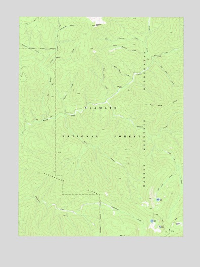
Medicine Mountain, CA USGS Topographic Map
Click on map above to begin viewing in our Map Viewer.

This topographic map contains these locations and features:
Feature Name Type Latitude Longitude GNIS ID View Map
Bear Skull CampLocaleN41.4599°W123.2973°256700View Map
Bear Skull CreekStreamN41.4649°W123.2889°256701View Map
Big Medicine CreekStreamN41.4837°W123.2795°256970View Map
Bridge CreekStreamN41.4407°W123.3581°257452View Map
Canyon CreekStreamN41.4440°W123.3389°257942View Map
Clear LakeLakeN41.3837°W123.2747°258440View Map
Dead Horse CreekStreamN41.4529°W123.3087°259112View Map
Halfmoon CreekStreamN41.4757°W123.3562°261016View Map
Hamilton CampLocaleN41.3824°W123.2564°261043View Map
Hancock CreekStreamN41.4512°W123.3092°261059View Map
Hell Hole CreekStreamN41.4746°W123.2739°261244View Map
Lily LakeLakeN41.3804°W123.2686°262461View Map
Little Medicine CreekStreamN41.4799°W123.2789°262667View Map
Lost LakeLakeN41.3959°W123.2702°262954View Map
Lost Lake CreekStreamN41.4149°W123.2559°262955View Map
Medicine MountainSummitN41.4951°W123.3181°263436View Map
North Fork CampLocaleN41.4707°W123.2789°1657812View Map
North Fork Wooley CreekStreamN41.4701°W123.2781°267079View Map
Rock CreekStreamN41.4432°W123.3403°265478View Map
Salt Log CreekStreamN41.4321°W123.2767°265784View Map
Snowslide GulchValleyN41.4921°W123.3453°267345View Map
Steinacher RidgeRidgeN41.4110°W123.3592°267720View Map
Yellow Jacket CreekStreamN41.4693°W123.3576°269344View Map

Note: Coordinates in the location and feature list above are referenced to NAD83 datum.


Copyright (C) 2008-2024 Ryan Niemi / Sunset Dynamics ... All Rights Reserved