TopoQuest Logo
Do you find TopoQuest useful?
Help keep TopoQuest running and adding new maps/features by donating!
Bitcoin:  19c7KJd3qBynnjoSw5npx9KScwjBe4ifkT
Litecoin:  LXs6TkuXGGXo1vDsWCkWVdjQX94eUKd6ui
Home View Maps Find Maps Find Places Resources & Links


Somes Bar, California Topographic Map

USGS Map Title: Somes Bar, CA
USGS Map MRC: 41123D4
DRG (GeoTIFF) Download: o41123d4.tif


Neighboring USGS Topographic Map Quads:


  Dillon Mountain, CA  
41123E5
 

  Ukonom Mountain, CA  
41123E4
 

  Ukonom Lake, CA  
41123E3
 

  Bark Shanty Gulch, CA  
41123D5
 

  Somes Bar, CA  
41123D4
 

  Medicine Mountain, CA  
41123D3
 

  Orleans, CA  
41123C5
 

  Orleans Mountain, CA  
41123C4
 

  Forks of Salmon, CA  
41123C3


Map MRC Location:

N42°
W124°
N42°
W123°
H8 H7 H6 H5 H4 H3 H2 H1
G8 G7 G6 G5 G4 G3 G2 G1
F8 F7 F6 F5 F4 F3 F2 F1
E8 E7 E6 E5 E4 E3 E2 E1
D8 D7 D6 D5 D4 D3 D2 D1
C8 C7 C6 C5 C4 C3 C2 C1
B8 B7 B6 B5 B4 B3 B2 B1
A8 A7 A6 A5 A4 A3 A2 A1
N41°
W124°
N41°
W123°

Somes Bar, CA USGS 1:24K Topographic Map Preview:
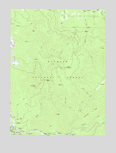
Somes Bar, CA USGS Topographic Map
Click on map above to begin viewing in our Map Viewer.

This topographic map contains these locations and features:
Feature Name Type Latitude Longitude GNIS ID View Map
Bald ButteSummitN41.4782°W123.4731°1657975View Map
Black MountainSummitN41.4612°W123.3773°219382View Map
Camp Four CampsiteLocaleN41.4779°W123.4039°220460View Map
Camp Three CampgroundLocaleN41.4421°W123.4228°220494View Map
Deer Lick CreekStreamN41.3968°W123.4109°222195View Map
East PeakSummitN41.3960°W123.4392°251985View Map
Edie RanchLocaleN41.4290°W123.3789°1682767View Map
Gates CreekStreamN41.4146°W123.3967°224099View Map
Halfmoon MeadowFlatN41.4985°W123.3867°224797View Map
Haypress CreekStreamN41.4304°W123.3773°225067View Map
Irving Creek RanchLocaleN41.4673°W123.4706°276864View Map
Irving Creek School (historical)SchoolN41.4696°W123.4956°1657788View Map
Irving MountainSummitN41.4860°W123.4373°1658838View Map
Ishi Pishi FallsFallsN41.3818°W123.4998°254825View Map
Junction Elementary SchoolSchoolN41.3922°W123.4963°226385View Map
Kworatem (historical)Populated PlaceN41.3765°W123.4914°1682144View Map
Let-Er Buck MeadowFlatN41.4973°W123.3942°227034View Map
Merrill CreekStreamN41.3787°W123.4734°228526View Map
Merrill MountainSummitN41.4248°W123.4353°228527View Map
Murderers BarBarN41.3751°W123.4189°229338View Map
Oak Bottom CampgroundLocaleN41.3773°W123.4514°276858View Map
Oak Bottom Forest Service StationLocaleN41.3757°W123.4526°229838View Map
Offield MountainSummitN41.4235°W123.4717°229936View Map
Offield Mountain LookoutLocaleN41.4240°W123.4720°276865View Map
Offield SaddleGapN41.4285°W123.4539°254997View Map
Rogers CreekStreamN41.4451°W123.4906°231821View Map
Salmon RiverStreamN41.3776°W123.4934°232287View Map
Somes BarPopulated PlaceN41.3762°W123.4762°1659814View Map
Somes Bar School (historical)SchoolN41.3812°W123.4895°1682772View Map
Somes Bar Work CenterLocaleN41.3868°W123.4926°276859View Map
Stanshaw MeadowsFlatN41.4948°W123.4320°235379View Map
Steinacher CreekStreamN41.3837°W123.4198°235436View Map
SugarloafSummitN41.3815°W123.4967°1659903View Map
Sulphur SpringSpringN41.4032°W123.4589°276860View Map
Trail MeadowFlatN41.4976°W123.4023°236512View Map
Ukonom Ranger StationLocaleN41.3868°W123.4926°236764View Map
Wooley CampLocaleN41.4257°W123.3831°238179View Map
Wooley CreekStreamN41.3771°W123.4226°238180View Map

Note: Coordinates in the location and feature list above are referenced to NAD83 datum.


Copyright (C) 2008-2024 Ryan Niemi / Sunset Dynamics ... All Rights Reserved