TopoQuest Logo
Do you find TopoQuest useful?
Help keep TopoQuest running and adding new maps/features by donating!
Bitcoin:  19c7KJd3qBynnjoSw5npx9KScwjBe4ifkT
Litecoin:  LXs6TkuXGGXo1vDsWCkWVdjQX94eUKd6ui
Home View Maps Find Maps Find Places Resources & Links


Ukonom Mountain, California Topographic Map

USGS Map Title: Ukonom Mountain, CA
USGS Map MRC: 41123E4
DRG (GeoTIFF) Download: o41123e4.tif


Neighboring USGS Topographic Map Quads:


  Bear Peak, CA  
41123F5
 

  Clear Creek, CA  
41123F4
 

  Huckleberry Mountain, CA  
41123F3
 

  Dillon Mountain, CA  
41123E5
 

  Ukonom Mountain, CA  
41123E4
 

  Ukonom Lake, CA  
41123E3
 

  Bark Shanty Gulch, CA  
41123D5
 

  Somes Bar, CA  
41123D4
 

  Medicine Mountain, CA  
41123D3


Map MRC Location:

N42°
W124°
N42°
W123°
H8 H7 H6 H5 H4 H3 H2 H1
G8 G7 G6 G5 G4 G3 G2 G1
F8 F7 F6 F5 F4 F3 F2 F1
E8 E7 E6 E5 E4 E3 E2 E1
D8 D7 D6 D5 D4 D3 D2 D1
C8 C7 C6 C5 C4 C3 C2 C1
B8 B7 B6 B5 B4 B3 B2 B1
A8 A7 A6 A5 A4 A3 A2 A1
N41°
W124°
N41°
W123°

Ukonom Mountain, CA USGS 1:24K Topographic Map Preview:
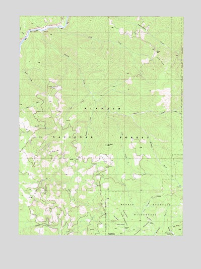
Ukonom Mountain, CA USGS Topographic Map
Click on map above to begin viewing in our Map Viewer.

This topographic map contains these locations and features:
Feature Name Type Latitude Longitude GNIS ID View Map
Albers MeadowFlatN41.5060°W123.4234°1657357View Map
Big MeadowFlatN41.5093°W123.4014°1657361View Map
Coon CreekStreamN41.6126°W123.4964°221506View Map
Cub CreekStreamN41.5712°W123.4328°221892View Map
Flems ForkStreamN41.5710°W123.3853°223606View Map
Haypress MeadowsFlatN41.5079°W123.4078°225070View Map
Jacobs LadderTrailN41.5987°W123.3948°226105View Map
Jacobs WellWellN41.6046°W123.3967°226107View Map
Jawbone CampLocaleN41.5051°W123.4217°226153View Map
Jims CampLocaleN41.5071°W123.4012°1657397View Map
King CreekStreamN41.6182°W123.4723°226585View Map
Klamath National ForestForestN41.6050°W123.4309°1851856View Map
Lick CreekStreamN41.5812°W123.4473°227073View Map
Lone Pine MeadowFlatN41.5123°W123.4201°1657402View Map
Long MeadowFlatN41.5162°W123.4039°1657436View Map
McCash ForkStreamN41.5685°W123.4162°228289View Map
Onemile CreekStreamN41.5726°W123.3778°254999View Map
Panther CreekStreamN41.5768°W123.4434°230305View Map
Ross MeadowFlatN41.5096°W123.4273°1657420View Map
Ten Bear MountainSummitN41.5515°W123.4345°236099View Map
Ti Creek MeadowsFlatN41.5132°W123.4231°236337View Map
Ukonom CreekStreamN41.6165°W123.4845°236761View Map
Ukonom MountainSummitN41.5840°W123.4767°236763View Map

Note: Coordinates in the location and feature list above are referenced to NAD83 datum.


Copyright (C) 2008-2024 Ryan Niemi / Sunset Dynamics ... All Rights Reserved