TopoQuest Logo
Do you find TopoQuest useful?
Help keep TopoQuest running and adding new maps/features by donating!
Bitcoin:  19c7KJd3qBynnjoSw5npx9KScwjBe4ifkT
Litecoin:  LXs6TkuXGGXo1vDsWCkWVdjQX94eUKd6ui
Home View Maps Find Maps Find Places Resources & Links


Upper Nutria, New Mexico Topographic Map

USGS Map Title: Upper Nutria, NM
USGS Map MRC: 35108C5
DRG (GeoTIFF) Download: o35108c5.tif


Neighboring USGS Topographic Map Quads:


  Bread Springs, NM  
35108D6
 

  Fort Wingate, NM  
35108D5
 

  Ciniza, NM  
35108D4
 

  Pinehaven, NM  
35108C6
 

  Upper Nutria, NM  
35108C5
 

  Page, NM  
35108C4
 

  Horsehead Canyon NW, NM  
35108B6
 

  Burned Timber Canyon, NM  
35108B5
 

  Ramah, NM  
35108B4


Map MRC Location:

N36°
W109°
N36°
W108°
H8 H7 H6 H5 H4 H3 H2 H1
G8 G7 G6 G5 G4 G3 G2 G1
F8 F7 F6 F5 F4 F3 F2 F1
E8 E7 E6 E5 E4 E3 E2 E1
D8 D7 D6 D5 D4 D3 D2 D1
C8 C7 C6 C5 C4 C3 C2 C1
B8 B7 B6 B5 B4 B3 B2 B1
A8 A7 A6 A5 A4 A3 A2 A1
N35°
W109°
N35°
W108°

Upper Nutria, NM USGS 1:24K Topographic Map Preview:
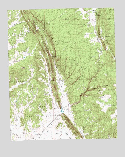
Upper Nutria, NM USGS Topographic Map
Click on map above to begin viewing in our Map Viewer.

This topographic map contains these locations and features:
Feature Name Type Latitude Longitude GNIS ID View Map
Agua RemoraStreamN35.3167°W108.5206°936857View Map
Brennan SpringSpringN35.3481°W108.5209°904076View Map
Brennan TankReservoirN35.3606°W108.5320°914134View Map
Garcia RanchLocaleN35.3328°W108.6026°906479View Map
Grasshopper CanyonValleyN35.2828°W108.5612°906708View Map
Grasshopper SpringSpringN35.3297°W108.5734°906710View Map
Indian SpringSpringN35.3064°W108.5820°914254View Map
Jurgensen PitMineN35.2839°W108.5476°917394View Map
Little Bear ReservoirReservoirN35.3706°W108.6219°923730View Map
Lost LakeLakeN35.3734°W108.5899°908241View Map
Lower NutriaPopulated PlaceN35.2567°W108.5895°908281View Map
Malcom TankReservoirN35.3649°W108.5591°908372View Map
McGaffey Camp and Picnic GroundsParkN35.3675°W108.5220°908520View Map
McGaffey CemeteryCemeteryN35.3703°W108.5231°908519View Map
McGaffey Lookout TowerTowerN35.3636°W108.5095°928987View Map
Mexican HillSummitN35.2653°W108.5676°908668View Map
Nutria CanyonValleyN35.2820°W108.5565°909222View Map
Nutria Diversion ReservoirReservoirN35.2766°W108.5646°923731View Map
Nutria SpringSpringN35.2817°W108.5540°909226View Map
Red MesaSummitN35.3197°W108.6095°910071View Map
Section TankReservoirN35.3589°W108.5317°914133View Map
Sixmile DrawValleyN35.2998°W108.5140°911104View Map
Stinking SpringSpringN35.3550°W108.5926°911421View Map
Tampico DrawValleyN35.2967°W108.5342°911534View Map
Tampico SpringSpringN35.3478°W108.5117°911536View Map
Torreon CemeteryCemeteryN35.3722°W108.5256°911758View Map
Upper NutriaPopulated PlaceN35.2698°W108.5709°911998View Map
Upper Nutria Limestone PitMineN35.2839°W108.5476°917549View Map

Note: Coordinates in the location and feature list above are referenced to NAD83 datum.


Copyright (C) 2008-2024 Ryan Niemi / Sunset Dynamics ... All Rights Reserved