TopoQuest Logo
Do you find TopoQuest useful?
Help keep TopoQuest running and adding new maps/features by donating!
Bitcoin:  19c7KJd3qBynnjoSw5npx9KScwjBe4ifkT
Litecoin:  LXs6TkuXGGXo1vDsWCkWVdjQX94eUKd6ui
Home View Maps Find Maps Find Places Resources & Links


Ciniza, New Mexico Topographic Map

USGS Map Title: Ciniza, NM
USGS Map MRC: 35108D4
DRG (GeoTIFF) Download: o35108d4.tif


Neighboring USGS Topographic Map Quads:


  Church Rock, NM  
35108E5
 

  Pinedale, NM  
35108E4
 

  Mariano Lake, NM  
35108E3
 

  Fort Wingate, NM  
35108D5
 

  Ciniza, NM  
35108D4
 

  Continental Divide, NM  
35108D3
 

  Upper Nutria, NM  
35108C5
 

  Page, NM  
35108C4
 

  Cottonwood Canyon, NM  
35108C3


Map MRC Location:

N36°
W109°
N36°
W108°
H8 H7 H6 H5 H4 H3 H2 H1
G8 G7 G6 G5 G4 G3 G2 G1
F8 F7 F6 F5 F4 F3 F2 F1
E8 E7 E6 E5 E4 E3 E2 E1
D8 D7 D6 D5 D4 D3 D2 D1
C8 C7 C6 C5 C4 C3 C2 C1
B8 B7 B6 B5 B4 B3 B2 B1
A8 A7 A6 A5 A4 A3 A2 A1
N35°
W109°
N35°
W108°

Ciniza, NM USGS 1:24K Topographic Map Preview:
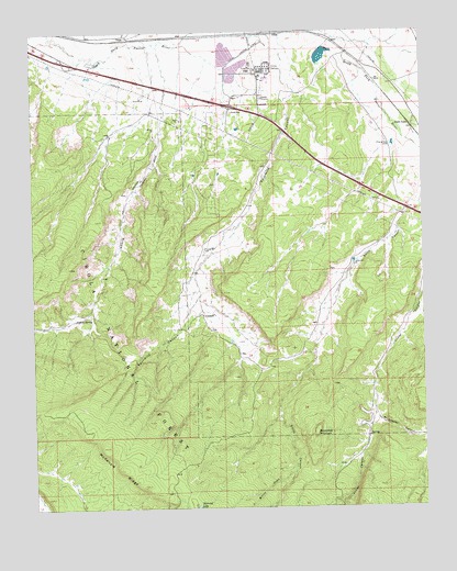
Ciniza, NM USGS Topographic Map
Click on map above to begin viewing in our Map Viewer.

This topographic map contains these locations and features:
Feature Name Type Latitude Longitude GNIS ID View Map
10001 Water WellWellN35.4772°W108.4384°921768View Map
10005 Water WellWellN35.4153°W108.4342°921766View Map
Barometer MountainSummitN35.3942°W108.4109°903574View Map
Brushy Two TankReservoirN35.3878°W108.4551°914241View Map
Brushy-One TankReservoirN35.3881°W108.4576°914240View Map
CinizaPopulated PlaceN35.4909°W108.4215°1987485View Map
Ciniza RefineryLocaleN35.4903°W108.4237°928901View Map
Deer Stock TankReservoirN35.3842°W108.4834°914238View Map
Foster Canyon GroupMineN35.3864°W108.3965°917548View Map
Fourmile CanyonValleyN35.4956°W108.4220°906354View Map
Grenko MineMineN35.4384°W108.4229°917385View Map
Iyanbito InterchangeCrossingN35.4936°W108.4906°914235View Map
North TankReservoirN35.3795°W108.4876°914237View Map
Perea Post Office (historical)Post OfficeN35.4992°W108.4706°937233View Map
Refinery InterchangeCrossingN35.4797°W108.4367°914234View Map
Section Six TankReservoirN35.3897°W108.4626°914239View Map
Six A RanchLocaleN35.4250°W108.4451°912555View Map
Sixmile CanyonValleyN35.4772°W108.4587°911103View Map
Sixmile SpringSpringN35.4243°W108.4872°938831View Map
South GuamPopulated PlaceN35.4750°W108.3792°911258View Map
Whispering Cedars Volunteer Fire DepartmentBuildingN35.4794°W108.4434°2657797View Map
Whitewater CanyonValleyN35.3986°W108.3909°912352View Map
Willow CreekStreamN35.3839°W108.4179°912404View Map
Windmill TankReservoirN35.3842°W108.4942°914236View Map
Yellow Stock TankReservoirN35.3792°W108.3920°937125View Map

Note: Coordinates in the location and feature list above are referenced to NAD83 datum.


Copyright (C) 2008-2024 Ryan Niemi / Sunset Dynamics ... All Rights Reserved