TopoQuest Logo
Do you find TopoQuest useful?
Help keep TopoQuest running and adding new maps/features by donating!
Bitcoin:  19c7KJd3qBynnjoSw5npx9KScwjBe4ifkT
Litecoin:  LXs6TkuXGGXo1vDsWCkWVdjQX94eUKd6ui
Home View Maps Find Maps Find Places Resources & Links


Bread Springs, New Mexico Topographic Map

USGS Map Title: Bread Springs, NM
USGS Map MRC: 35108D6
DRG (GeoTIFF) Download: o35108d6.tif


Neighboring USGS Topographic Map Quads:


  Gallup West, NM  
35108E7
 

  Gallup East, NM  
35108E6
 

  Church Rock, NM  
35108E5
 

  Twin Buttes, NM  
35108D7
 

  Bread Springs, NM  
35108D6
 

  Fort Wingate, NM  
35108D5
 

  Vanderwagen, NM  
35108C7
 

  Pinehaven, NM  
35108C6
 

  Upper Nutria, NM  
35108C5


Map MRC Location:

N36°
W109°
N36°
W108°
H8 H7 H6 H5 H4 H3 H2 H1
G8 G7 G6 G5 G4 G3 G2 G1
F8 F7 F6 F5 F4 F3 F2 F1
E8 E7 E6 E5 E4 E3 E2 E1
D8 D7 D6 D5 D4 D3 D2 D1
C8 C7 C6 C5 C4 C3 C2 C1
B8 B7 B6 B5 B4 B3 B2 B1
A8 A7 A6 A5 A4 A3 A2 A1
N35°
W109°
N35°
W108°

Bread Springs, NM USGS 1:24K Topographic Map Preview:
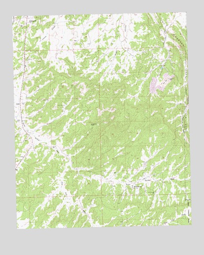
Bread Springs, NM USGS Topographic Map
Click on map above to begin viewing in our Map Viewer.

This topographic map contains these locations and features:
Feature Name Type Latitude Longitude GNIS ID View Map
Ba-Ha-LiLocaleN35.3950°W108.6695°924298View Map
Blue M WellWellN35.4220°W108.7237°903946View Map
Bread SpringsPopulated PlaceN35.3984°W108.6670°904071View Map
Bread Springs WellWellN35.3945°W108.6517°904073View Map
Browns WellWellN35.4503°W108.7256°904104View Map
Cresto RanchLocaleN35.4386°W108.7487°905502View Map
FranklinLocaleN35.3939°W108.7484°924285View Map
Hyde DepositMineN35.4870°W108.6445°917389View Map
KQNM-FM (Gallup)TowerN35.4942°W108.7429°938657View Map
Largo Number 4 MineMineN35.4870°W108.6445°940043View Map
Navajo MissionChurchN35.4484°W108.7468°909025View Map
Pine Tree WashArroyoN35.4122°W108.7134°909691View Map
SundancePopulated PlaceN35.4603°W108.6381°917580View Map
Sundance MineMineN35.4603°W108.6384°911487View Map
Tah Ha Bah WellWellN35.4470°W108.7140°911528View Map
Umbrella RockSummitN35.4370°W108.6970°911951View Map

Note: Coordinates in the location and feature list above are referenced to NAD83 datum.


Copyright (C) 2008-2024 Ryan Niemi / Sunset Dynamics ... All Rights Reserved