TopoQuest Logo
Do you find TopoQuest useful?
Help keep TopoQuest running and adding new maps/features by donating!
Bitcoin:  19c7KJd3qBynnjoSw5npx9KScwjBe4ifkT
Litecoin:  LXs6TkuXGGXo1vDsWCkWVdjQX94eUKd6ui
Home View Maps Find Maps Find Places Resources & Links


Warsaw North, North Carolina Topographic Map

USGS Map Title: Warsaw North, NC
USGS Map MRC: 35078A1
DRG (GeoTIFF) Download: o35078a1.tif


Neighboring USGS Topographic Map Quads:


  Dobbersville, NC  
35078B2
 

  Mount Olive, NC  
35078B1
 

  Williams, NC  
35077B8
 

  Faison, NC  
35078A2
 

  Warsaw North, NC  
35078A1
 

  Summerlins Crossroads, NC  
35077A8
 

  Turkey, NC  
34078H2
 

  Warsaw South, NC  
34078H1
 

  Kenansville, NC  
34077H8


Map MRC Location:

N36°
W79°
N36°
W78°
H8 H7 H6 H5 H4 H3 H2 H1
G8 G7 G6 G5 G4 G3 G2 G1
F8 F7 F6 F5 F4 F3 F2 F1
E8 E7 E6 E5 E4 E3 E2 E1
D8 D7 D6 D5 D4 D3 D2 D1
C8 C7 C6 C5 C4 C3 C2 C1
B8 B7 B6 B5 B4 B3 B2 B1
A8 A7 A6 A5 A4 A3 A2 A1
N35°
W79°
N35°
W78°

Warsaw North, NC USGS 1:24K Topographic Map Preview:
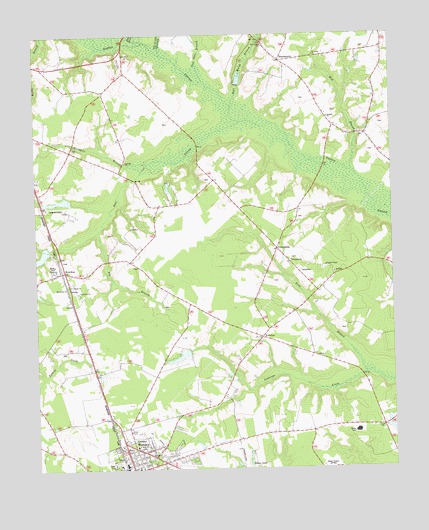
Warsaw North, NC USGS Topographic Map
Click on map above to begin viewing in our Map Viewer.

This topographic map contains these locations and features:
Feature Name Type Latitude Longitude GNIS ID View Map
Bear Marsh BranchStreamN35.1043°W78.0553°980726View Map
Bear Marsh ChurchChurchN35.1221°W78.0442°980727View Map
Bear SwampStreamN35.0999°W78.0522°980735View Map
Bear Swamp Post Office (historical)Post OfficeN35.0941°W78.0244°1008034View Map
BeautancusPopulated PlaceN35.1177°W78.0383°1008233View Map
Big BranchStreamN35.0688°W78.1028°981329View Map
Bowden MillpondReservoirN35.0613°W78.1239°998357View Map
Bowden Millpond DamDamN35.0635°W78.1197°998356View Map
BowdensPopulated PlaceN35.0571°W78.1155°981764View Map
Bowdens ChurchChurchN35.0516°W78.1094°981765View Map
Calvary ChurchChurchN35.0046°W78.0847°982440View Map
Cow Hole BranchStreamN35.1118°W78.0653°983641View Map
Dicks BranchStreamN35.1229°W78.0858°984171View Map
Dolph Post Office (historical)Post OfficeN35.0963°W78.0078°1008033View Map
EvertonPopulated PlaceN35.0379°W78.0458°984886View Map
Faisons ChapelChurchN35.0585°W78.0230°984938View Map
FriendshipPopulated PlaceN35.0635°W78.0403°1006209View Map
Friendship ChurchChurchN35.0602°W78.0353°985433View Map
Horsepen BranchStreamN35.0879°W78.0853°987129View Map
King BranchStreamN35.0274°W78.0097°987974View Map
Larry McCullen PondReservoirN35.0039°W78.0505°998286View Map
Larry McCullen Pond DamDamN35.0035°W78.0497°998287View Map
Macedonia ChurchChurchN35.0524°W78.1130°989175View Map
Mill BranchStreamN35.0857°W78.0136°989870View Map
Red Hill ChurchChurchN35.0888°W78.0928°993116View Map
Reedy BranchStreamN35.1071°W78.1250°993178View Map
Saint Johns ChurchChurchN35.1191°W78.0264°993934View Map
Saint Thomas ChurchChurchN35.0529°W78.1133°994145View Map
Sanford ChurchChurchN35.1010°W78.0217°1008035View Map
Taylor Airport (historical)AirportN35.0727°W78.1164°997882View Map
Township of FaisonCivilN35.1054°W78.0865°1026641View Map
Unity Methodist ChurchChurchN35.0118°W78.0042°1008245View Map
Warsaw Junior High School (historical)SchoolN35.0066°W78.0900°1001130View Map
Warsaw Post OfficePost OfficeN35.0013°W78.0934°2505398View Map
Whiteoak BranchStreamN35.1196°W78.0794°997235View Map
WTRQ-AM (Warsaw)TowerN35.0004°W78.0242°1018388View Map

Note: Coordinates in the location and feature list above are referenced to NAD83 datum.


Copyright (C) 2008-2024 Ryan Niemi / Sunset Dynamics ... All Rights Reserved