TopoQuest Logo
Do you find TopoQuest useful?
Help keep TopoQuest running and adding new maps/features by donating!
Bitcoin:  19c7KJd3qBynnjoSw5npx9KScwjBe4ifkT
Litecoin:  LXs6TkuXGGXo1vDsWCkWVdjQX94eUKd6ui
Home View Maps Find Maps Find Places Resources & Links


Unadilla, Nebraska Topographic Map

USGS Map Title: Unadilla, NE
USGS Map MRC: 40096F3
DRG (GeoTIFF) Download: o40096f3.tif


Neighboring USGS Topographic Map Quads:


  Eagle, NE  
40096G4
 

  Elmwood, NE  
40096G3
 

  Weeping Water, NE  
40096G2
 

  Palmyra, NE  
40096F4
 

  Unadilla, NE  
40096F3
 

  Syracuse, NE  
40096F2
 

  Douglas, NE  
40096E4
 

  Burr, NE  
40096E3
 

  Cook, NE  
40096E2


Map MRC Location:

N41°
W97°
N41°
W96°
H8 H7 H6 H5 H4 H3 H2 H1
G8 G7 G6 G5 G4 G3 G2 G1
F8 F7 F6 F5 F4 F3 F2 F1
E8 E7 E6 E5 E4 E3 E2 E1
D8 D7 D6 D5 D4 D3 D2 D1
C8 C7 C6 C5 C4 C3 C2 C1
B8 B7 B6 B5 B4 B3 B2 B1
A8 A7 A6 A5 A4 A3 A2 A1
N40°
W97°
N40°
W96°

Unadilla, NE USGS 1:24K Topographic Map Preview:
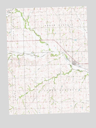
Unadilla, NE USGS Topographic Map
Click on map above to begin viewing in our Map Viewer.

This topographic map contains these locations and features:
Feature Name Type Latitude Longitude GNIS ID View Map
Christian ChurchChurchN40.6833°W96.2697°1884341View Map
Greenwood Farmers Co-op ElevatorLocaleN40.6833°W96.2697°1884340View Map
Henry CreekStreamN40.6933°W96.2886°829933View Map
Hooper CreekStreamN40.6989°W96.3097°830114View Map
North Russell Election PrecinctCivilN40.7402°W96.2924°1929111View Map
Owl CreekStreamN40.7225°W96.2550°831937View Map
Palmyra CemeteryCemeteryN40.6903°W96.3689°831961View Map
Russell CreekStreamN40.6767°W96.2750°832790View Map
Russell Election Precinct (historical)CivilN40.6983°W96.2892°1929263View Map
Silver CreekStreamN40.6953°W96.3670°833436View Map
South Russell Election PrecinctCivilN40.6534°W96.2929°1929298View Map
Thompson CemeteryCemeteryN40.7255°W96.3314°834092View Map
Township of North RussellCivilN40.7389°W96.2920°1884369View Map
Township of South RussellCivilN40.6500°W96.2920°1884370View Map
UnadillaPopulated PlaceN40.6833°W96.2697°834256View Map
UnadillaLocaleN40.6819°W96.2736°1884342View Map
Unadilla CemeteryCemeteryN40.6975°W96.2822°834257View Map
Unadilla Post OfficePost OfficeN40.6818°W96.2729°1884339View Map
Unadilla Public SchoolSchoolN40.6844°W96.2714°1884283View Map
United Methodist ChurchChurchN40.6833°W96.2697°1884338View Map
Village of UnadillaCivilN40.6827°W96.2699°2400019View Map

Note: Coordinates in the location and feature list above are referenced to NAD83 datum.


Copyright (C) 2008-2024 Ryan Niemi / Sunset Dynamics ... All Rights Reserved