TopoQuest Logo
Do you find TopoQuest useful?
Help keep TopoQuest running and adding new maps/features by donating!
Bitcoin:  19c7KJd3qBynnjoSw5npx9KScwjBe4ifkT
Litecoin:  LXs6TkuXGGXo1vDsWCkWVdjQX94eUKd6ui
Home View Maps Find Maps Find Places Resources & Links


Church Rock, New Mexico Topographic Map

USGS Map Title: Church Rock, NM
USGS Map MRC: 35108E5
DRG (GeoTIFF) Download: o35108e5.tif


Neighboring USGS Topographic Map Quads:


  Big Rock Hill, NM  
35108F6
 

  Hard Ground Flats, NM  
35108F5
 

  Oak Spring, NM  
35108F4
 

  Gallup East, NM  
35108E6
 

  Church Rock, NM  
35108E5
 

  Pinedale, NM  
35108E4
 

  Bread Springs, NM  
35108D6
 

  Fort Wingate, NM  
35108D5
 

  Ciniza, NM  
35108D4


Map MRC Location:

N36°
W109°
N36°
W108°
H8 H7 H6 H5 H4 H3 H2 H1
G8 G7 G6 G5 G4 G3 G2 G1
F8 F7 F6 F5 F4 F3 F2 F1
E8 E7 E6 E5 E4 E3 E2 E1
D8 D7 D6 D5 D4 D3 D2 D1
C8 C7 C6 C5 C4 C3 C2 C1
B8 B7 B6 B5 B4 B3 B2 B1
A8 A7 A6 A5 A4 A3 A2 A1
N35°
W109°
N35°
W108°

Church Rock, NM USGS 1:24K Topographic Map Preview:
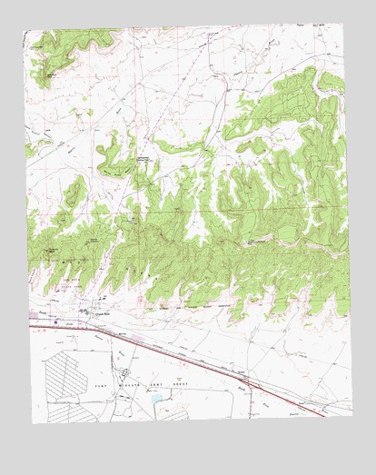
Church Rock, NM USGS Topographic Map
Click on map above to begin viewing in our Map Viewer.

This topographic map contains these locations and features:
Feature Name Type Latitude Longitude GNIS ID View Map
10022 Water WellWellN35.6136°W108.5167°921968View Map
16T-510 Water WellWellN35.6195°W108.6223°921787View Map
16T-513 Water WellWellN35.6136°W108.5167°921969View Map
Church RockPopulated PlaceN35.5339°W108.5998°902212View Map
Church Rock Census Designated PlaceCensusN35.5309°W108.6234°2407618View Map
Church Rock ChapterCivilN35.5750°W108.6127°2419343View Map
Church Rock MineMineN35.6222°W108.5526°887589View Map
Church Rock Post OfficePost OfficeN35.5339°W108.5998°937495View Map
Fort Wingate 68 Water WellWellN35.5156°W108.5873°922828View Map
Foutz Number 1 MineMineN35.5642°W108.5445°917352View Map
Foutz Number 2MineN35.5636°W108.5501°917363View Map
Foutz Number Three MineMineN35.5670°W108.5667°917545View Map
Hard Ground CanyonValleyN35.5853°W108.6156°889759View Map
Kit Carson SpringSpringN35.5641°W108.5846°917576View Map
McCunePopulated PlaceN35.5278°W108.5909°898675View Map
Navajo ChurchPillarN35.5575°W108.6015°892387View Map
Navajo Wingate VillagePopulated PlaceN35.5497°W108.5987°917203View Map
Nose Rock PointCapeN35.6100°W108.6165°892755View Map
Nose Rock WellWellN35.6192°W108.6226°892756View Map
PereaPopulated PlaceN35.5045°W108.5190°898687View Map
Pyramid RockPillarN35.5550°W108.6173°893573View Map
Red Rock MusuemBuildingN35.5445°W108.6087°929486View Map
Red Rock State ParkParkN35.5445°W108.6087°902842View Map
Red RocksSlopeN35.5503°W108.5929°893785View Map
Red Rocks Historical MarkerParkN35.5503°W108.5929°932377View Map
Saint Phillips Mission Indian VillageChurchN35.5339°W108.5998°917491View Map
SJOBS Water WellWellN35.5156°W108.5873°922827View Map
Springstead Trading PostLocaleN35.5831°W108.5767°897483View Map
U MineMineN35.5578°W108.5315°914646View Map
White Rock MesaSummitN35.5772°W108.5887°896525View Map
Williams and Reynolds MineMineN35.5561°W108.5401°896624View Map
WingatePopulated PlaceN35.5145°W108.5448°898708View Map
Wingate 6 Water WellWellN35.5164°W108.5490°922829View Map
Wingate 7 Water WellWellN35.5189°W108.5515°922831View Map

Note: Coordinates in the location and feature list above are referenced to NAD83 datum.


Copyright (C) 2008-2024 Ryan Niemi / Sunset Dynamics ... All Rights Reserved