TopoQuest Logo
Do you find TopoQuest useful?
Help keep TopoQuest running and adding new maps/features by donating!
Bitcoin:  19c7KJd3qBynnjoSw5npx9KScwjBe4ifkT
Litecoin:  LXs6TkuXGGXo1vDsWCkWVdjQX94eUKd6ui
Home View Maps Find Maps Find Places Resources & Links


Busseyville, Wisconsin Topographic Map

USGS Map Title: Busseyville, WI
USGS Map MRC: 42088H8
DRG (GeoTIFF) Download: o42088h8.tif


Neighboring USGS Topographic Map Quads:


  Deerfield, WI  
43089A1
 

  Lake Mills, WI  
43088A8
 

  Jefferson, WI  
43088A7
 

  Rockdale, WI  
42089H1
 

  Busseyville, WI  
42088H8
 

  Fort Atkinson, WI  
42088H7
 

  Edgerton, WI  
42089G1
 

  Milton, WI  
42088G8
 

  Lima Center, WI  
42088G7


Map MRC Location:

N43°
W89°
N43°
W88°
H8 H7 H6 H5 H4 H3 H2 H1
G8 G7 G6 G5 G4 G3 G2 G1
F8 F7 F6 F5 F4 F3 F2 F1
E8 E7 E6 E5 E4 E3 E2 E1
D8 D7 D6 D5 D4 D3 D2 D1
C8 C7 C6 C5 C4 C3 C2 C1
B8 B7 B6 B5 B4 B3 B2 B1
A8 A7 A6 A5 A4 A3 A2 A1
N42°
W89°
N42°
W88°

Busseyville, WI USGS 1:24K Topographic Map Preview:
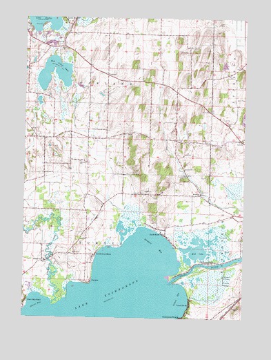
Busseyville, WI USGS Topographic Map
Click on map above to begin viewing in our Map Viewer.

This topographic map contains these locations and features:
Feature Name Type Latitude Longitude GNIS ID View Map
Blackhawk IslandPopulated PlaceN42.8983°W88.8923°1561899View Map
Blackhawk SchoolSchoolN42.9267°W88.8998°1561902View Map
BusseyvillePopulated PlaceN42.8986°W88.9879°1562463View Map
Busseyville CemeteryCemeteryN42.9002°W88.9829°2781315View Map
CarcajouPopulated PlaceN42.8897°W88.9621°1562713View Map
Gilbert BayBayN42.8839°W88.9118°1565511View Map
Glenn Oaks BeachPopulated PlaceN42.8814°W88.9987°1565576View Map
Jefferson County Waterfowl Production AreaParkN42.9853°W88.9816°2765347View Map
Koshkonong CreekStreamN42.8811°W88.9840°1567628View Map
Koshkonong ManorPopulated PlaceN42.9014°W88.9601°1567629View Map
Lake KoshkonongPopulated PlaceN42.9097°W88.9196°1852244View Map
Lake Koshkonong Census Designated PlaceCensusN42.8838°W88.9424°2393080View Map
Mud LakeLakeN42.9043°W88.9007°1569905View Map
North ShorePopulated PlaceN42.9111°W88.9204°1570501View Map
OaklandPopulated PlaceN42.9767°W88.9557°1570699View Map
Oakland Center CemeteryCemeteryN42.9767°W88.9532°2781329View Map
Oakland SchoolSchoolN42.9400°W88.9684°1570705View Map
Olsons BayBayN42.8775°W88.9976°1570810View Map
Red Cedar LakeLakeN42.9815°W88.9837°1572131View Map
Red Cedar Lake State Natural AreaParkN42.9786°W88.9807°1988739View Map
Royce SchoolSchoolN42.9489°W88.8759°1572699View Map
Saint Johns ChurchChurchN42.9372°W88.9093°1573075View Map
Stinkers BayBayN42.9050°W88.9248°1574902View Map
Strasburg PitMineN42.9836°W88.8867°2634499View Map
Sylvan MoundsPopulated PlaceN42.9992°W88.9784°1575204View Map
Town of OaklandCivilN42.9786°W88.9534°1583845View Map
Town of SumnerCivilN42.9002°W88.9633°1584252View Map
Union CemeteryCemeteryN42.9341°W88.9088°1575864View Map
Union CemeteryCemeteryN42.9617°W88.8957°1575866View Map
Vinnie Ha HaPopulated PlaceN42.8806°W88.9048°1576107View Map

Note: Coordinates in the location and feature list above are referenced to NAD83 datum.


Copyright (C) 2008-2024 Ryan Niemi / Sunset Dynamics ... All Rights Reserved